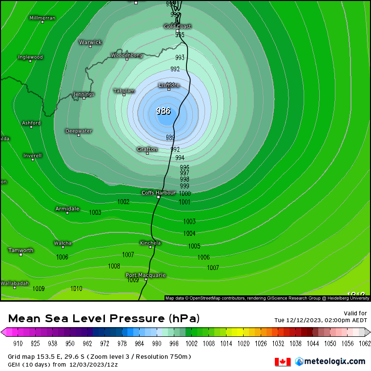
Not Seen For A Long Time
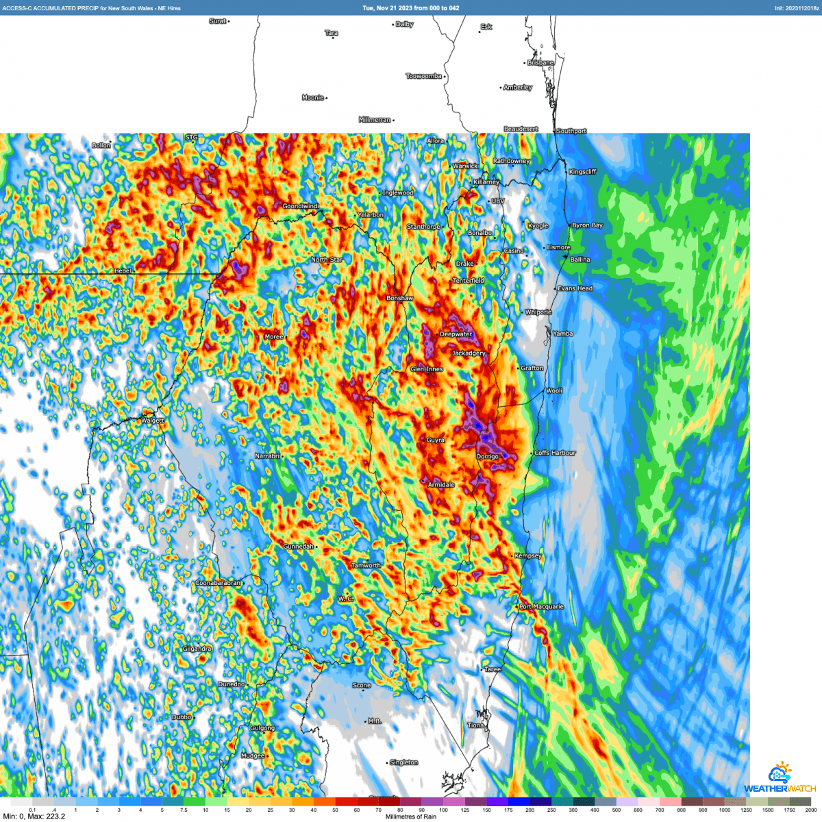
We had a lovely storm move across yesterday evening and a little overnight rain before more showers roll in from the west this afternoon...but we've then got a bigger change…
We had a lovely storm move across yesterday evening and a little overnight rain before more showers roll in from the west this afternoon...but we've then got a bigger change…

A dynamic Christmas with big storms around...more to follow for New Year? Plus - a look at the global picture and further ahead...
A quick end-of-day post to flag a potentially stormy spell coming up. We've got a strong cold upper low moving in as we move through the weekend: Combine that with…
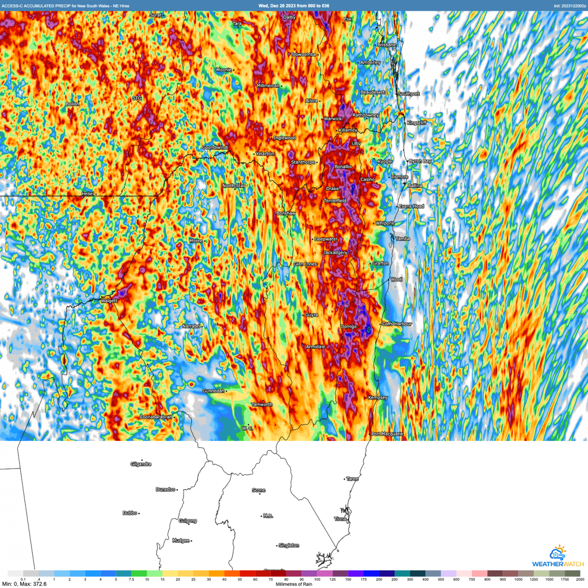
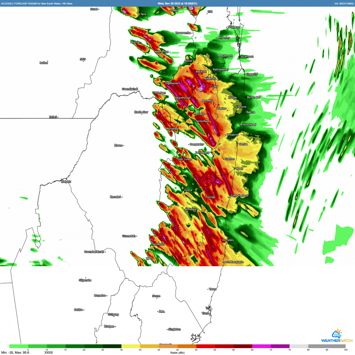
A quick post to flag that storms are likely over this afternoon and through tomorrow...and that the BoM high resolution models are indicating that some locations (particularly over the hills…
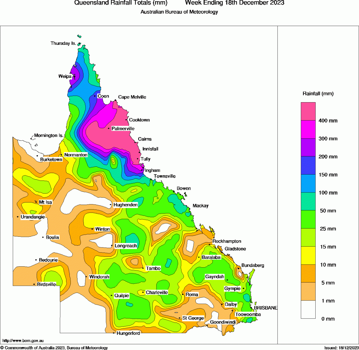
We've currently got a thick layer on smoke up high above us from a huge fire burning at emergency warning level in the Pilliga. You can see the smoke across…
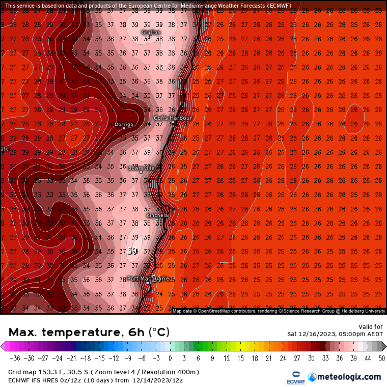
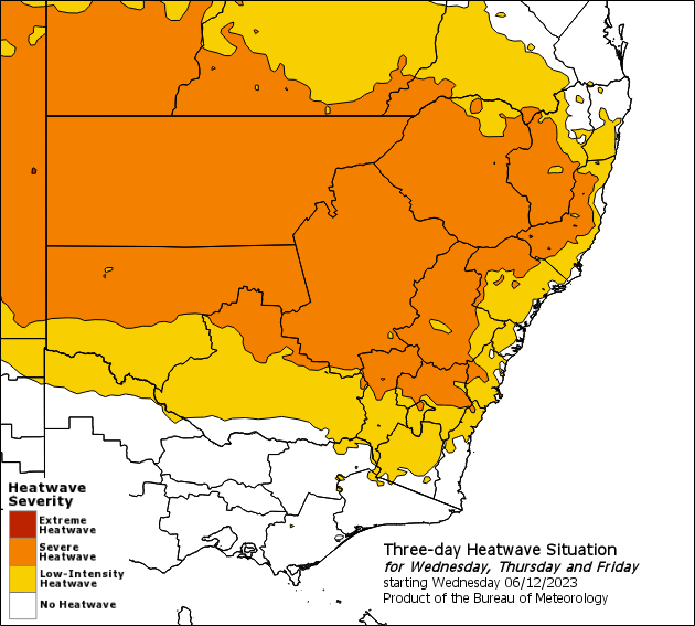
A quick post about some decent heat over the next few days. It's been dry for a while - and at this time of year that gives our beautiful land…
After the quick burst of excitement earlier in the week...perhaps not surprisingly models now show the cyclone taking a more northerly track and landing on the Northern Queensland coast. Here's…
Had no choice but to write a post this morning. We've got three top models all showing a Coral Sea cyclone developing and moving close to / over the east…