As is the case with every storm day…some days you get a banger and the next you miss out entirely. Tomorrow is looking like a classic storm day across NE NSW. A low will move to our south under the influence of a significant upper system, leaving us in north westerly winds to the north. The air is moisture laden – so add an an approaching trough to the mix and some decent upper winds and we’ll have most of the ingredients for a higher-end storm day.
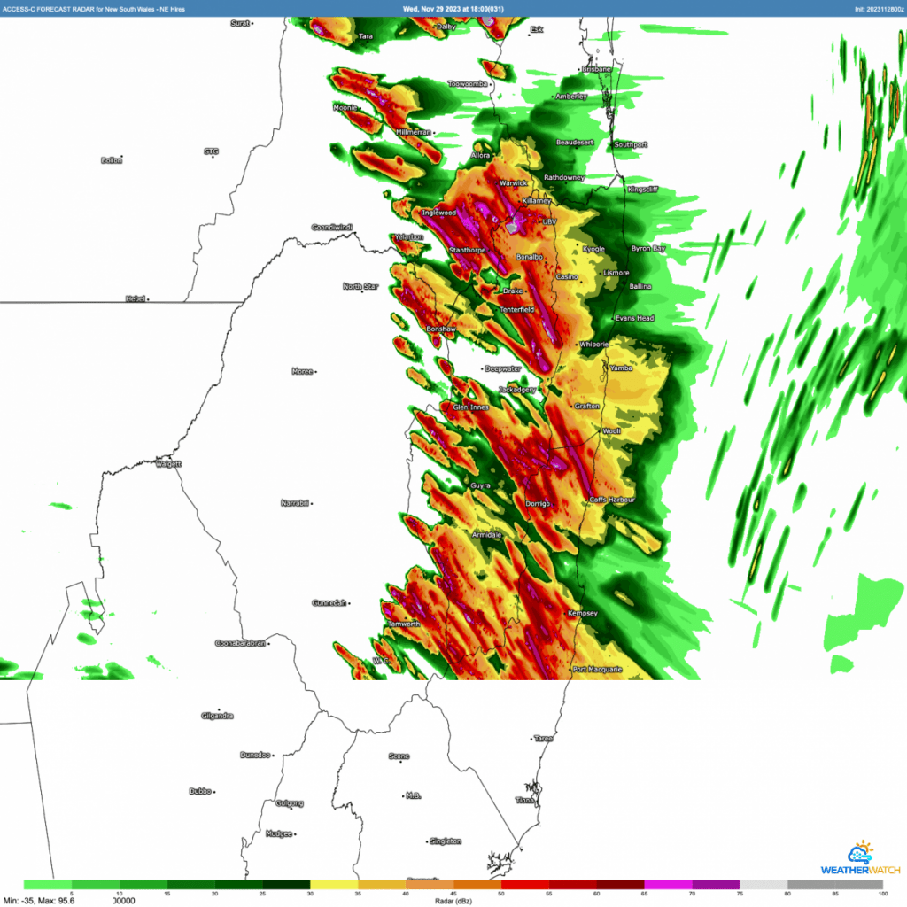
The BoM high – resolution model shows the following radar for tomorrow arvo – some good storms around but other areas missing out:
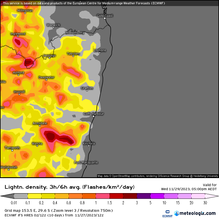
…while the EC lightning forecast looks like this:
The BoM storm forecast map for tomorrow looks like this:
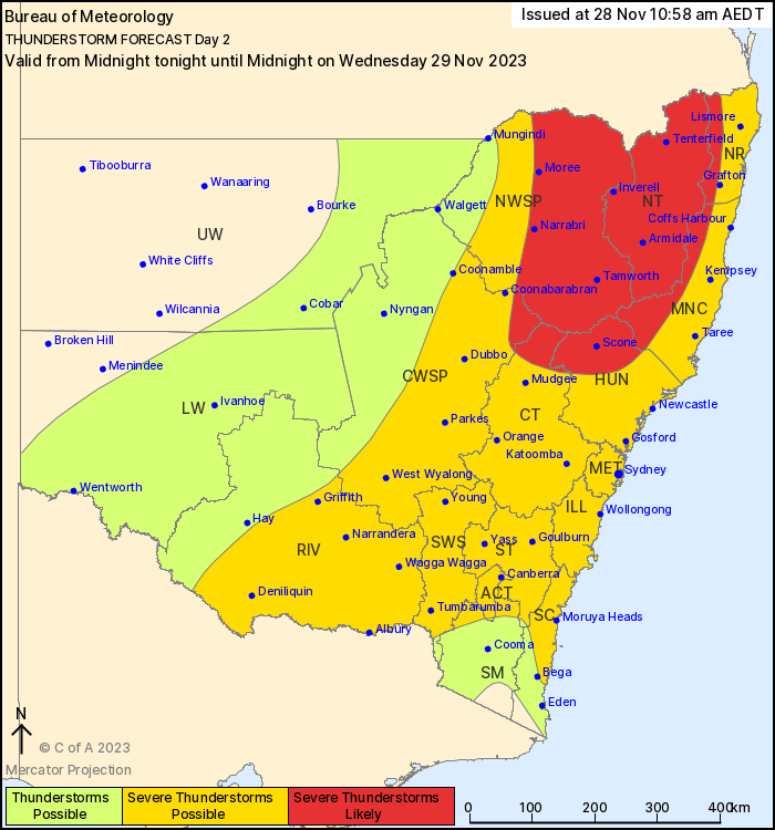
…and in their words: “There is a added risk of more frequent severe thunderstorms In the northeast during the afternoon and evening, with possible high end thunderstorms that may bring localised destructive winds (> 125 km/h), and giant hailstones (> 5cm).”
That doesn’t mean we will see those conditions – but somewhere across NE NSW likely will. Could be a day to keep an eye on the radar and warnings, particularly if we get some hot sunshine in the morning. Peak storm time will be from early afternoon onwards – expect to see the radar light up (though no guarantees that will be across our area).
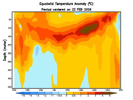
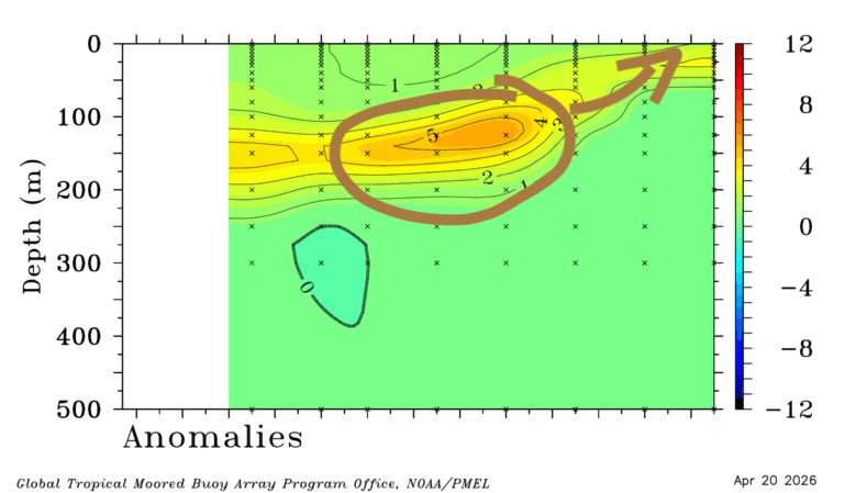
Looking slightly further ahead and whilst the storms moving through tomorrow will likely dry things out for a day or two, we’ll still be running the risks of showers and storms at times through the short term outlook period. It also looks like the southern oscillation will turn positive over the next couple of weeks:

This will increase, though not guarantee, the risk of wetter weather at times (despite the El Nino). I’ll post again as bigger events / storm days look likely. The 10 day outlook from the all-new Google AI Deepmind model (which uses a completely different method of forecasting which uses massively less computer power, is a lot faster and is already up there with the top models for accuracy) looks like this:
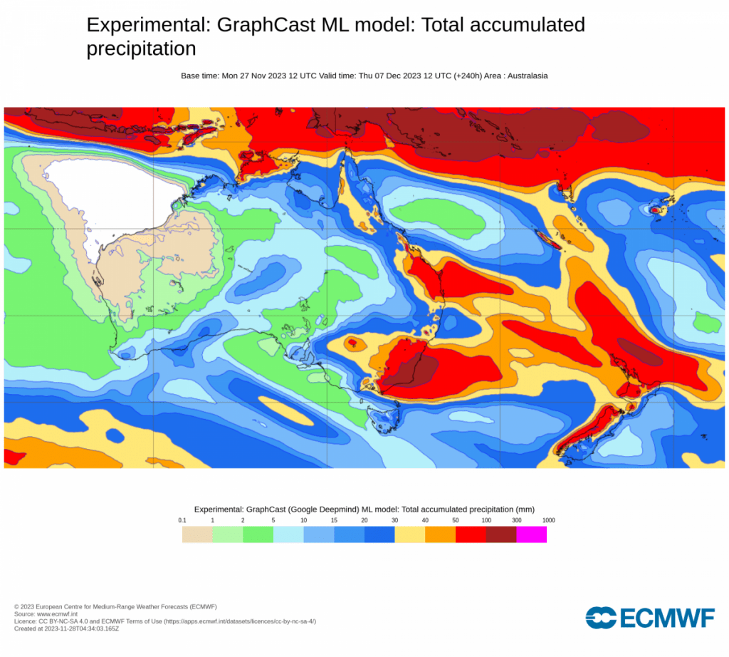
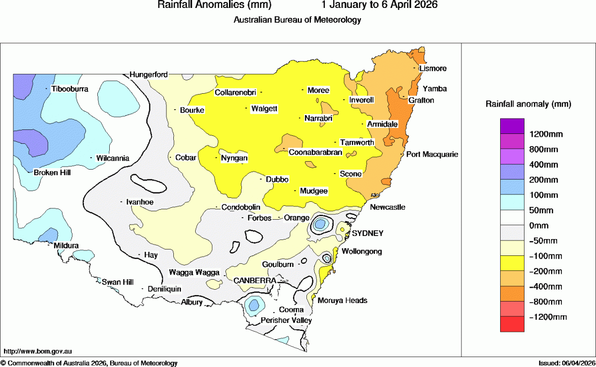
You can see the forecast higher falls to our north, and particularly to our south (with flood watches issued for the south coast), but with the atmosphere looking unstable right through we could well end up with some decent falls across our region too…I’ll post again if / when other storm / rain events look likely.
Thanks to Kombu Wholefoods and Snapfrozen for hosting and sponsoring this page
Thanks to NOAA / BoM / Meteologix for images.