Sudden stratospheric warmings are hard beasts to predict…and we’ve had one pop up this year. A sudden stratospheric warming is a significant disruption of the stratospheric polar vortex that begins with large-scale atmosphere waves (called Rossby waves) getting pushed higher into the atmosphere. These waves can “break” (like waves in the ocean) on top of the polar vortex and weaken it. If waves are strong enough, the winds of the polar vortex can weaken so much that they can reverse from being westerly to easterly. This leads to cold air descending and warming rapidly – creating a sudden warming event. If we look at the wave pattern over the Antarctic right now we can easily see the changes in the wave pattern:
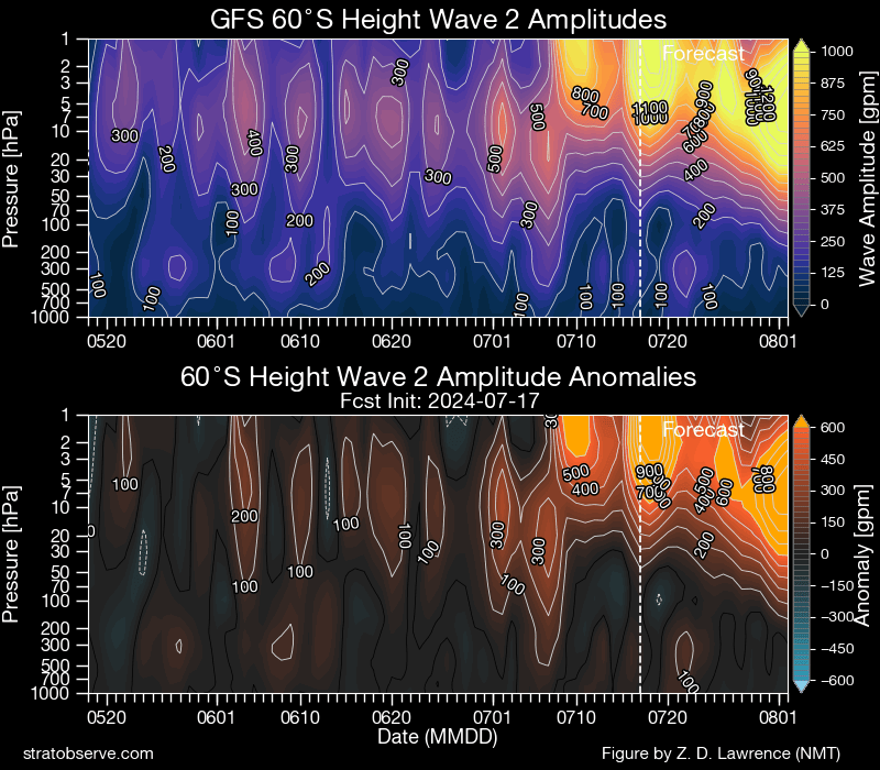
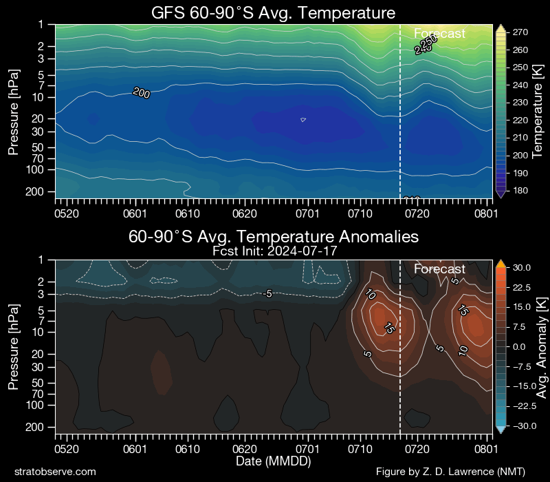
Some decent ongoing wave breaking happening right now and forecast to continue for some time. The outcome from those changes in wave pattern…a sudden warming up high over the Antarctic polar region:
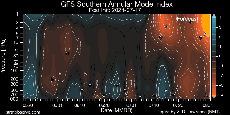
…and going on from that, we thus get to see a weakening in the vortex, with the Southern Annular Mode turning negative, initially up high but likely moving lower over time:
…and going on from that we get to see westerly winds and cold pools extending further north across Australia (and many other places across the southern hemisphere)…and that means colder weather for many, with a likelihood of snow over the mountains down south – which is exactly what we’ve got coming up this weekend.
Bellingen is low down and east of the divide so (usually) miss the worst of the winds and the coldest of the weather, whereas Ebor, Dorrigo and areas further south can take a bigger hit. Compare the forecast for Bellingen tomorrow / Sunday:

…with that for Perisher:

Some wild snowy weather coming up down south, with blizzard warnings in place for Alpine regions. Assuming they can make it there through the snow that is great timing for the Bellingen High School snow camp coming up this weekend and into next week.
Looking further ahead and the SSW event will increase the risk of westerly winds through August, which for us usually means drier weather, though it can be cold and windy at times. We’ll see some possible showers at times as changes move through, but not looking at higher totals at this time. One thing that can happen during these events is for upper cold pools to move further north than usual and increase the risk of east coast lows, but right now there are no indications of this happening.
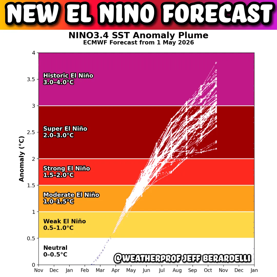
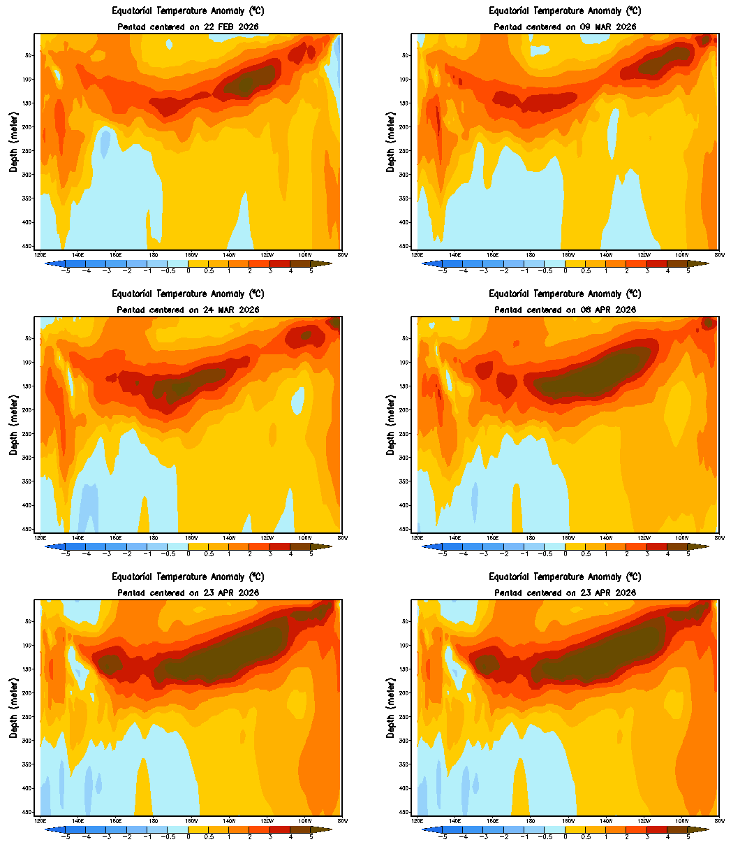
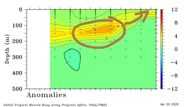
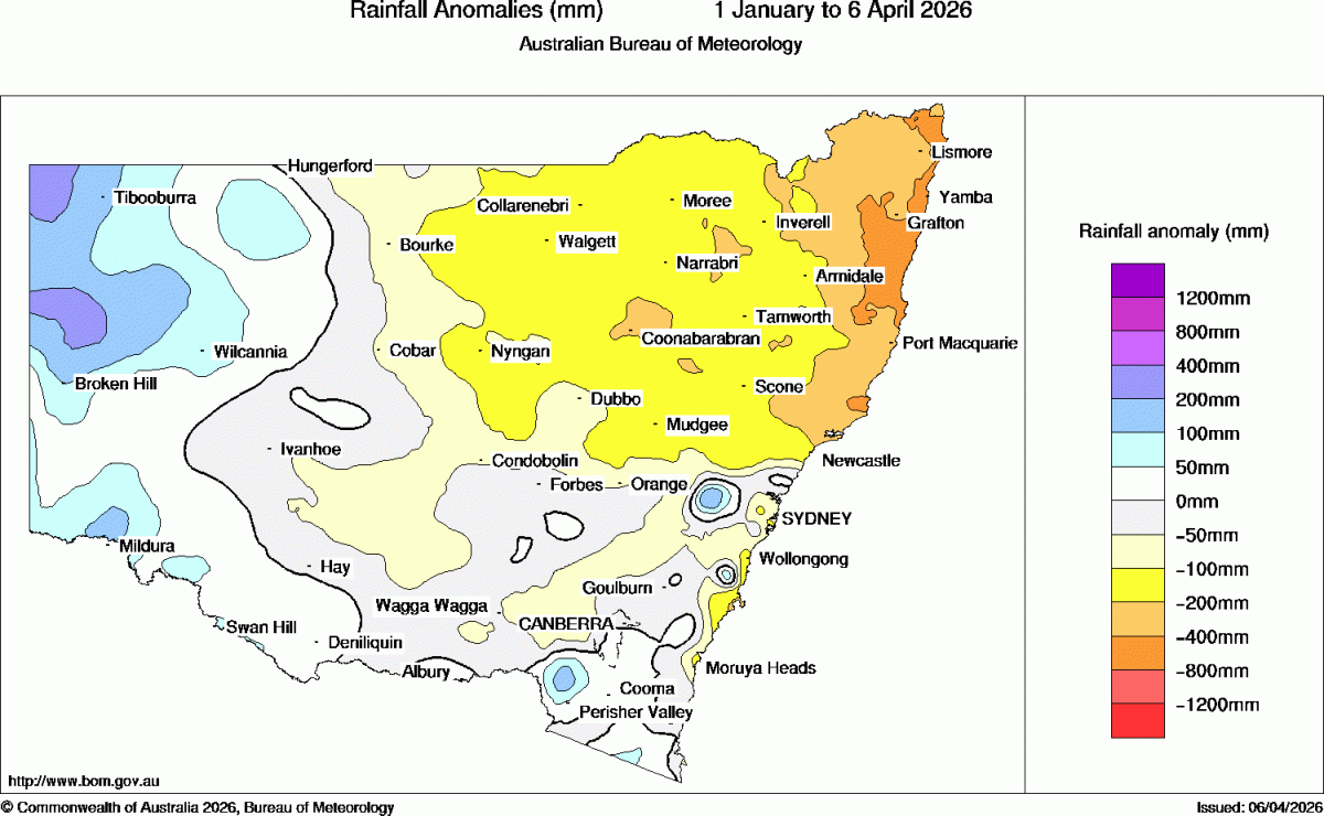
Even further ahead and most models still indicate a La Nina of sorts coming together over coming months – and that would mean the risk of wetter weather as we head into and through late Spring and Summer:
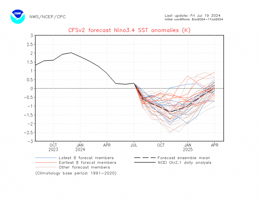
…again something to watch carefully. More on that as we move into Spring. As we know all too well wet summer weather can bring decent floods to our river valleys – and there is currently a fantastic citizen-science project coming together to be able to monitor and publish live Bellinger / Kalang valley river height information in real time. We’re looking for volunteer monitors for this project. It won’t take much time but can be of significant benefit to our community. If you are interested in getting involved please drop us an email to admin@bellingenweather.org and we’ll pass your details onto the team.
Talking of developments we’re lucky to have live weather data from two RFS weather stations available on the Bellingen Weather site – hover over the RFS AWS menu a the top and you’ll be able to access live weather data for Bellingen and Deervale. It’s a work in progress and right now only works well on desktop computers, but we’ll keep working to improve the display as we go…and feedback is welcome to the email address above. Many thanks to local landowners for hosting the stations and to the RFS Coffs Coast team for their work securing funding for the stations and then working towards their installation.
That’s all for now, keep warm and enjoy the sunshine!
Thanks to RFS / NSW / NOAA / Stratobserve.com / yr.no for some excellent imagery
Thanks to Kombu Wholefoods and Snapfrozen for hosting and developing this site

This Post Has One Comment
Pingback: Showers and Sudden Warmings... - Bellingen Weather
Comments are closed.