Hope you had a lovely Christmas. We have been blessed the last few days – definitely some storms around our region, but we managed to avoid the most destructive storms, which kept to the north and south of us. Here’s a map showing lightning strikes across our region over the last three days:

We got to see some decent lightning but not as much as north and south of our region. A storm loop from yesterday likewise shows big storms blowing up all around us:
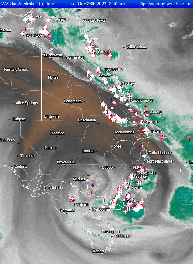
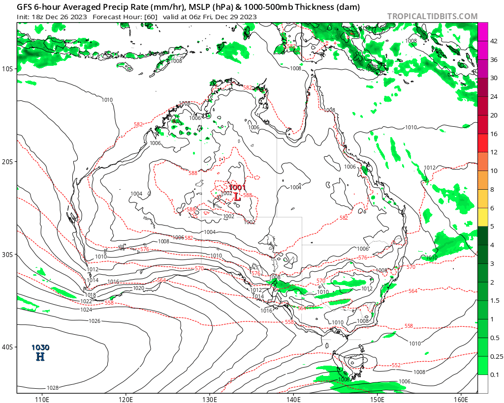
You can see the upper low swirling through southern NSW – actually looks even better in this visible image:
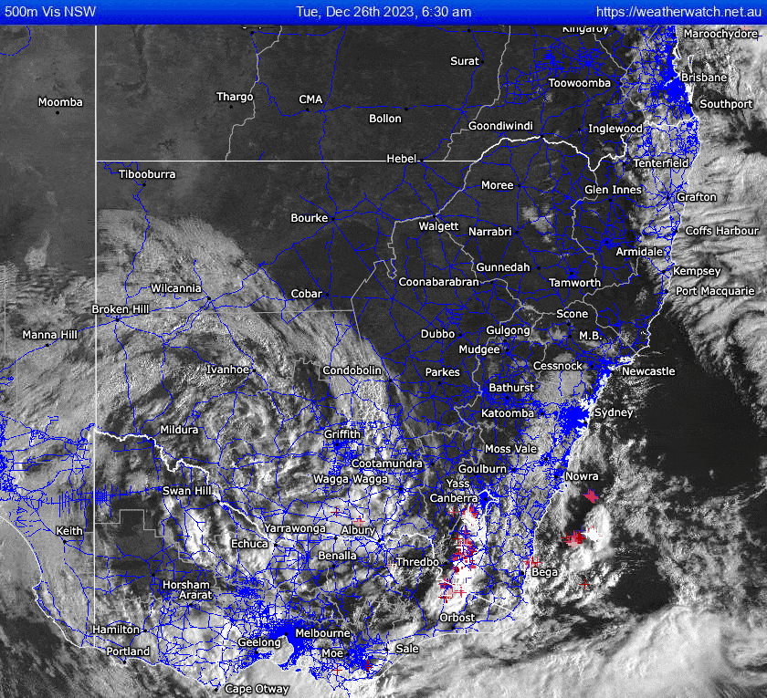
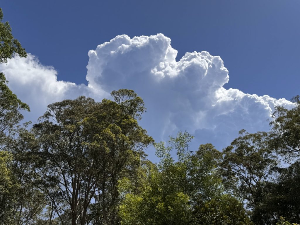
Just an amazing sight – and very late in the year for such a system…something we usually see in September and October. Storms yesterday kept just to the south of us but still appeared fairly spectacularly in our sky to the south:
Further down to our south around Bulahdelah they saw a decent hail storm move through – dangerous on the roads and a nightmare for growers:
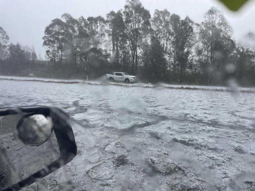
Thanks to Higgins Storm Chasers for that image. There was also a tornado that moved through parts of SE Qld causing significant damage and recorded winds over 160km/hour. The cold pool is now moving offshore (but as I type giving some decent storms through the Sydney basin) and we have a couple of quieter days coming up before the next system moves in. This one will bring the risk of showers and storms once again but as the surface trough moves offshore winds will turn onshore and could bring us a spell of wetter weather around New Years Day. Here’s the latest animation – and check out the forecast threat of more severe storms, particularly around SE Qld:
Not looking at huge totals for our region, but if you catch a decent storm you’ll once again see decent falls in a short period of time. The multi-model average running out for the next week shows these totals across NE NSW:
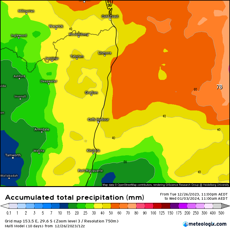
As an average across a number of models the higher / lower totals blur out…so some locations will see much higher totals than detailed above, while others may well miss out pretty much altogether. Our dams and creeks are currently very low, so hoping we get to see some decent totals in the valley.
The bigger picture right now shows ocean temperatures around the world sitting much higher than average:
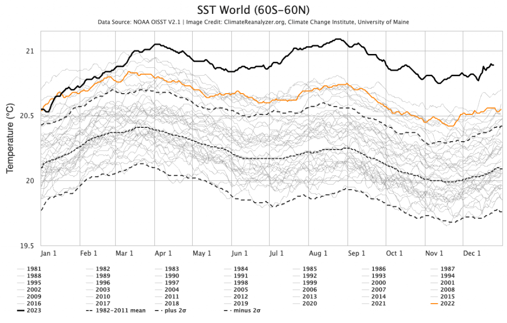
We’ll likely maintain higher levels through 2024 as a combination of El Nino and climate change converge. Expect more severe global weather with those sort of figures…
We might have an El Nino in place but with warmer than average ocean temperatures in many locations it can be hard to spot the pattern. Worth checking out current sea surface temperature anomalies across the globe:
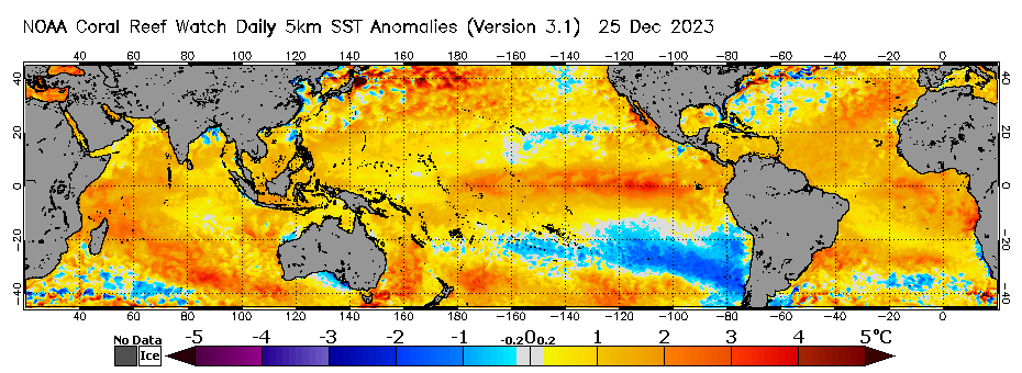
You can (just) see the El Nino signature in the Pacific, warmer than average temperatures around Australia and a developing area of colder than average ocean temperatures off the coast of S America. If you compare the image above with one for the 1997 El Nino:

…you can see how much harder it is to spot the El Nino pattern in 2023.
We did see a drop in ocean temperatures in the Coral Sea with the recent system that moved through there…but that has now gone with much warmer ocean temperatures returning. Check out how much the Coral Sea has warmed back up in this image, which shows the temperature change over the last seven days:
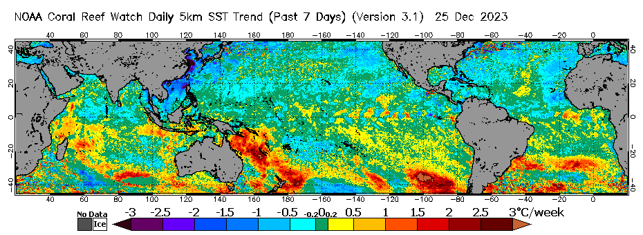
The East Australia current will draw some of those warmer waters down towards our region over the coming weeks. Looking further ahead and it looks like a repeating pattern coming up with more stormy systems moving through from time to time over the next few weeks. Warmer than average ocean temps will give those systems a lot of energy to play with so expect more dramatic weather across Eastern Australia. I’ll post again when more severe systems / storms look likely across our region.
Thanks as always to Kombu Wholefoods and Snapfrozen for sponsorship
Thanks to NOAA / BoM / WeatherWatch / Higgins Storm Chasing / ClimateReanalyzer / Tropical Tidbits for the images


