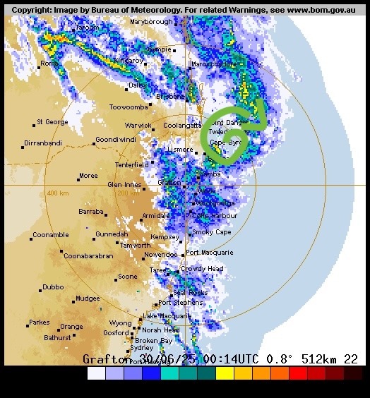
After the quick burst of excitement earlier in the week…perhaps not surprisingly models now show the cyclone taking a more northerly track and landing on the Northern Queensland coast. Here’s how it looks right now – pretty awesome actually:
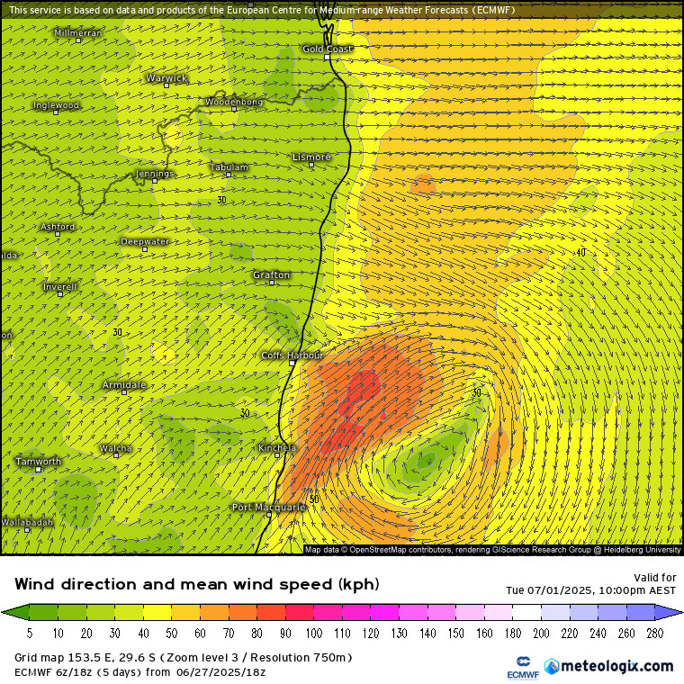
And here is how models show it moving:
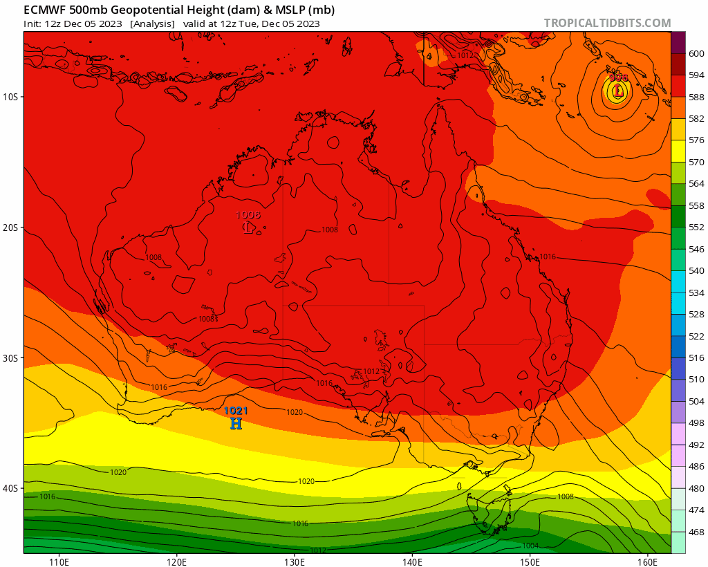
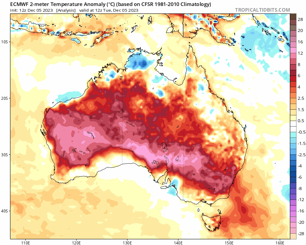
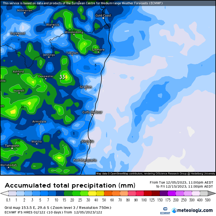
Still something to keep an eye on, but right now it’s not looking like it is going to impact our region. What IS going to impact us is the heat. The focus will be inland NSW, but we’ll see decent temperatures right through and some real heat moving in from time to time. The problem is the upper low to our west – they usually move east and clear the heat away (and drag cyclones down south!) but this one looks like moving west and then south. Here’s how the heat anomalies looks across NSW over the coming 9 days – not moving out any time soon:
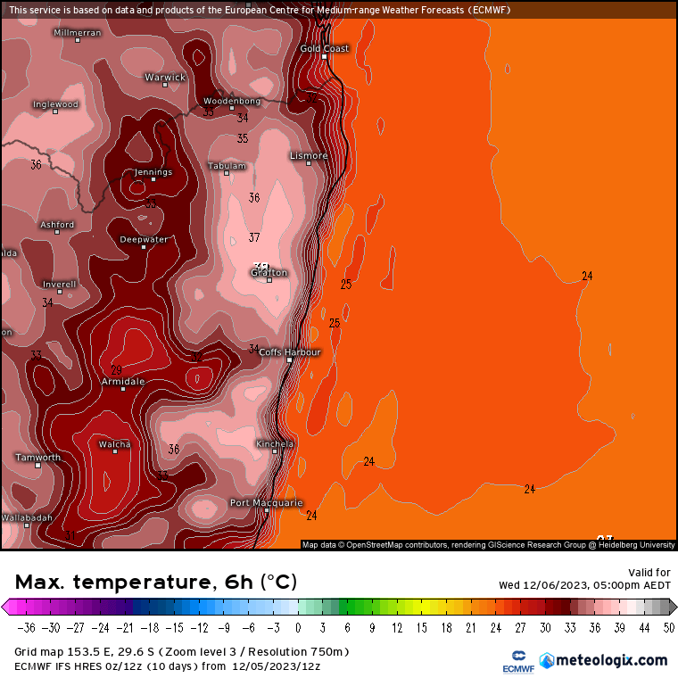
The forecast top temps for today are upper 30s across our valleys:
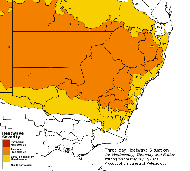
Not surprisingly the BoM have a heatwave warning out for NSW:
It should cool down a little at times over the coming week, but we’ll still see top temps into the low 30s each day, with the more intense inland heat likely to move back across later next week. The heat is going to generate a few storms over the hills, but likely to remain drier closer to the coast (though always the chance of the odd storm moving across):
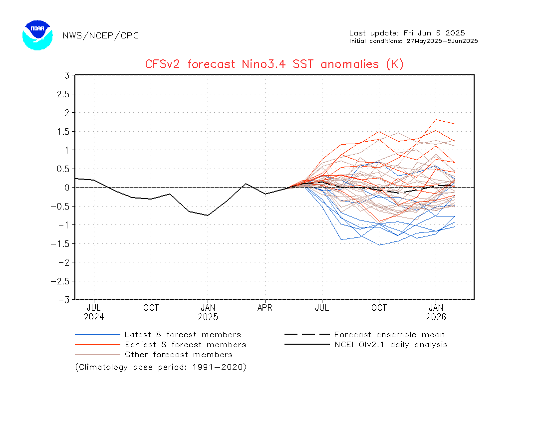
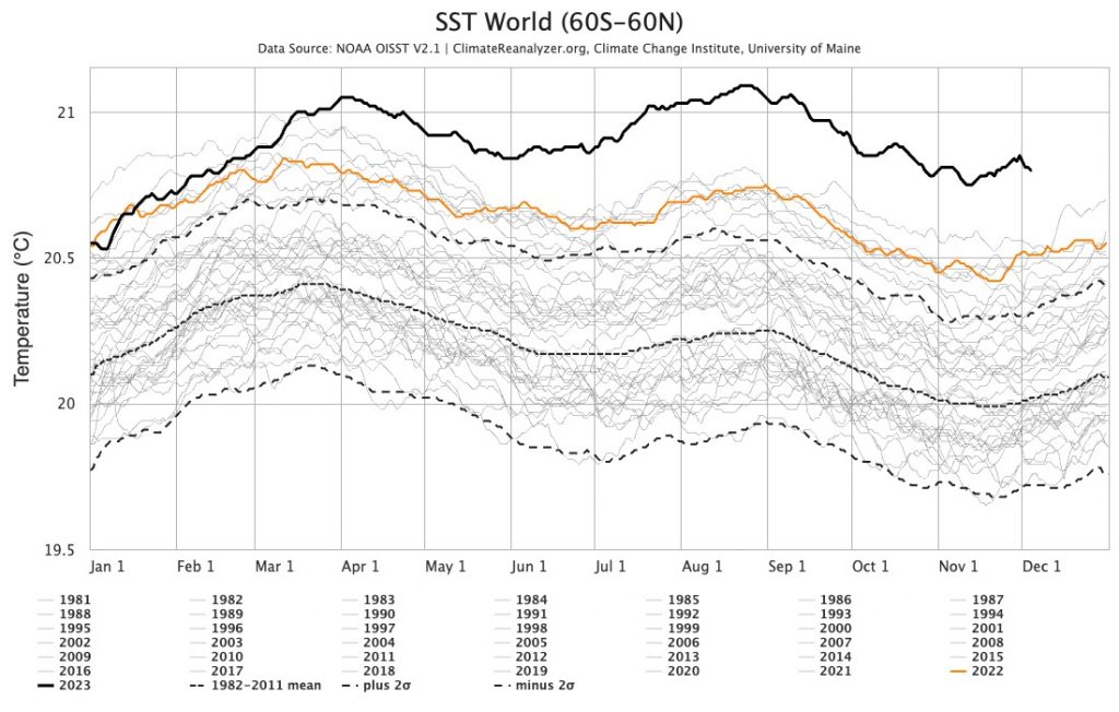
Looking further ahead and the seasonal models indicate hotter average temperatures right through – not surprisingly when average ocean temperatures across the world are at record levels:
…but they also indicate that we could see some wetter weather at times through summer. The Pacific looks like returning to neutral values through late summer and into our winter, before some signs we could see a return to La Nina as we head into late winter. That is a LONG way off however and there is ample time for things to change…
Thanks to Kombu Wholefoods and Snapfrozen for ongoing support
Images thanks to Meteologix / Tropical Tidbits / NOAA / BoM