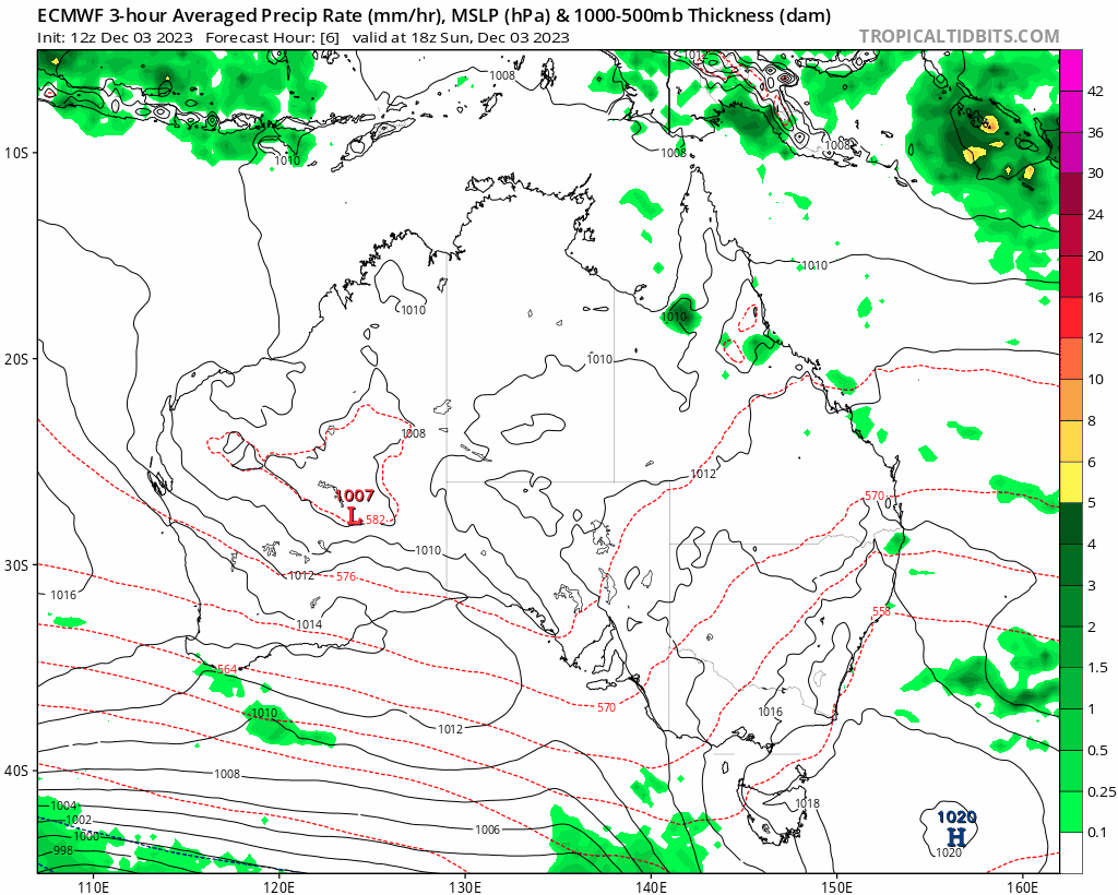
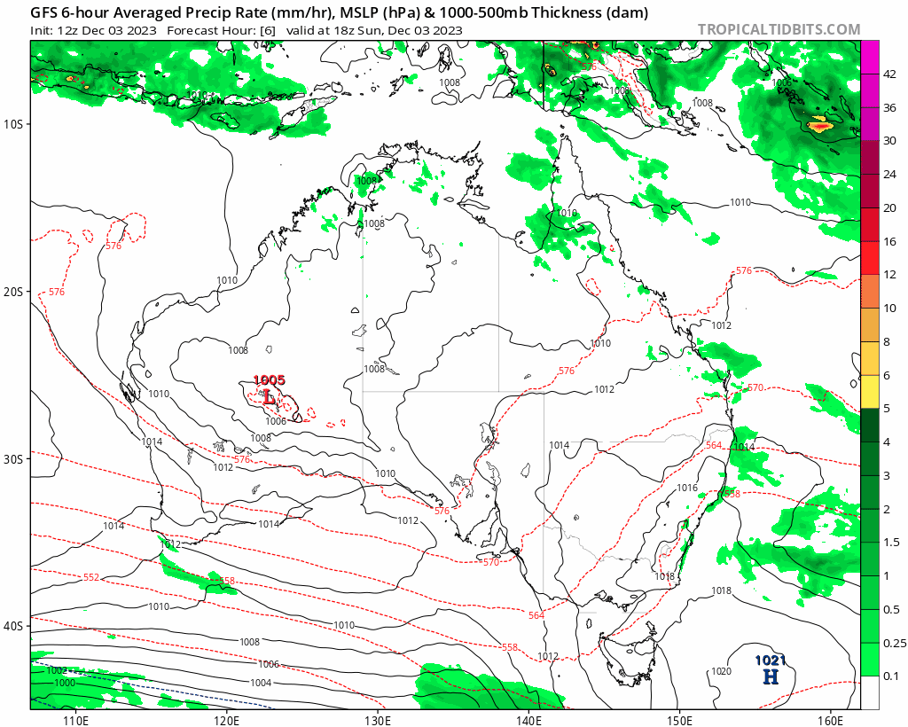
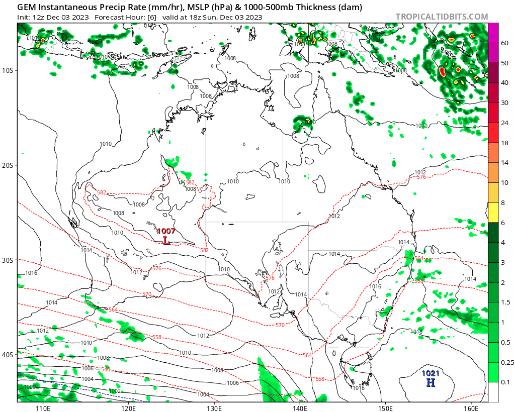
Had no choice but to write a post this morning. We’ve got three top models all showing a Coral Sea cyclone developing and moving close to / over the east coast of Australia in about a weeks time. There are a heap of buts in there…but first the runs from the three main models.
First up EC:
GFS:
GEM:
Needless to say, if that came off we’d see some very decent rain totals with flooding likely – here is the GFS model by way of example:
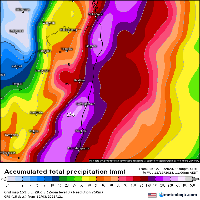
That’s just one side of the picture however. A few points to remember…
- This is the Coral Sea, which is one of the hardest tropical regions in the world in which to forecast
- Impact is a good week out – and a lot can change in that time
- Small changes in the short term mean BIG changes in the longer term
- Climatologically it would be *very* unusual to see a cyclone impact along the east coast in December
- If the system did make it down to us it would be weakening, though would likely still pack some punch
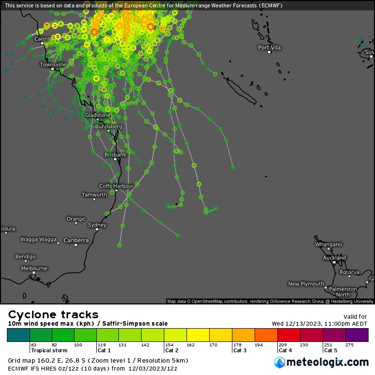
At times like this it is worth also looking at the EC ensemble track – and that has the majority of runs keeping the system offshore or impacting way to our north:
We can also look at ensemble forecast rainfall – and for both EC:

…and GFS:

…and we see a lot of variation in forecast total rainfall across our area across their ensemble…which flags that very small differences at this time create very big differences in the movement of the system over coming days – so reliability right now is low.
Regardless…this is a fascinating system to watch and there would be significant impacts across our region should it come off as currently forecast…as such I’ll keep a close eye on this one and post updates over the coming days.
Thanks to Kombu Wholefoods and Snapfrozen for sponsoring this site
Thanks to Tropical Tidbits / Meteologix for images


