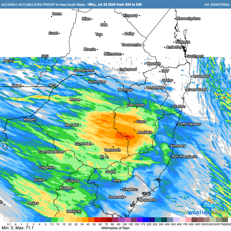
A quick update as it looks like we might see a few showers around tomorrow as a change moves through. As this one is moving in from the west we’ll see most of the rain to the west of the divide, with much lower totals towards the coast. The BoM high resolution model forecasts the following totals between now and the end of Saturday:
Looking into the medium term and we’ll likely see the impacts of a Stratospheric Sudden Warming over the coming weeks. You can read up on SSWs on the previous post but it’s worth an update with the warming well underway:
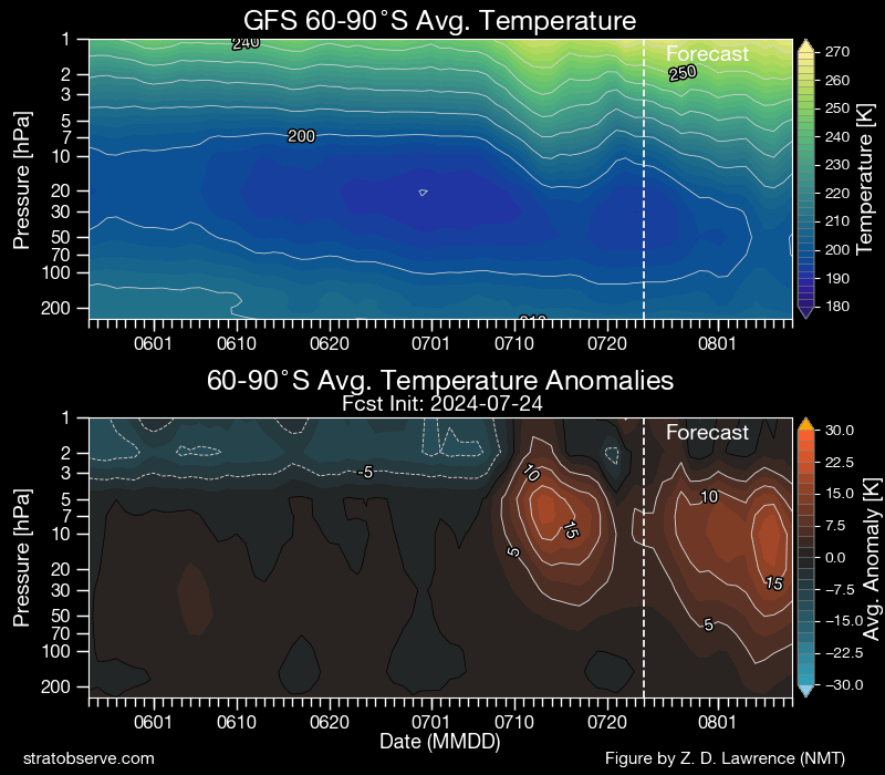
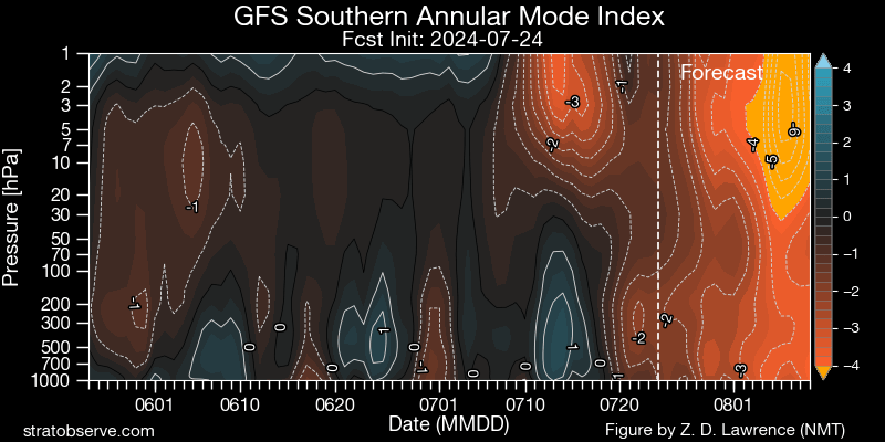
…and as a result the SAM (indication of how strong the Antarctic vortex is) is heading well into the negative over the coming days:
That’s not a pattern you’d like to see in the middle of Spring – but this one is kicking off much earlier (and in much wetter conditions) than 2019, so although drier weather is more likely as a result we’re very unlikely to see the same fire outcomes as we did in 2019. Likely outcomes from this event include stronger cold fronts through the south of Australia, more snow on the mountains, westerly winds for us, and reduced rainfall along the east coast. I’ll post again with updates as it develops.
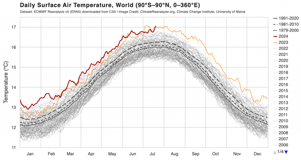
One thing worth noting at this time – global temperatures have just broken back through the 2023 record levels:
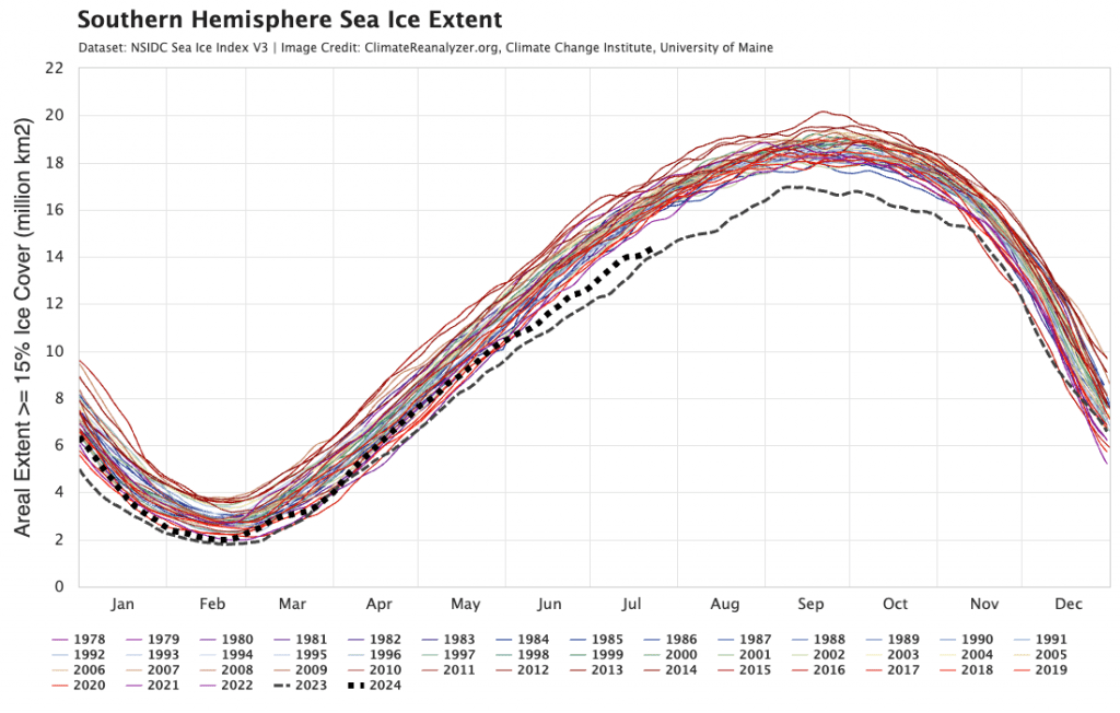
…and sea ice around the south pole is also heading once again towards record low levels:
It’s beyond my knowledge to know how these events will impact our weather – or even if the low sea ice has helped trigger the SSW – but regardless it’s good to know the global CO2 output has likely peaked. The record temperatures will impact global weather patterns in more extreme and unexpected ways…something else to keep an eye on.
That’s it for now, thanks for reading, and thanks to University of Maine / stratobserve.com / Weatherwatch MetCenter for the images
Thanks as always to Snapfrozen and Kombu Wholefoods for the ongoing support