Stormy Times!
I think we all agree that Thursday's storm was a cracker. The atmosphere was fairly well capped but then broke across our region on Thursday evening. Capping means a layer…
I think we all agree that Thursday's storm was a cracker. The atmosphere was fairly well capped but then broke across our region on Thursday evening. Capping means a layer…

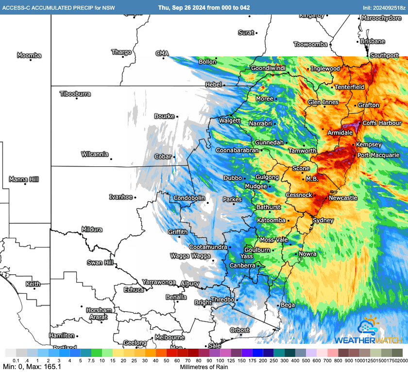
It was certainly a stormy day yesterday. Here's the radar animation from the afternoon: ...and that gave us the following rainfall accumulations: Not so much in the valley but the…
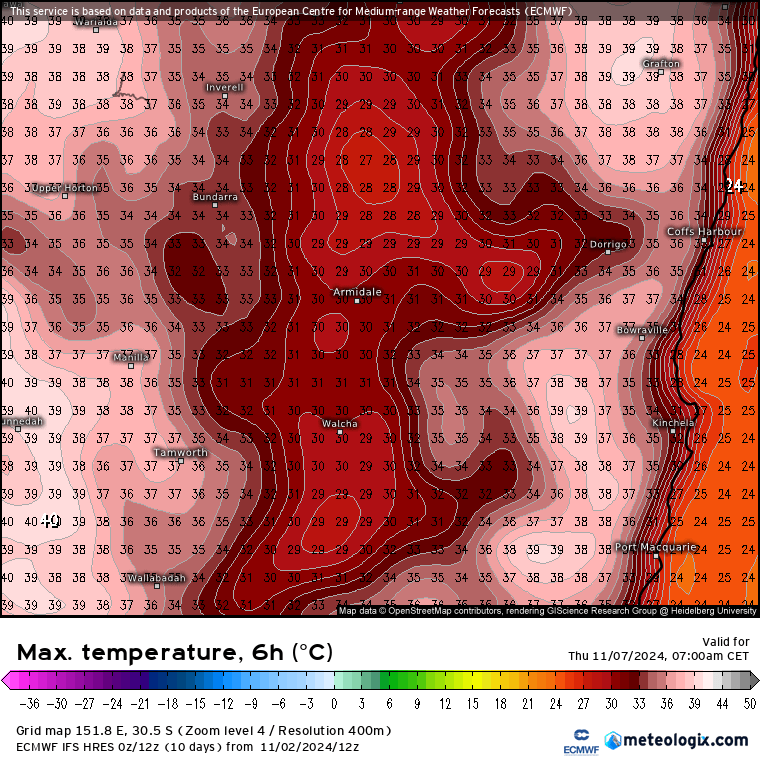
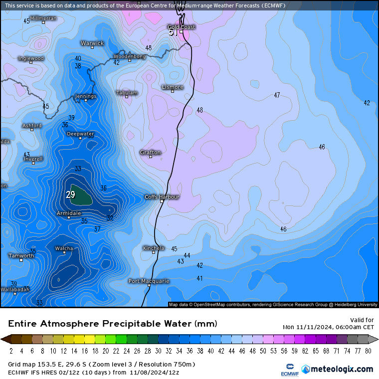
We've talked about showers and storms as changes move through, but worth flagging the heat building inland as that heat can get pulled across to the coast ahead of changes.…
Another night of storms last night - with close strikes and decent sized hail waking many of us up late in the night. Here's how it looked on the radar…
We had some great storms move across much of NE NSW and SE QLD last Thursday - as forecast by the models. Worth checking out the lightning strikes for the…
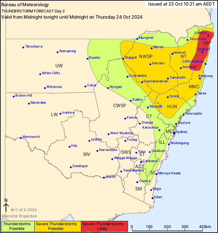
A quick post to flag the chance of some stormy weather as we move through Thursday. According to the BoM: "Thunderstorms are possible in NSW across the northeast quarter, western…

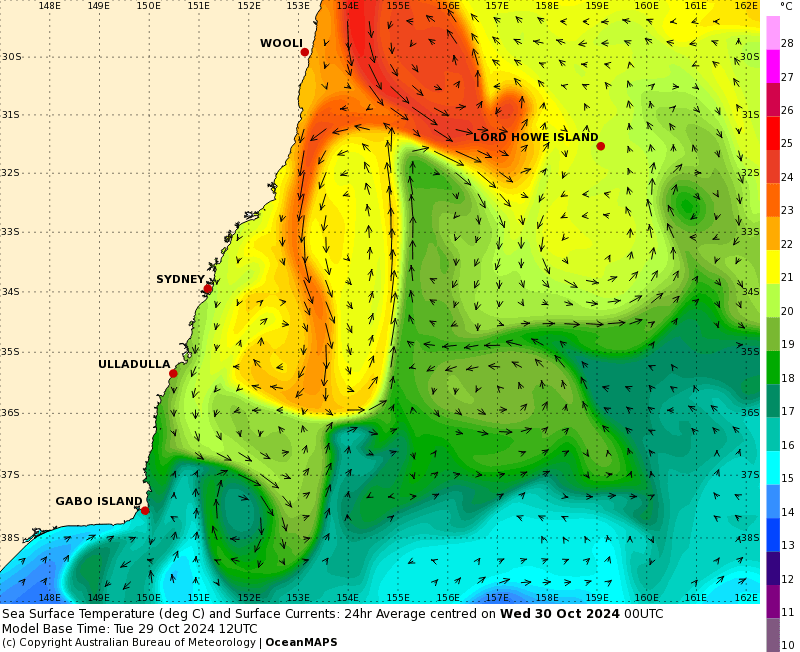
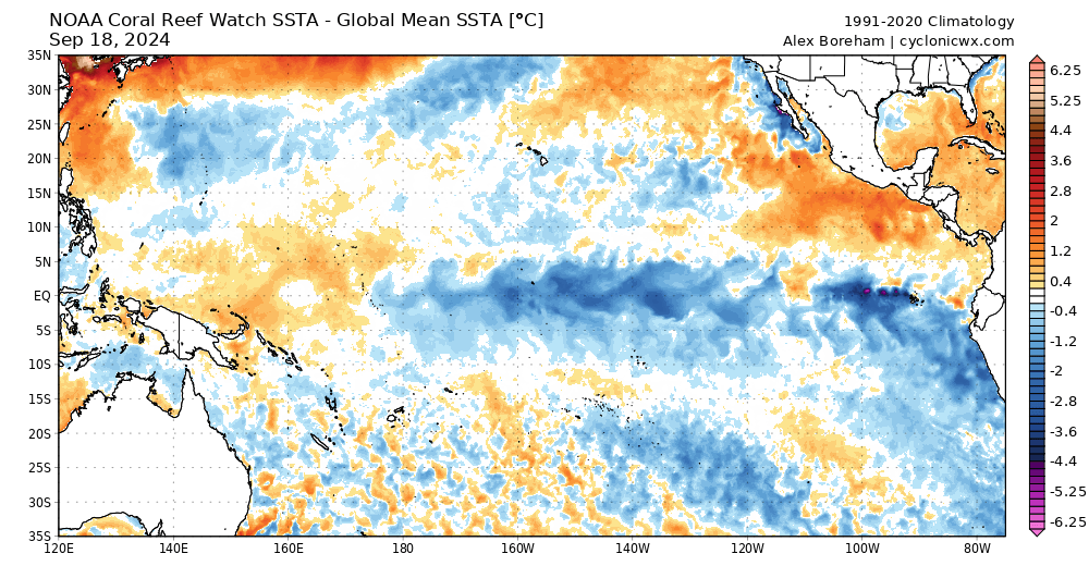
Some quieter weather to come (though with the chance of a storm and a few showers as changes move through) so a chance for a bigger picture update... Ocean temperatures…
We've got that change discussed in the last post moving up the coast right now: ...and we'll see some decent totals accumulate as it moves through our region. With winds…

We've got another change coming through later this week. We'll see a trough at the surface and a pool of cold air likely to move through up high. Here's how…
With some calm weather around it's a good time for a quick climate driver update :) The polar vortex is still a little negative (meaning more likelihood of westerly winds…