Some quieter weather to come (though with the chance of a storm and a few showers as changes move through) so a chance for a bigger picture update…
Ocean temperatures are currently sitting above normal across much of the world:
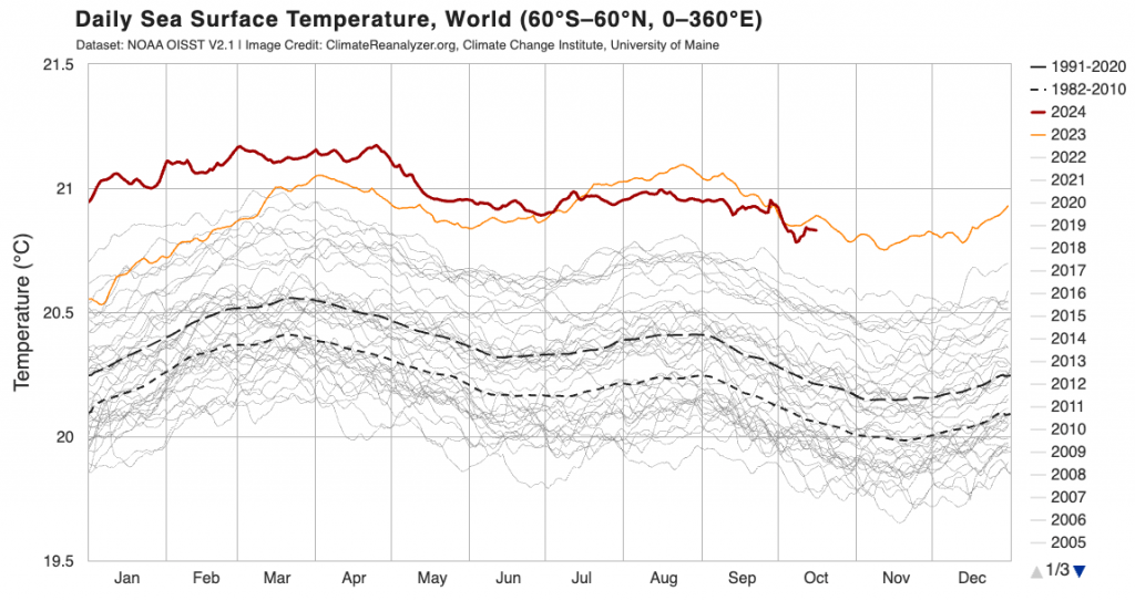
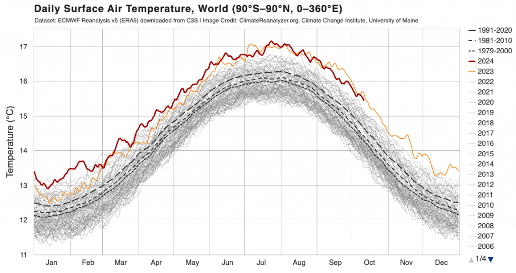
As the USA recently discovered that can lead to significantly higher rain totals during flood events, as well as stronger cyclones. With a La Nina developing right now you would expect ocean temperatures to drop, but that’s not happening right now. Definitely one to watch. As with ocean temperatures the air temperature is also sitting higher than average:
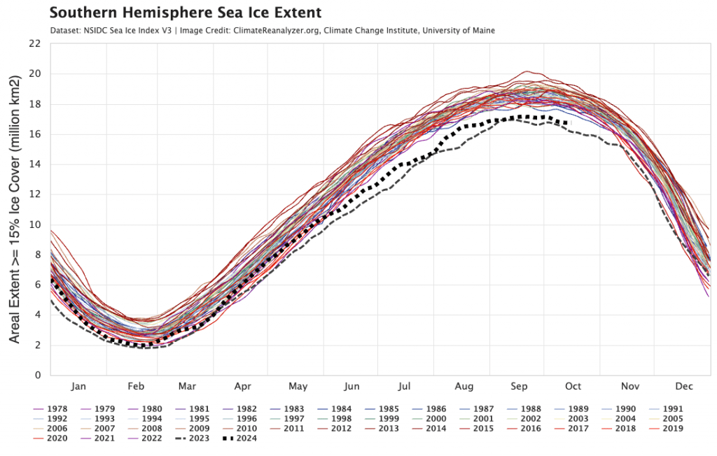
…and needless to say that has led to lower than average sea ice around Antarctica (and a much earlier than usual decline in the southern vortex):
…as well as a forecast of higher than average maximum temps through summer, despite the La Nina:

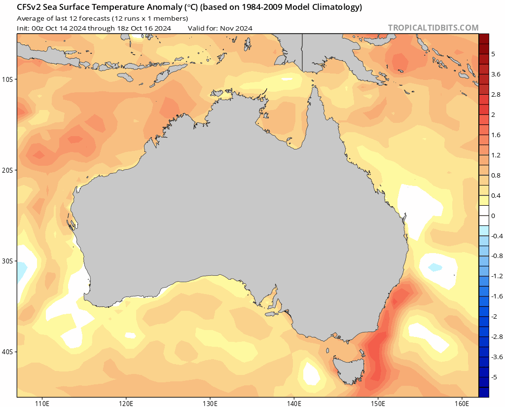
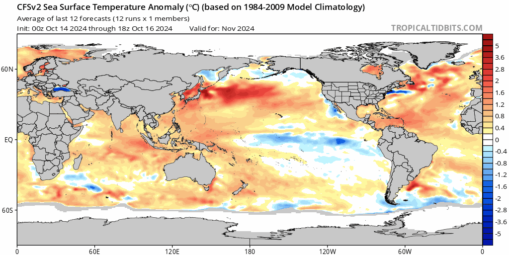
Part of the reason for the forecast higher maximum temperatures is the higher than average ocean temperatures close to Australia. Here’s the forecast ocean temperature anomalies across Aus running through to July next year – and worth noting the significant oceanic heatwave forecast off the NSW coast:
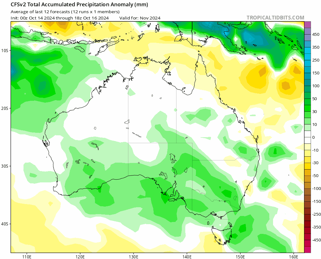
…and needless to say higher ocean temperatures and a La Nina combine to offer higher than average forecast rainfall over our summer – and not surprising to note how a blob of higher rainfall sits over those warmer ocean temperatures:
Worth noting the forecast minimum (overnight) temperatures forecast for summer by the BoM – and they’re forecasting literally 100% of Australia to swelter with well above average overnight minimums:

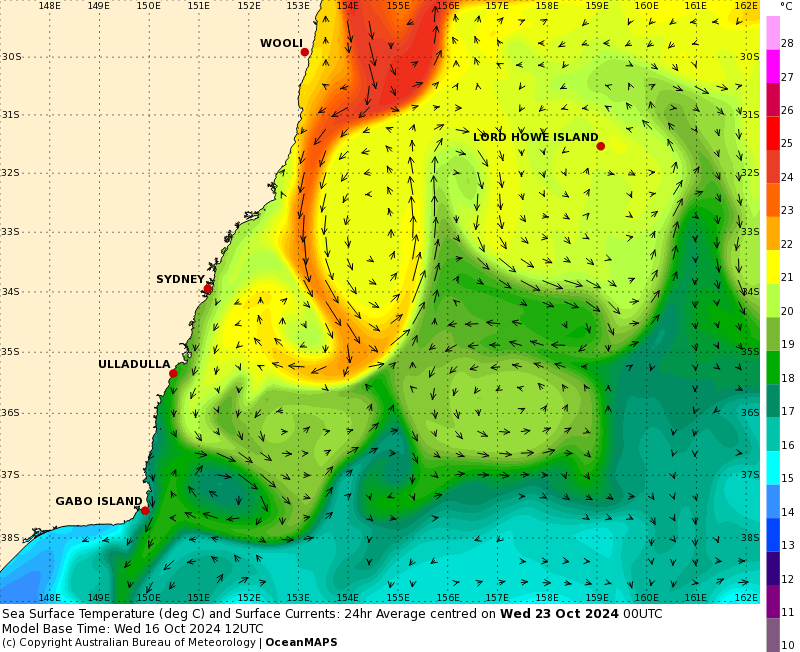
If you want to see one example of climate change in action then that chart will do it! Back to our region and bringing down those warmer ocean temperatures is an active East Australia Current. Here’s the forecast for later next week – and expect to see even warmer water pushing down quickly from the north over coming weeks:
Looking further afield and models indicate a weak La Nina will be in place for the next couple of months before weakening into 2025:
…so we’ll potentially see a return to drier and warmer conditions through 2025….but that’s a long way ahead! With talk of warmer conditions the latest greenhouse gas update has just been released…and those gases are still climbing steeply:
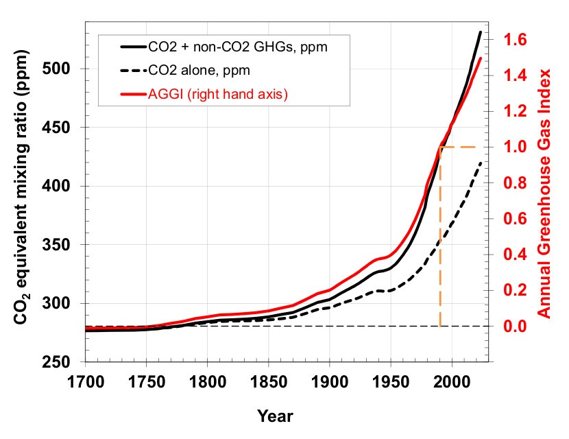
The solid black line is a combination of all greenhouse gases and is yet to show a much needed levelling off / decline. It would make sense for all of humanity if governments took urgent action to bring them down as soon as possible…
I’ll post again either when more significant weather looks likely or when the new seasonal forecasts come out in early November.
Thanks to our awesome image providers, but a particular nod to NOAA’s National Center for Environmental Information (NCEI), which was virtually wiped out in recent North Carolina flooding and has been rapidly brought back online thanks to a huge behind-the-scenes effort from US climate scientists.
Thanks also to our long term supporters, without whom this site would not exist – Snapfrozen and Kombu Wholefoods.