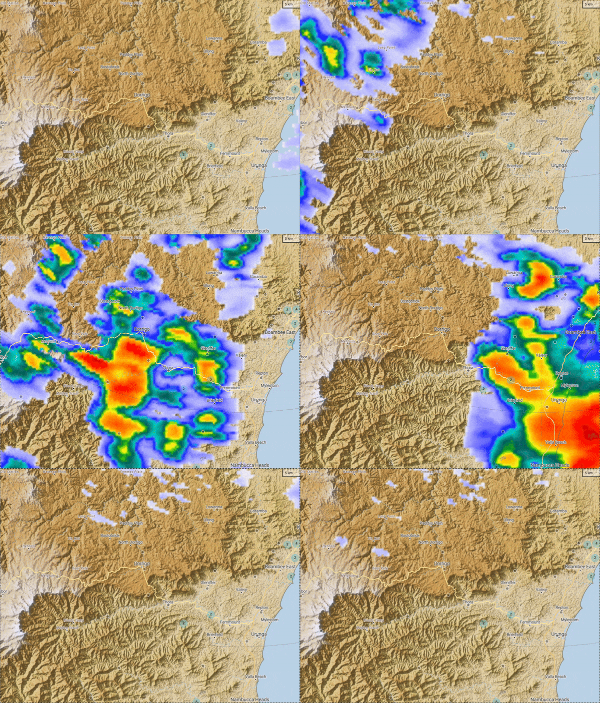
I think we all agree that Thursday’s storm was a cracker. The atmosphere was fairly well capped but then broke across our region on Thursday evening. Capping means a layer of warmer air up high which helps stabilise the atmosphere – and thus reduce storm opportunities on days when it feels warm enough at ground level to fire off some storms. When the cap breaks it creates a ‘hole’ for the unstable warm and humid air at the surface to rush up – and if the cap only breaks in one place over land (as happened Thursday) then much of that air rushes towards that break – and the result is some very quickly intensifying storms. Here’s how it looked on radar:
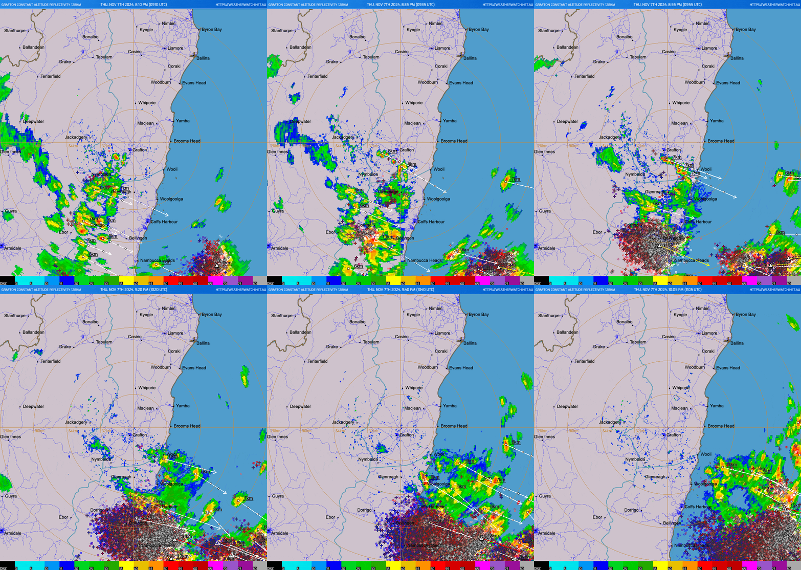
…and here’s the lightning animation – it explodes over Bello, with each white cross a cloud to ground strike (and squares a cloud to cloud strike):
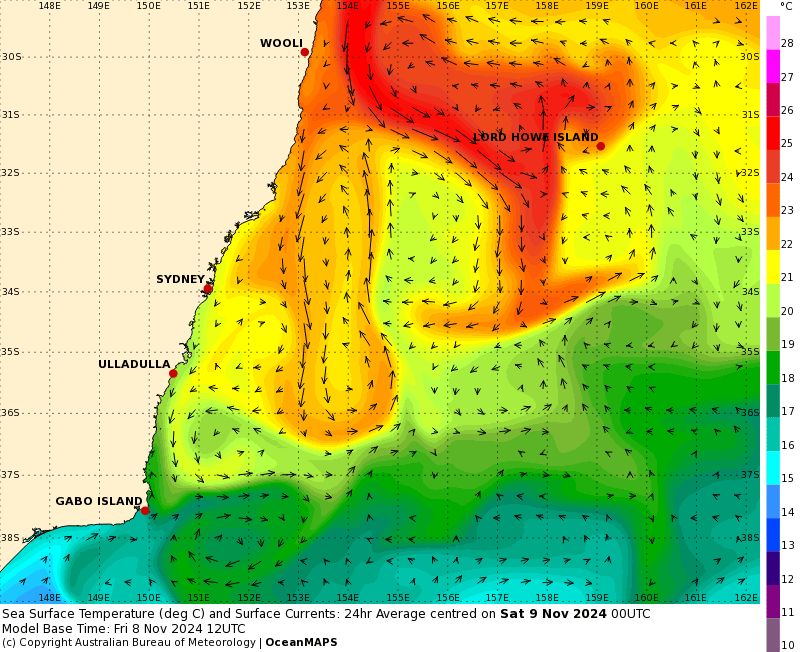
Looking ahead and the weather is stuck in a bit of a rut for now, with troughing to our west drawing down warm, wet winds from the NE. We’ve got some warm ocean temperatures out that way as well with warm waters pumping down the East Australia Current:
…and that is going to result in some very high precipitable water (PW) levels across our region over the next few days. Like rainfall, precipitable water is measured in millimetres. It is derived by calculating how much liquid water you would end up with if you condensed all of the water vapour above your head – from Earth’s surface to the top of the atmosphere. Higher precipitable water values mean that more water is available for potential rainfall. Today the PW is sitting at close to average:
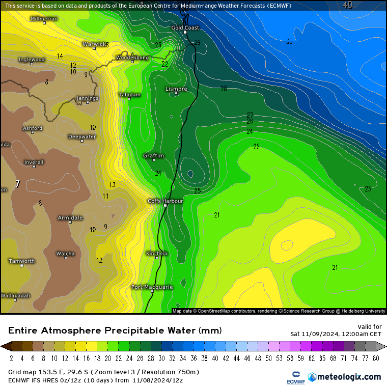
You can see some dry air inland, with slightly wetter air closer to the coast. Move forwards a couple of days and some deep tropical air will bring much higher PW levels across our region:
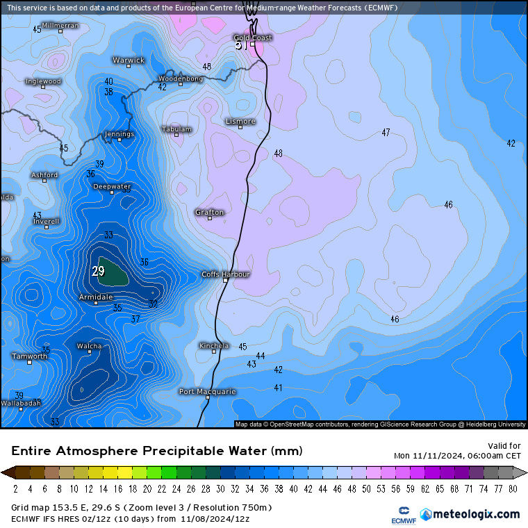
Hi PW levels by themselves don’t mean heavy rain – you need a trigger to condense it into rain…but it does mean that any storms that form from tomorrow into next week have a lot of moisture to play with, so we could see some localised heavy falls with any storms (and equally, as is the way with storms, some areas could well miss out). There’s also the chance of some more showery / rainy weather when PW totals get this high. Forecast rain totals over the next 6 days look like this:
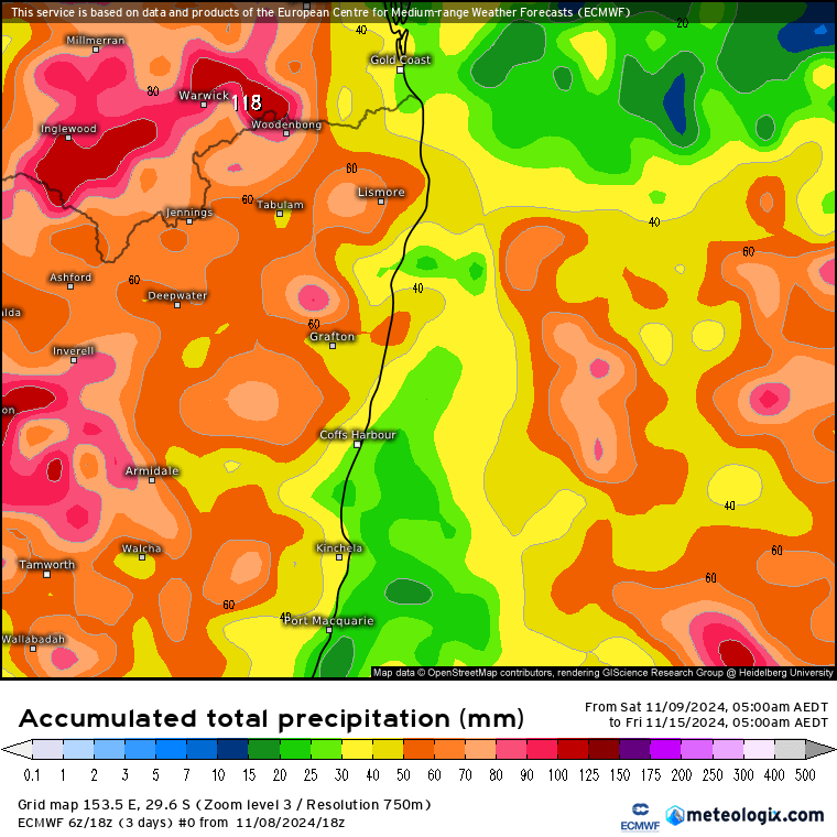
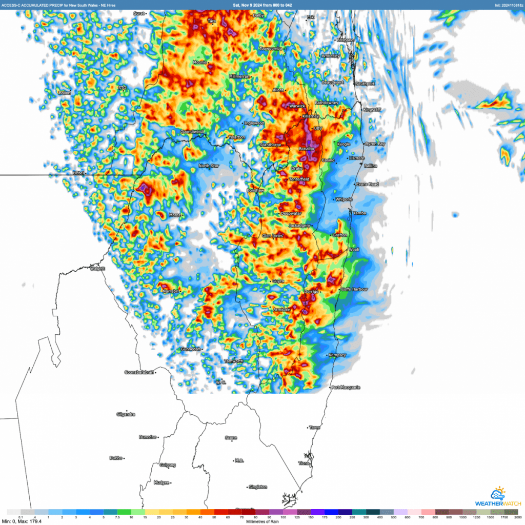
You can see the highest falls forecast for just inland of us, but still the chance of some reasonable totals across our region, particularly close to and over the hills. The 2 day BoM high resolution forecast also shows the higher totals in the usual locations:
Add another week to the forecast and totals look like this:
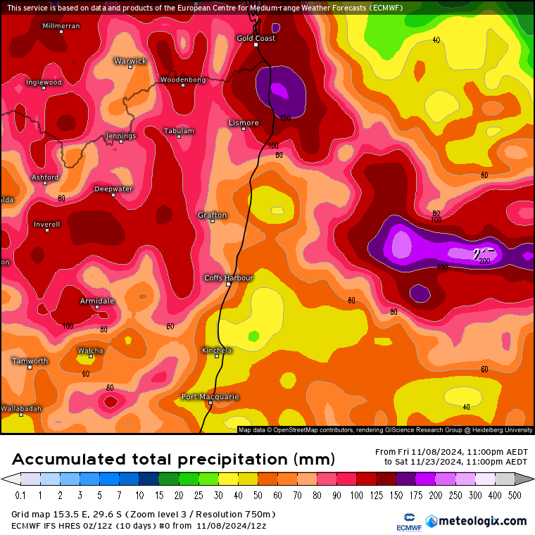
Again worth emphasising that these are forecast totals from models and are only an indicator that we’ll see some good totals. Some will see considerably more, while others see much lower totals – but it does indicate a continuation of stormy / wetter weather at times. Looking ahead at the averaged 6 week forecast totals and it looks like we’ll see more wet weather over coming month and a half:
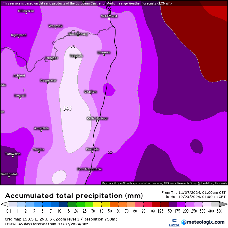
The monthly seasonal outlooks keep wetter than average conditions rolling through until the end of summer. It won’t be wet all the time but it does mean that we’re likely to see some wetter spells over the coming months, with flooding a risk through summer. I’ll post again as events roll in, but for now keep an eye out for more storms over the coming days ⛈️
Thanks to Meteologix / Weather Chaser / MetCentre for the images, and our usual thanks to our sponsors 🙂 :

