With some calm weather around it’s a good time for a quick climate driver update 🙂
The polar vortex is still a little negative (meaning more likelihood of westerly winds sitting further north than usual) but with the recent warming event pretty much over we should see the index return to neutral values over coming weeks. In the image below you can see the strongly negative values through August gradually fading away:
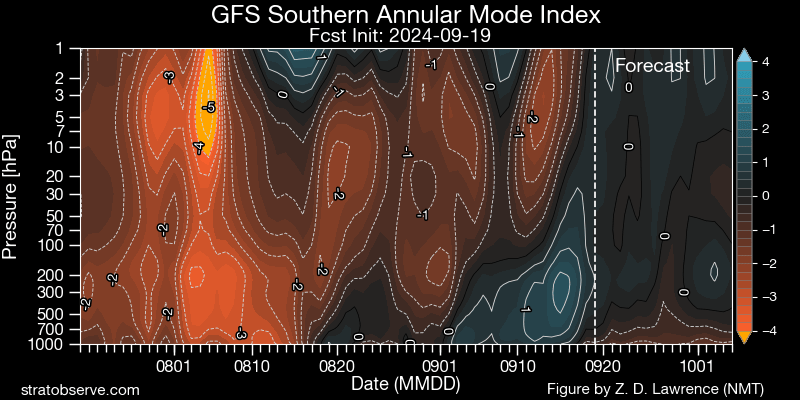
A negative SAM gives us an increased likelihood of drier than usual weather – so a return to neutral values means that other climate drivers become more important…however we’ll still likely see some impacts from the SAM over the coming month. If and when the SAM does go neutral the biggest climate driver for us as we head into late spring and summer is the Pacific Ocean.
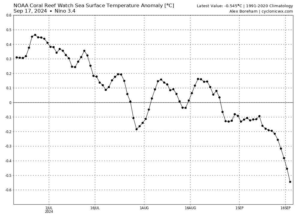
Right now the key parts of the tropical Pacific are moving into a La Nina type pattern. Here’s a graph showing the decrease in ocean temperatures in the key 3.4 region:
…and here’s how that colder water looks across the eastern tropical Pacific:
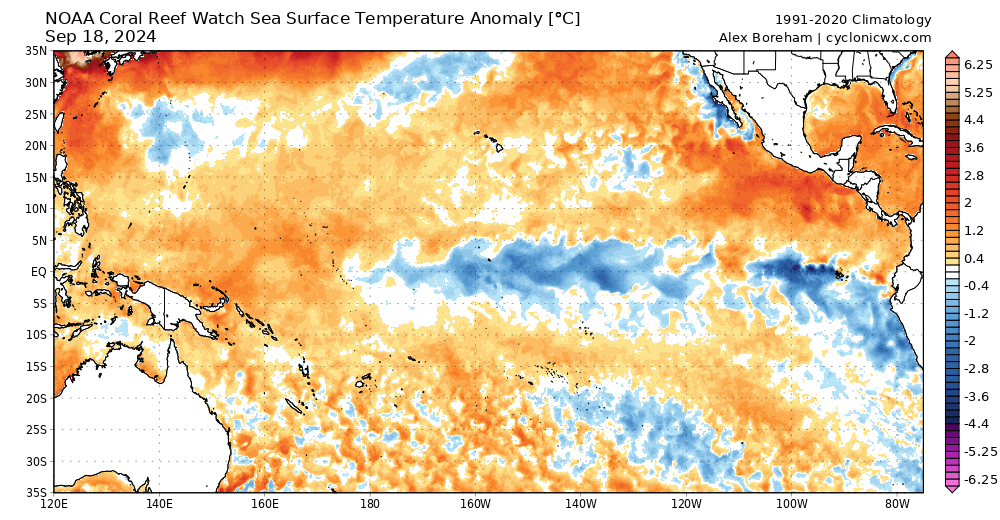
You can easily see the colder water surfacing…BUT (and there is always a but!) it can be harder to identify a cool La Nina pattern in a world where ocean temperatures are increasing. What matters is how much cooler that region is compared to other regions – so another way of looking at it is to take warming ocean temperatures into account and then show how much warmer or cooler it is compared to the new average…which gives us this chart where the La Nina pattern is a lot easier to see:
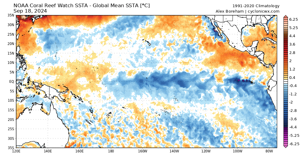
That looks fairly clear – and La Nina usually means wetter than average conditions across Eastern Australia. Worth noting that this pattern only increases the chances of wetter weather – so no guarantee it will happen – and likewise doesn’t mean that everyone will see wet weather…but the longer term outlooks from most climate models do indicate that wetter weather will likely move in at times over coming months. I’ll post again when wetter weather looks likely – which might be quite soon according to one model, but too far off for any detail yet.
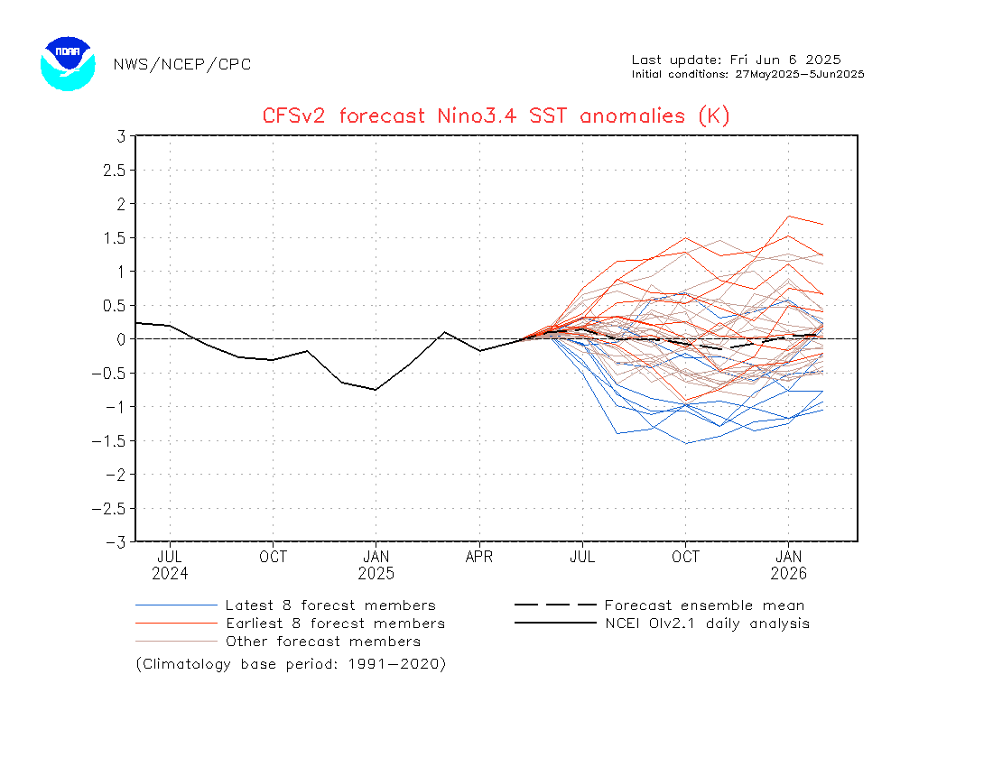
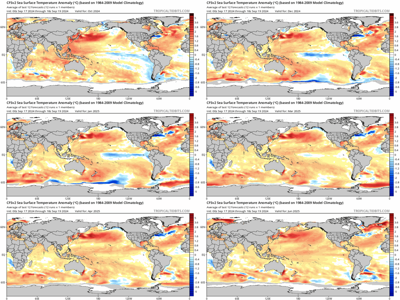
Looking further ahead and models are indicating a return to neutral / warm neutral conditions we we move into the middle of next year:
…but that’s an even longer way off. Until next time I hope you have the chance to enjoy some fantastic spring weather.
Images thanks to stratobserve / cyclonicwx
Thanks to our ongoing hosts and sponsors, Kombu Wholefoods and Snapfrozen 🙂

