It was certainly a stormy day yesterday. Here’s the radar animation from the afternoon:
…and that gave us the following rainfall accumulations:
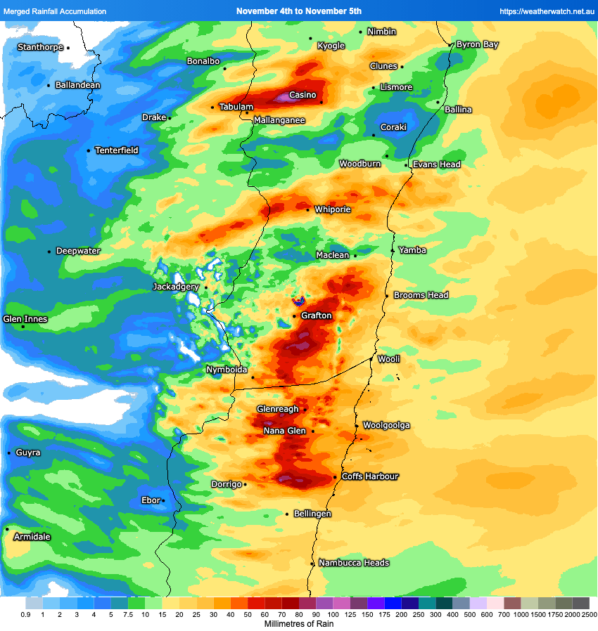
Not so much in the valley but the hills copped some big totals! Quite a bit of lightning scattered around as well:

…and that included some close strikes around town:

We’ve got the chance of a few more showers and storms through today, then drier (but still the chance of the odd storm) tomorrow before some decent heat gets pulled to the coast by the next change. Thursday maximums looking a little like this:

…Reckon there is a chance the Bellingen CBD could crack the first 40 of the season on Thursday. The chance of a few storms in the heat during the arvo but not looking like any significant totals. It actually looks like we could see some wetter storms / showers early next week…but more on that over the weekend. Until then enjoy any storms that kick off – and the cooler weather today and tomorrow!