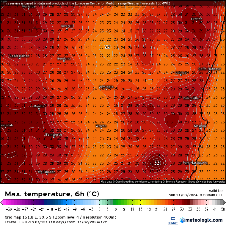
We’ve talked about showers and storms as changes move through, but worth flagging the heat building inland as that heat can get pulled across to the coast ahead of changes. Maximums today are pretty decent:
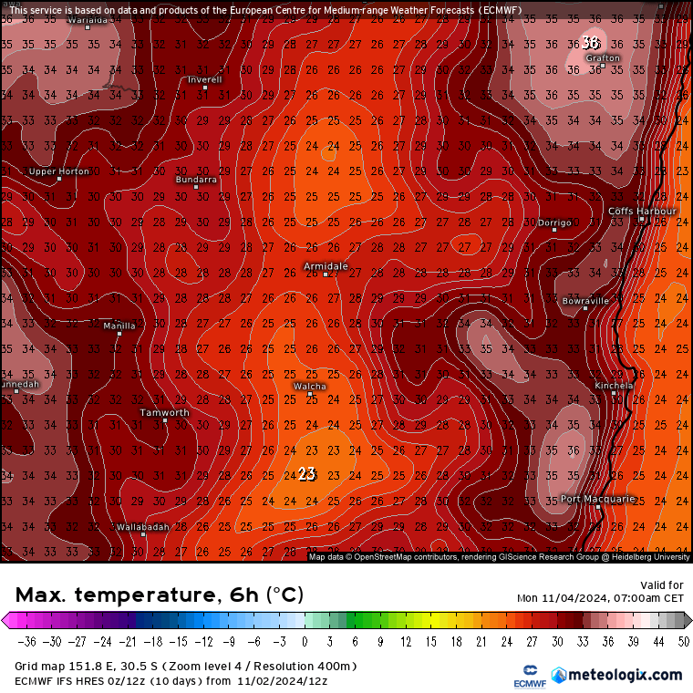
…but with some of that inland heat creeping in tomorrow is looking hotter (before a chance of showers and storms late arvo):
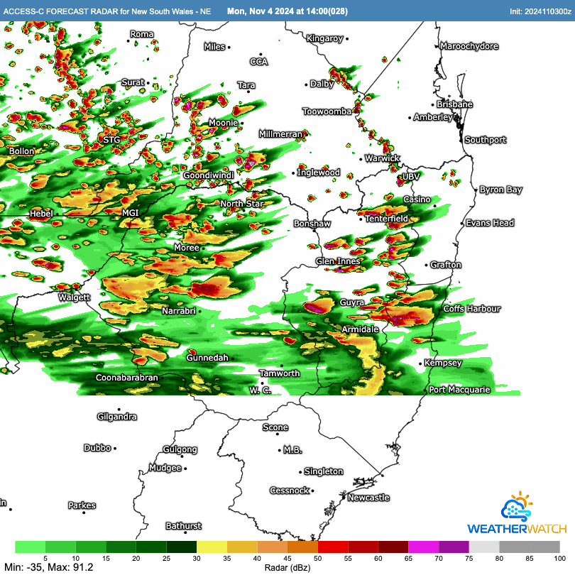
BoM high resolution models show storms kicking off around our region early afternoon tomorrow – and with the heat it’s worth keeping an eye on any storms that form as they’ll have a lot of energy to play with:
Things cool down for Tuesday and Wednesday after the change has moved through, but by the time we get to Thursday it looks like the heat will be back:
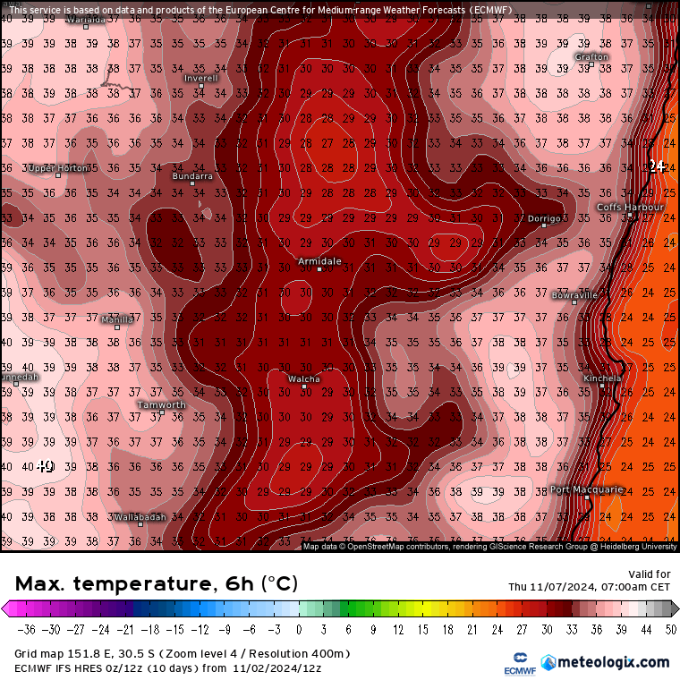
…and if it feels hot here spare a thought for our neighbours inland who will see less relief with changes as well as even hotter temperatures:
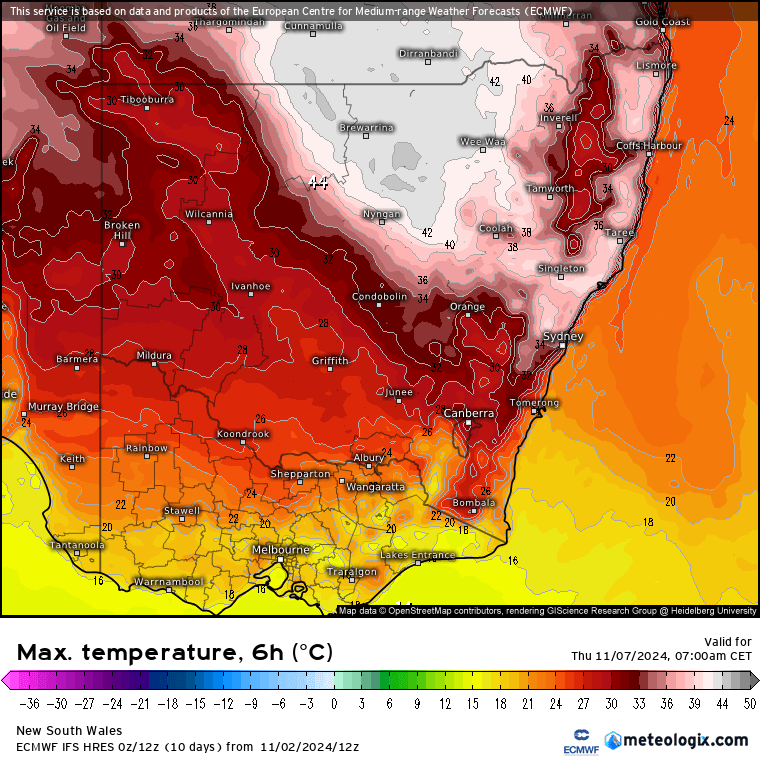
Those temperatures are well above average for the time of year:
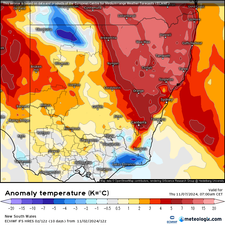
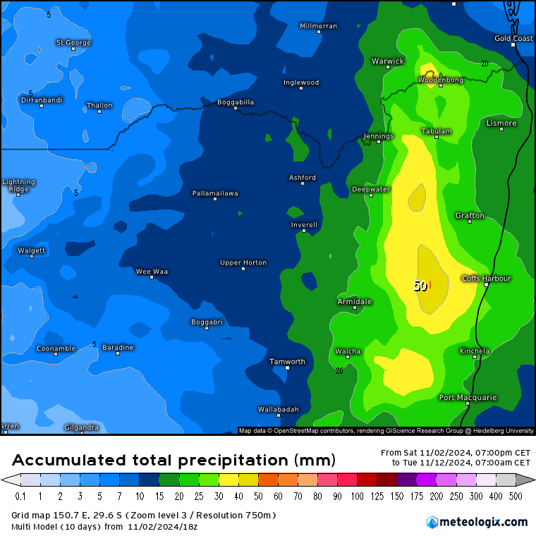
…though those colder temperatures in far west NSW hint at another change moving in, which will help reduce temperatures temporarily…before more heat moves in once again. At this stage it’s not looking like we’ll see multiple days of significant heat in our region – but on those days where the heat is pulled in ahead of changes we’ll certainly feel it. Worth noting that with the chance of storms across multiple days over the coming couple of weeks we could see some decent totals accumulate in the usual places – though as is always the case with storms some areas will see considerably more than others:
Thanks to WeatherWatch and Meteologix for images. Thanks to Kombu and Snapfrozen for ongoing site support, sponsorship and hosting 🙂

