Good morning Bellingen! We’ve had a few showers and storms around over recent weeks, with some areas getting a lot more (or less) than others. This week we’ve got more showers and storms for the start of the week (more likely tomorrow onwards) before we see the chance of showers and storms moving in from the east towards next weekend.
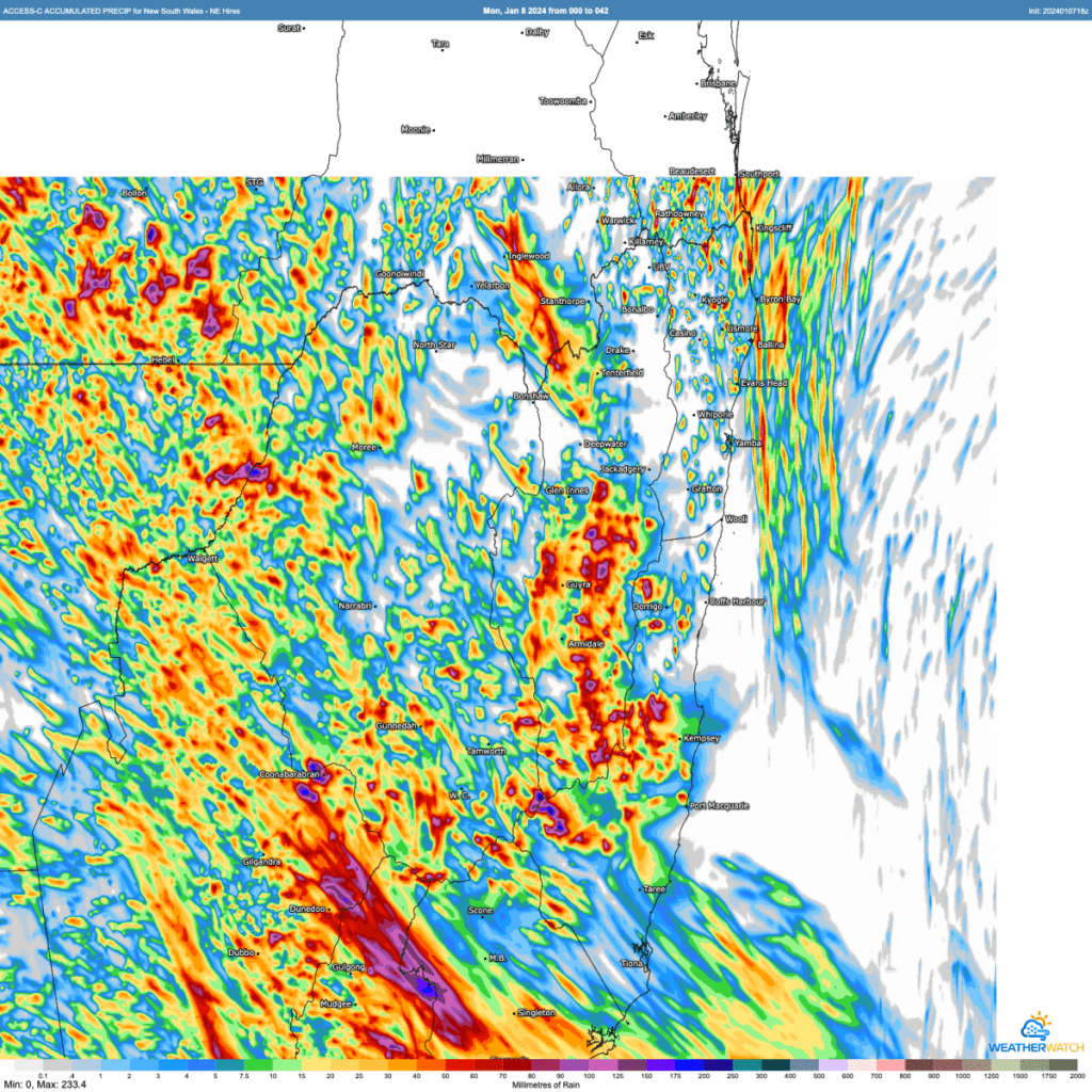
First off the rain chances for today and tomorrow show big totals across the inland once again, with an increasing risk of storms across the hills to our west (with a chance one of two may move towards the coast). Here’s the forecast totals from the BoM hi-resolution model through the end of Tuesday:
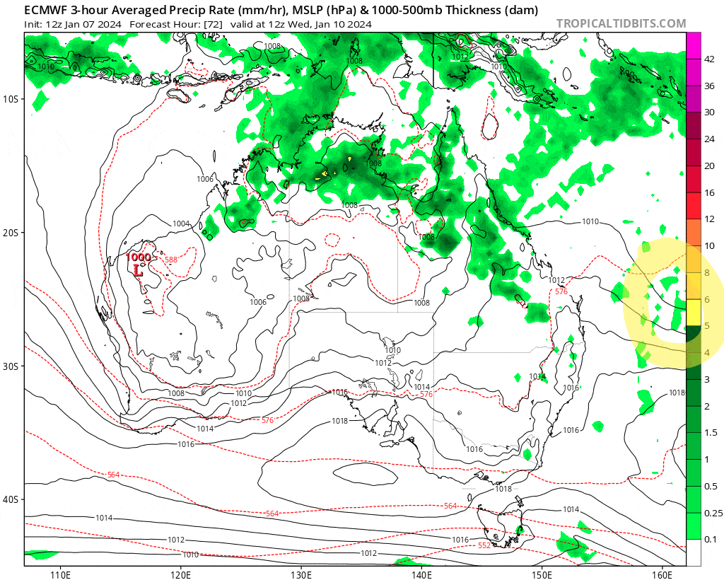
We’ll see that pattern for a few days before the winds switch onshore as a trough approaches. Check out the animation below and have a look at the right had side of the screen – you’ll see a trough move across the Pacific and towards the east Australian coast. I’ve highlighted the trough with a yellow circle in the first image:
You can see the daily storms give way to wetter weather from the east. Still some way off so many opportunities to see changes that could bring lower totals, but I’ll be watching this one through the week. Rain totals from a few of the models still up and down, which is understandable as we are still close to a week out. Here’s the forecast totals from the US / EC / Aus models:
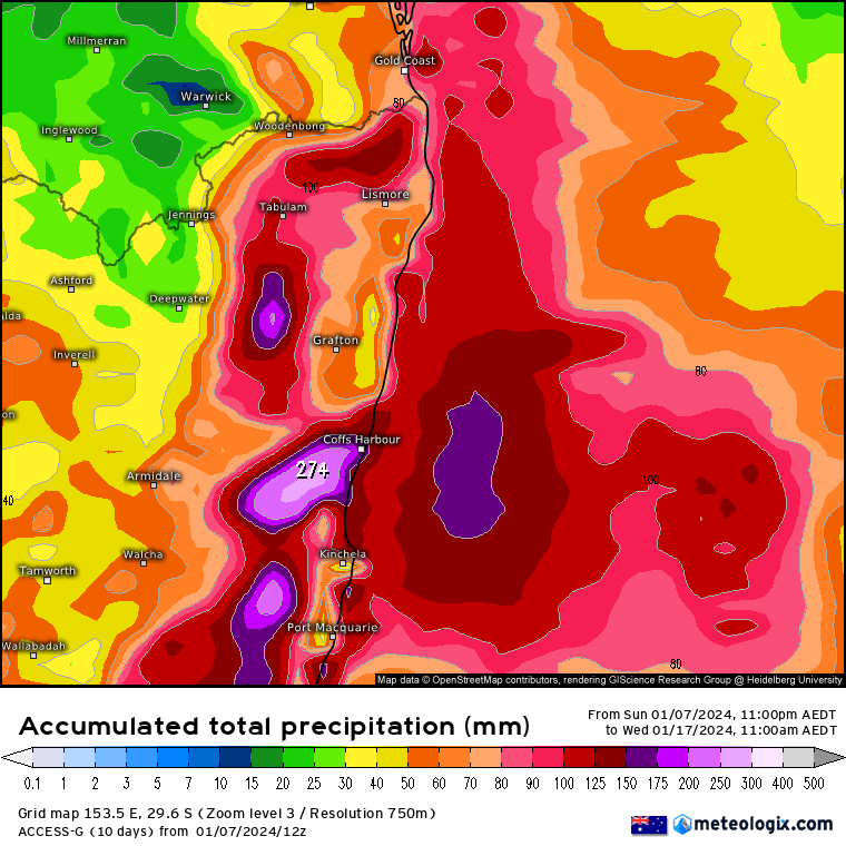
You can see quite a range of totals, so all options still open. Once models get a better grip on the trough we should have a better idea on likely totals, and I’ll post again later in the week with more details. One thing worth noting – the local creeks and rivers are very low for this time of year, so we would need to see some decent totals (which is possible) before rivers and creeks react.
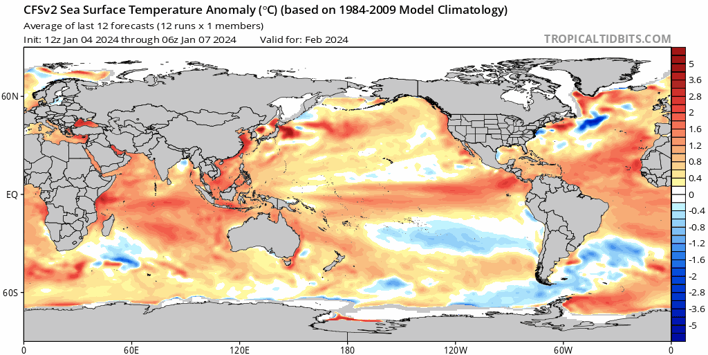
One thing we do need to be aware of – the higher than average ocean temperatures off the coast. These higher temperatures will offer more energy and water to the trough as it moves in, which could bump up the rain totals. Here’s how much warmer than average ocean temperatures (across much of the world) are sitting now:
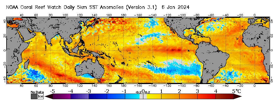
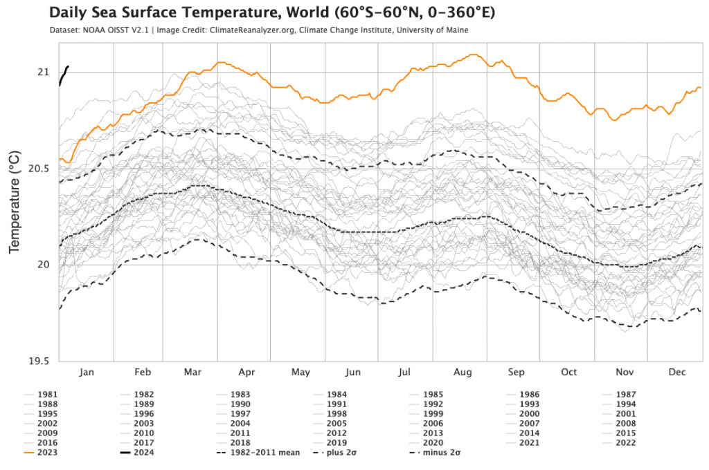
Worth noting that global sea temperatures are significantly higher than anything recorded in recent history. Here’s how 2024 has kicked off – check out the black line to the top left:
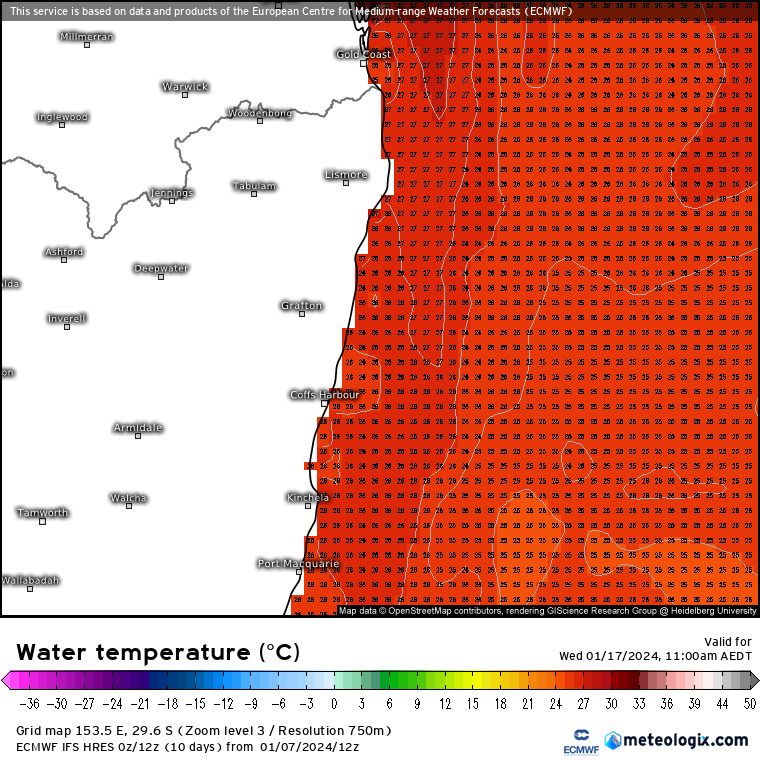
Closer to home the East Australia current has also moved closer to the coast, which will also help enhance any showers that move onshore later in the week:
So an interesting week to come…I’ll post again later in the week with an update on what we can expect across our region. Looking much further ahead and models are still hinting at La Nina later next year – something to watch out for:
Thanks to Meteologix / Tropical Tidbits / WeatherWatch for images
Many thanks to local businesses Kombu Wholefoods and Snapfrozen for their support