As promised a quick update on the rain totals likely from the showers this week:

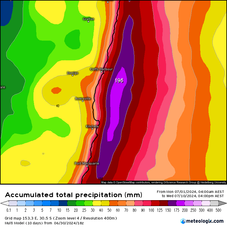
…and you can see totals increasing day by day, with anything between 40mm and 80mm averaged across our area looking possible. We’re looking at showers so favoured locations could see higher totals with other areas seeing less…but the general picture is for showers at times right through the week with higher totals likely closer to the coast and facing hills. An average of all models gives us:
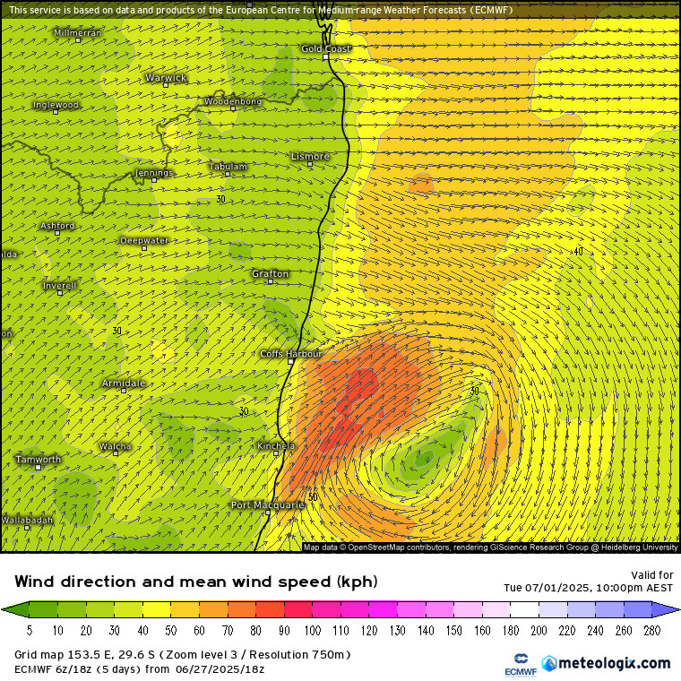
Certainly looking wet just offshore – good that the winds are aligned more north / south than east / west. Looking slightly further ahead and the significant cold pool likely to develop over SA looks like it will weaken as it moves east:
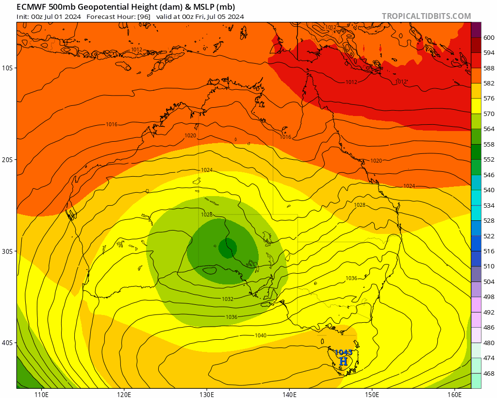
…so beyond an increase in showers is unlikely to have too much of an influence on our area.
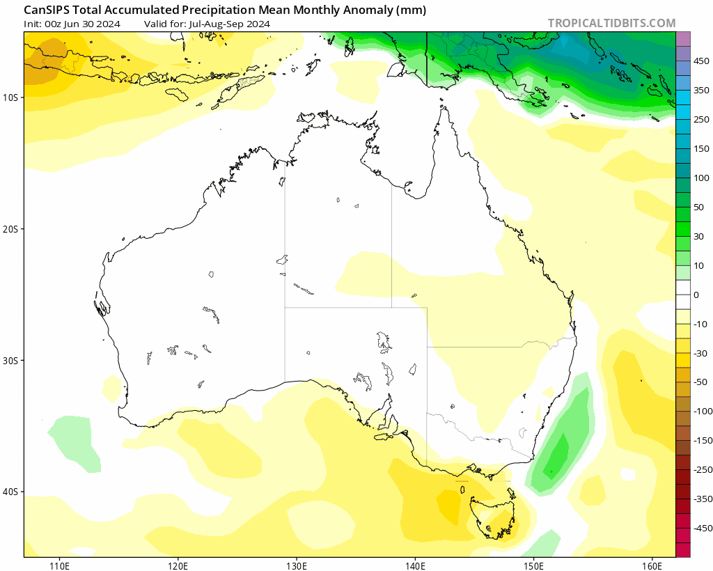
Even further ahead and the first of the monthly outlooks has been released, and it shows rain totals increasing as we head through the end of the year and into early 2025, before dropping back towards average once again as the forecast La Nina weakens. The images below are three month averages from now through the end of June next year:
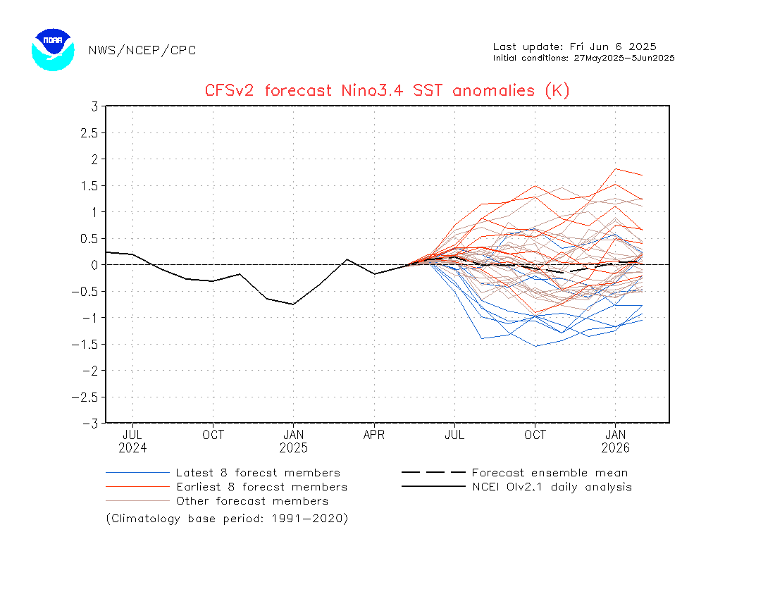
Talking of La Nina…and it’s struggling to develop right now – ocean temperatures in the region that counts (Nina 3.4 for the nerds 🤓) dropped back to neutral from El Nino levels but are struggling to drop into negative territory:
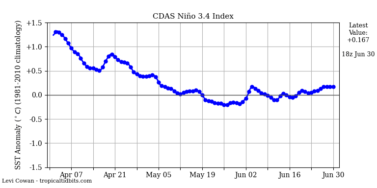
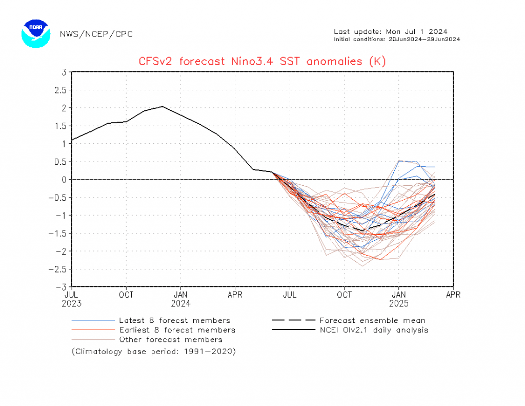
The models show ocean temperatures in that region should drop as we head through the coming months, but right now reality is looking a little different to forecast models…something to watch – I’ll post updates as we head through the coming months:
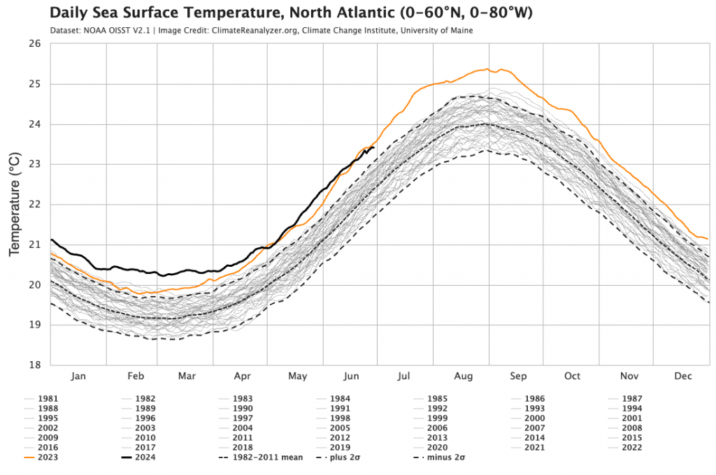
To finish on something spectacular – and close-to-record ocean temperatures in the Atlantic…
…have resulted in Beryl – already a record breaking early season hurricane that is likely to have a significant impact on the Windward Islands over the coming days before it moves further into the Caribbean. Check out the latest image – you wouldn’t want to ever be in the path of something looking like this:
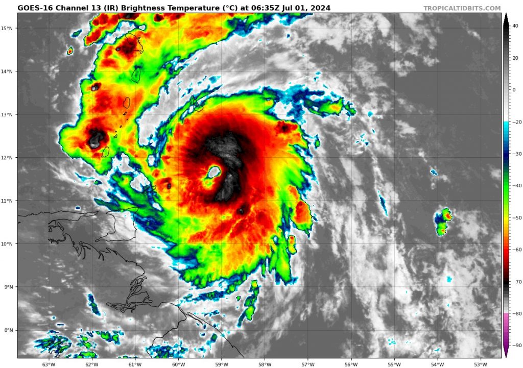
This is an early start to what is likely to be a very active hurricane season.
Thanks to Tropical Tidbits, Meteologix, NWS, University of Maine for images
Thanks to Snapfrozen and Kombu Wholefoods for ongoing support of this site 😊