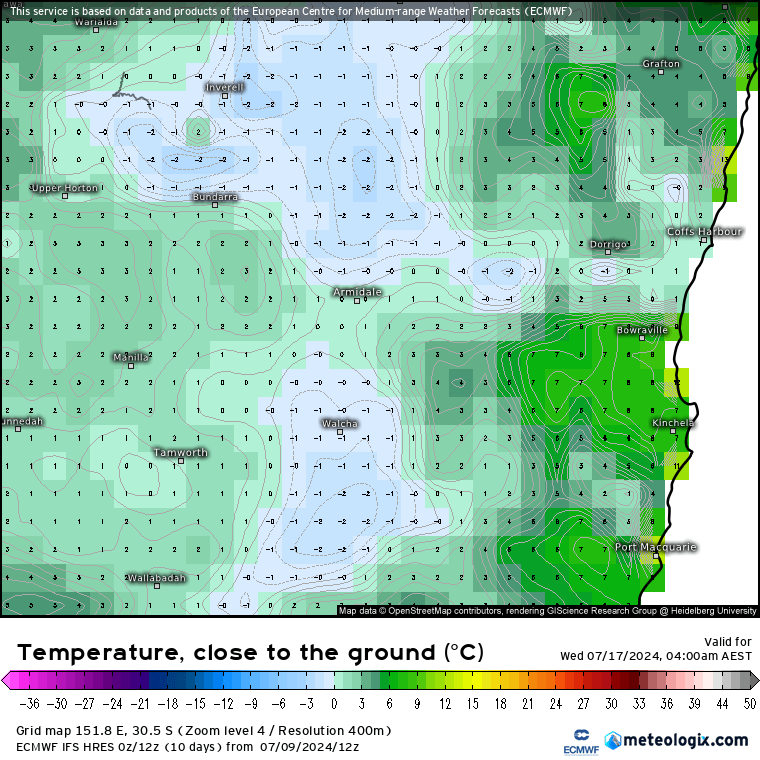
After a week of showers we’ve finally got some sunshine back – sure you join me in celebrating some blue sky! In the short term we’ve got more blue sky days to come…though some very cold air up high will also increase the chance of the odd shower and, especially next week, some cold nights with ground frost looking likely:
The quieter spell gives us a chance to look further ahead…and right now there is some uncertainty over the forecast La Nina. The current forecast from the American model still looks decent:
…but the just-out European model looks fairly underwhelming:
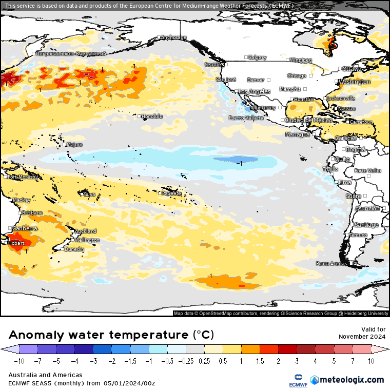
…and looking at the change from the May to July forecast for November and we can see the EC forecast heading back towards neutral:
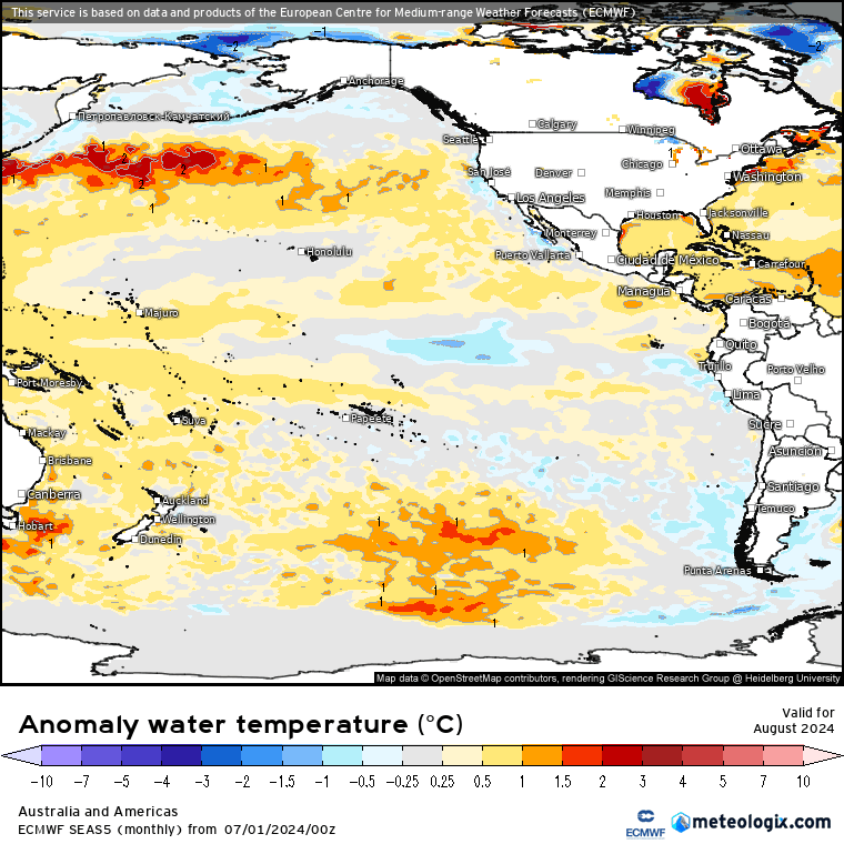
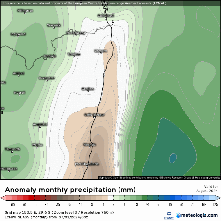
Looking at forecast rainfall and the EC model is now indicating drier weather as we head into Spring, with wetter likely as we head into Summer:
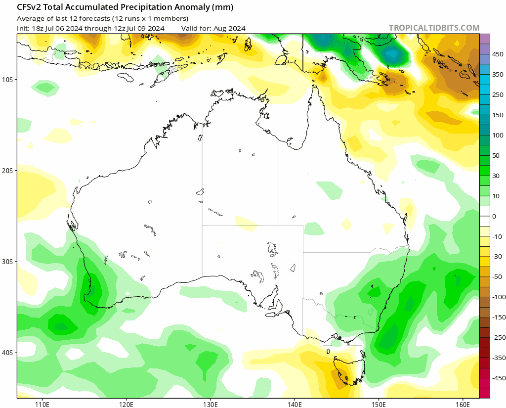
….while other models show wetter weather more likely from August right through Summer:
…so what we know right now is that while wetter weather is still a good chance, it’s not looking as locked in as it was a couple of months back. More to come on this one until models lock in their options.
Something else coming into play is a sudden stratospheric warming event that looks like to kick off over the Antarctic over coming days:
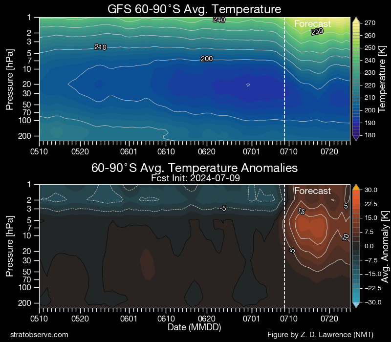
The last time we saw one of these was in 2019 and we all know how that ended up. There are a lot of differences this time around however…we’re not in drought, the event is weaker and it is kicking off earlier than in 2019…so different outcomes likely. What it may do it is increase the chance of westerly winds and drier weather as we head into Spring, which would reduce rainfall…so could see this event impact us over the coming couple of months. i’ll keep an eye on how this one develops…
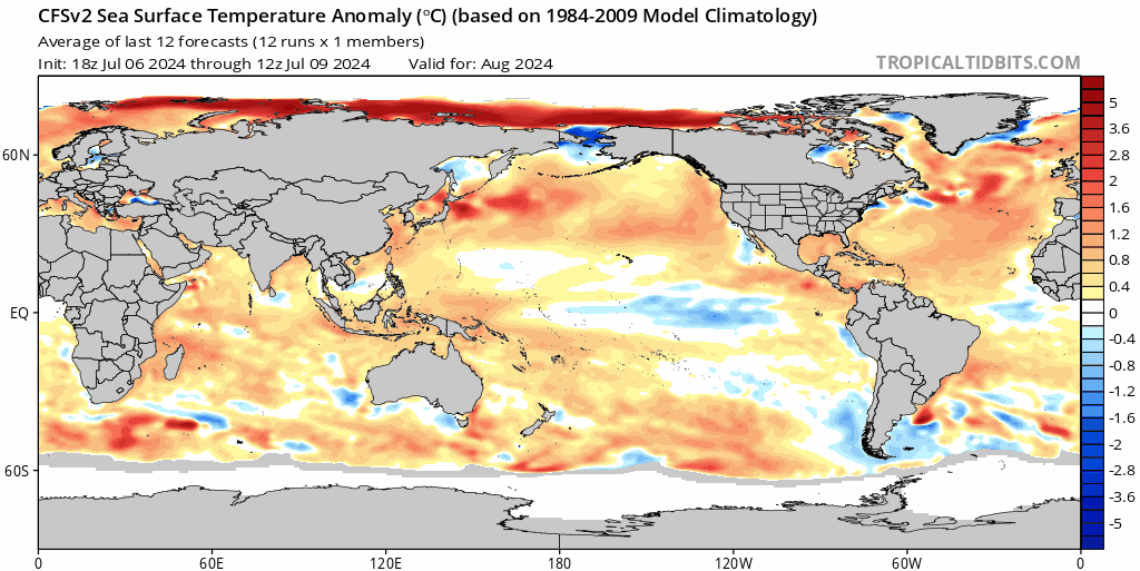
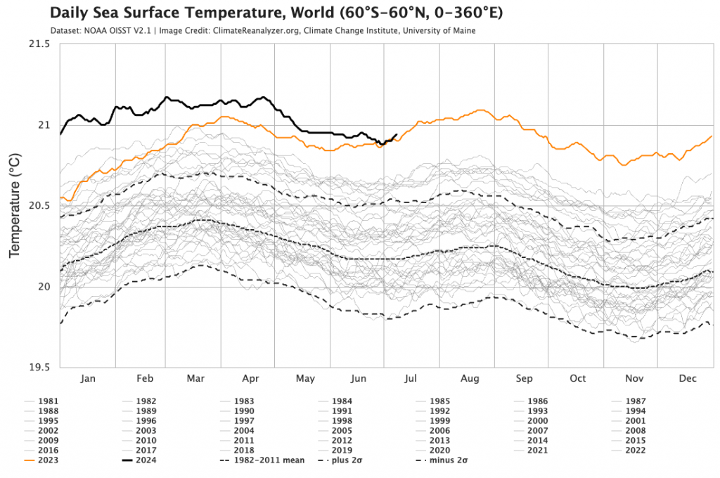
Worth adding one more variable to the mix – global sea surface temperatures are at record levels once again:
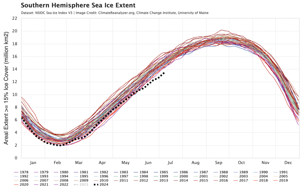
…and Antarctic sea ice is at very low levels, with only 2023 lower than this year:
Record SSTs and low sea ice means the atmosphere doesn’t always act as we would expect – something seasonal models are still struggling to fully digest.
That’s it for now, wishing you some good sunshine and decent firewood stacks as we head into the remainder of winter.
Thanks to University of Maine | Tropical Tidbits | Meteologix | Stratobserve for images. Animations by Bellingen Weather
Thanks to our long term hosts and sponsors – Snapfrozen and Kombu Wholefoods – without whom this site would not exist 🙏