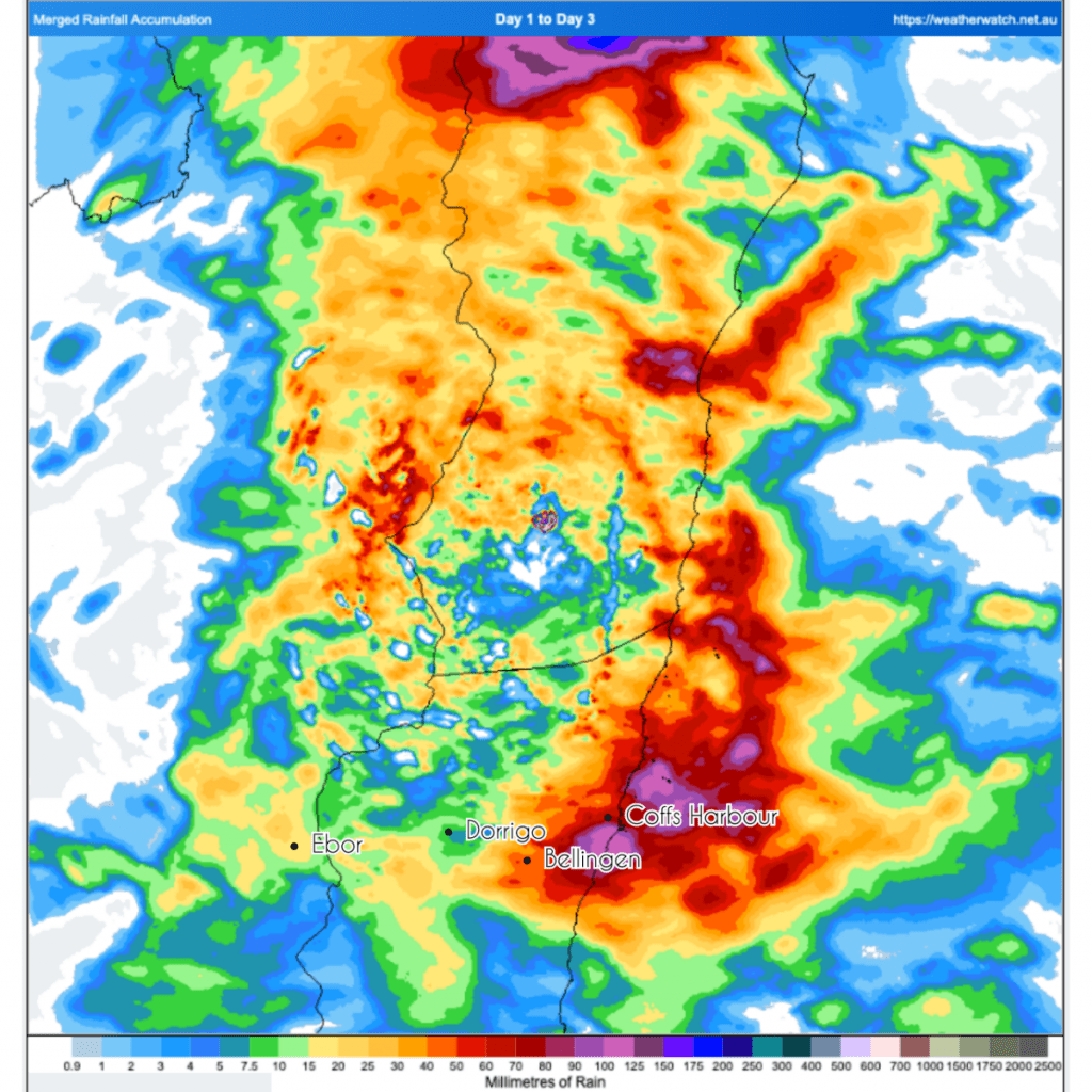
Well the forecast rain certainly arrived. No big totals in Bellingen but we sat on the edge of some big falls, with over 200mm in Coffs Harbour / Sawtell. Here’s the three day rain totals for our region:
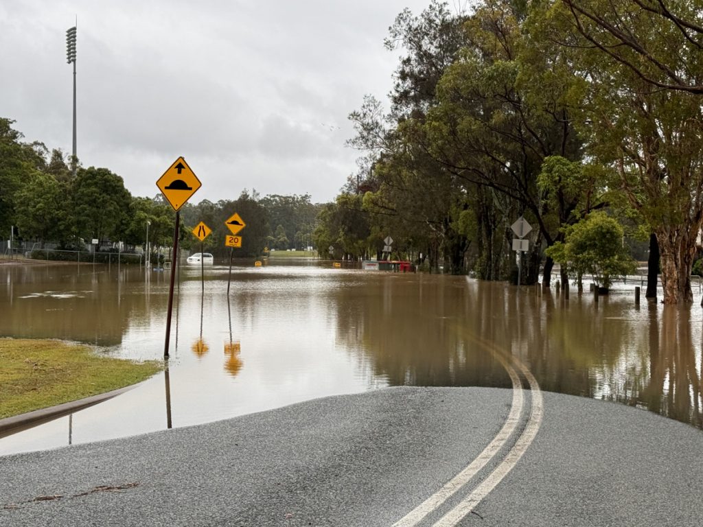
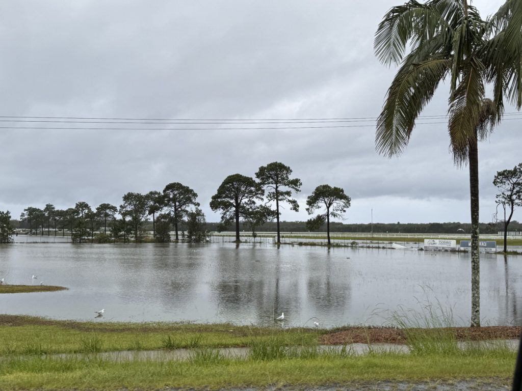
And those downpours caused some decent flash flooding through Coffs Harbour:
…but it could have been a lot bigger – the focus of the showers and storms ended up further to our north around SE Qld. Check out their three day rain totals:
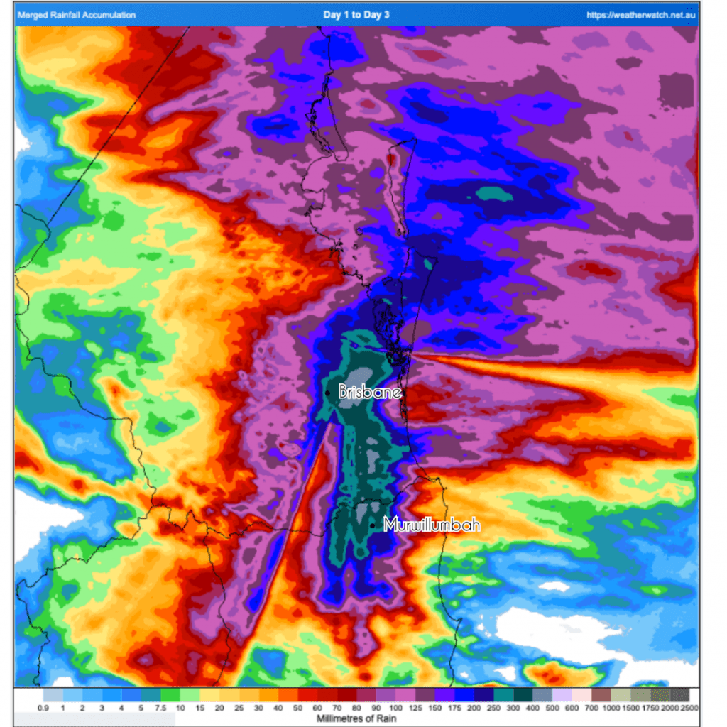
Yep – some locations recording totals over 500mm over three days, with significant flooding the result.
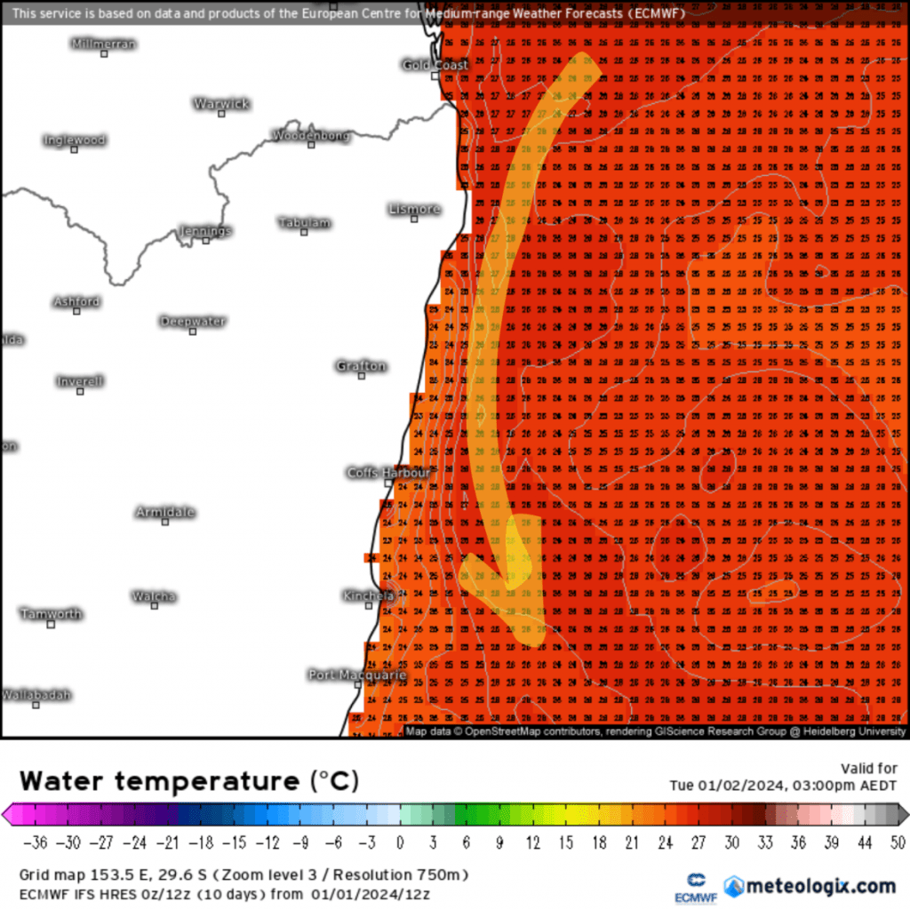
We’ve got a few more showers at times over the next week with temperatures sitting in the 20s to low 30s, but for now the bigger falls have moved away. We’ve still got very warm oceans off the coast, so the potential is still there for heavier falls if the conditions line up. Here’s how it looks right now off the coast (with the pumping East Australia Current marked with the arrow):
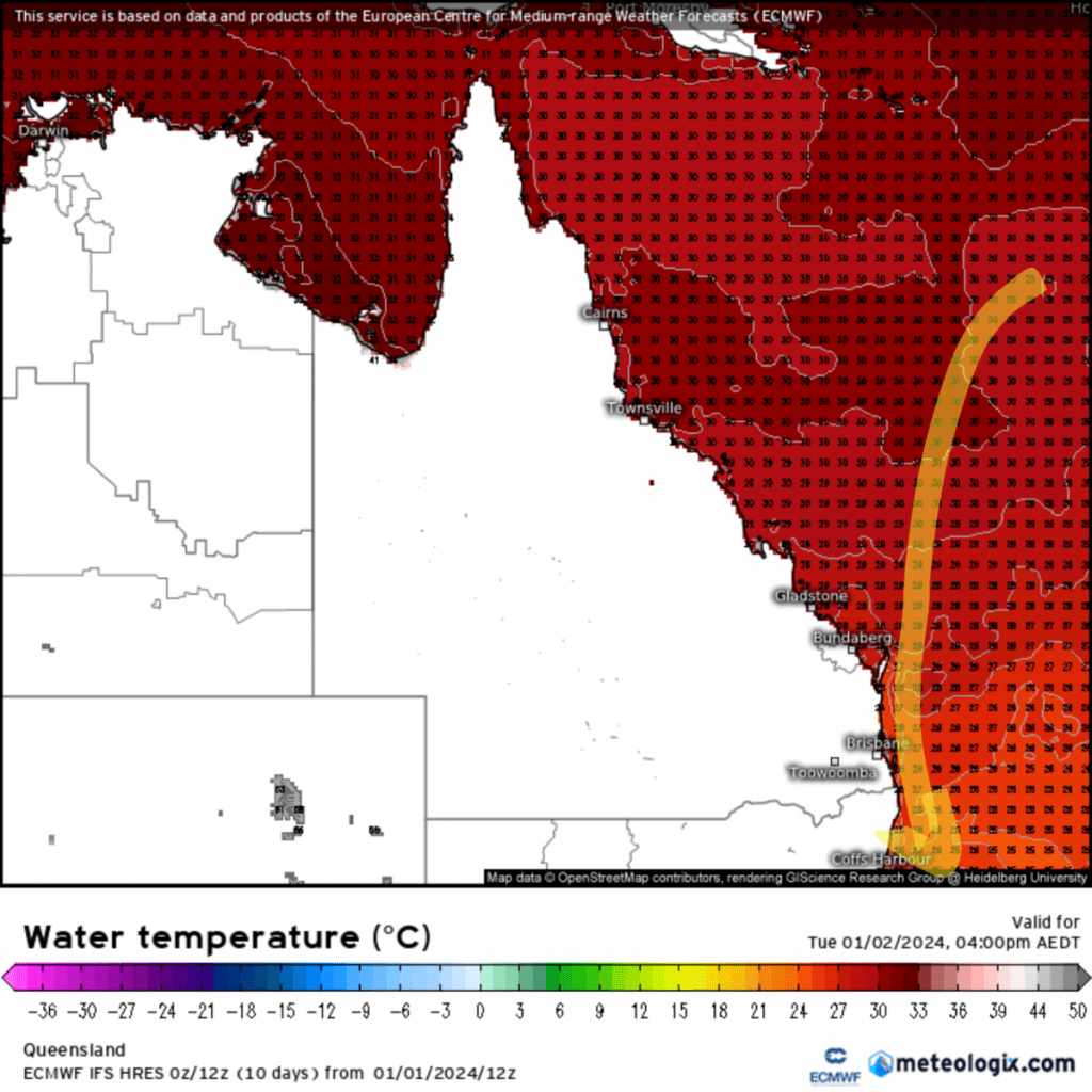
…and there is a lot more heat where that current originates from – these are the current water temperatures off the Queensland coast:
We’re unlikely to see ocean temperatures into the 30s where we are, but those temps are still high enough to pump some decent heat / energy / humidity down our way – hence the bigger rain events we can see at this time of year. Those temperatures are higher than usual though:
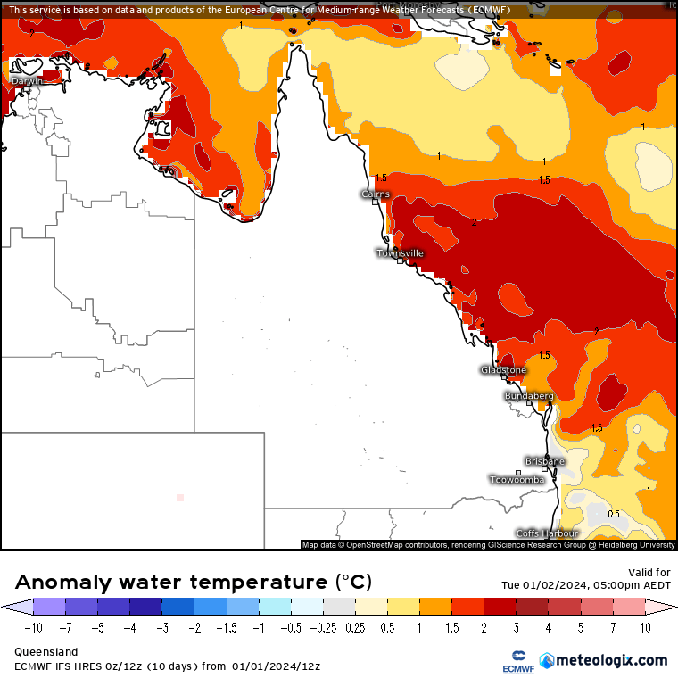
2c above normal is a lot of extra heat for the atmosphere to play with. The MJO will move back across the N of Australia late January, and that will be the next significant opportunity for cyclones to develop across the tropical north of Australia.
Looking even further ahead and models are still indicating a return to either neutral or La Nina conditions as we head through winter:
That doesn’t guarantee big rains but certainly increases the chances. Another element to add to the mix – the significant water still in the upper atmosphere from the Tongan volcano eruption:
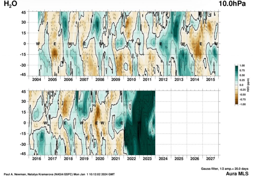
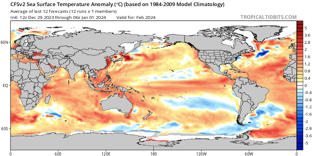
It’s certainly unprecedented and the effects will last for some years to come. Add record warm global oceans:
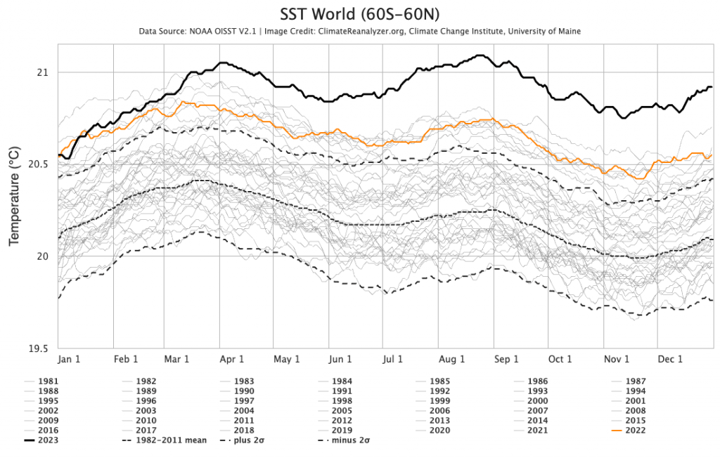
…and we can be sure of some interesting global conditions in the year to come. Welcome to 2024!
Thanks as always to Kombu Wholefoods and Snapfrozen for sponsorship
Images:Climate Reanalyzer / Bellingen Weather / NASA / Tropical Tidbits / Meteologix


