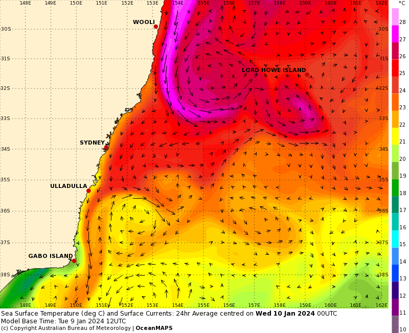
Feeling hot and sticky out there? One big reason is the ocean temps along our coast. Check out this image showing the current sea surface temperatures and you can see the East Australia Current absolutely pumping and sending a heap of hot water past the Coffs Coast. I’ve added the currents to the pattern but you don’t really need them to make out what is going on:
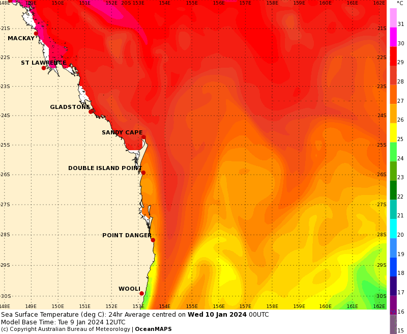
That current comes down from the Coral Sea – you can see it developing in the Coral Sea and moving south (with a note of the different colour scheme used for SE QLD):
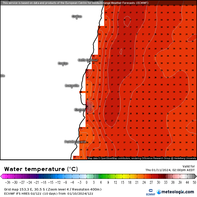
…and here are the actual ocean temperatures for our region:
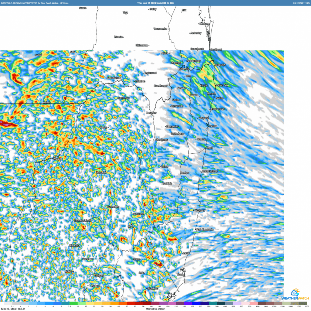
…hence the humidity when we get north / north east / easterly (and right now even south easterly) winds. Those onshore winds will bring a few showers over the next couple of days as a weak trough moves in from the east – though right now it looks like the majority of the coastal showers will be just to our north:
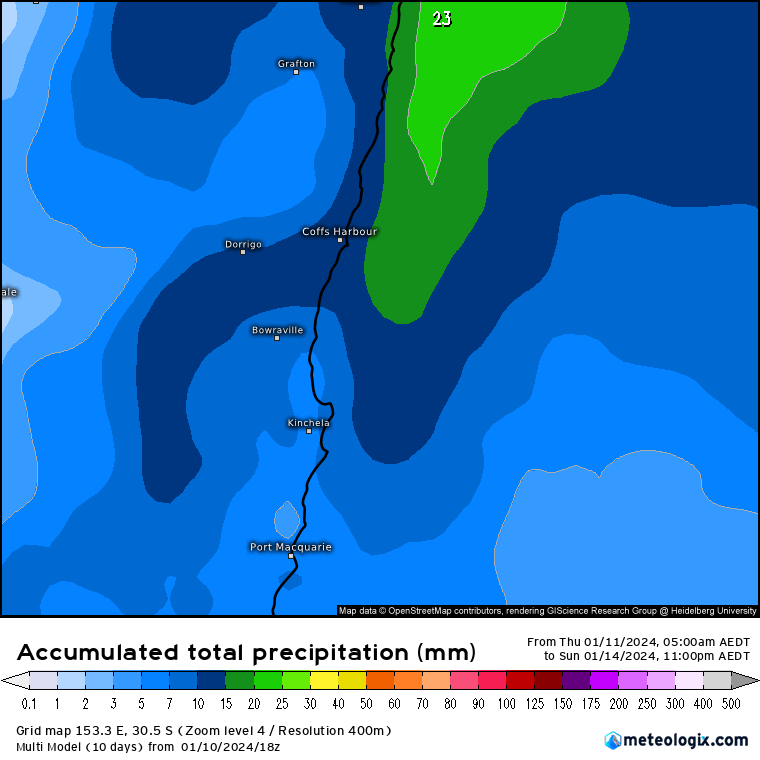
Only isolated to scattered showers over the next couple of days, but those showers will be given a boost by a southerly change moving up the coast early next week – so expect to see an increase in showers and storms as we enter the new week. Totals to the end of Sunday across all models average out at:
…but by the time we get to the middle of next week the totals are looking a little higher:
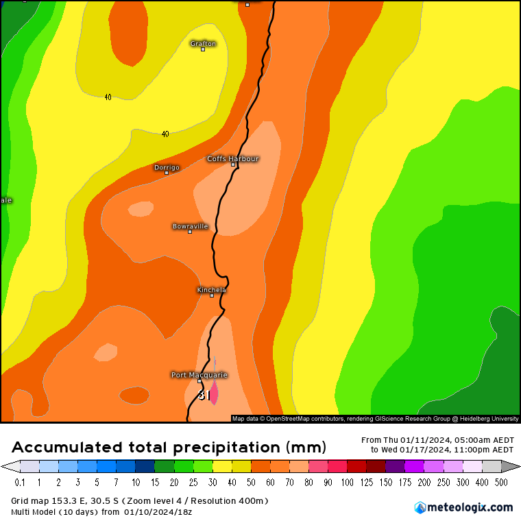
…so the showers might take a while to get going, but once they do we might see some reasonable totals across our region. The monsoon is likely to get cranking across far N Australia over the next week – check out the forecast totals from the latest model runs:
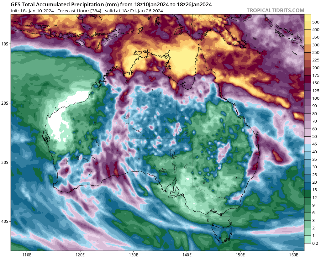
Way too early to know when cyclones / monsoon lows will form, but where that happens can have quite a big impact across our region. A focus in the Coral Sea will cool down ocean temps there but potentially increase rain across our region if the low ends up in just the right spot…but a focus along the WA / NT coast can mean hotter and drier weather for us. Overall an active monsoon can dry it out a little for us – all that air rising to our north has to descend somewhere…and that can be over us. Still, one to watch.
Short post today, but will post again over the weekend with likely totals through early next week.
Thanks as always to Kombu Wholefoods and Snapfrozen
Images thanks to Tropical Tidbits / BoM / Meteologix