A quick post looking (for a change!) just at today. We’ve got a southerly change running up the coast overnight tonight. Before it moves in we’ll see some warm temps as the pre-change draws in some warm air from inland, before a chance of a storm early evening and into the night (change is arriving too late for peak heating so higher chance of storms further south) and then showers to follow in the southerly flow. Here’s how the winds will play out between now and early morning tomorrow:
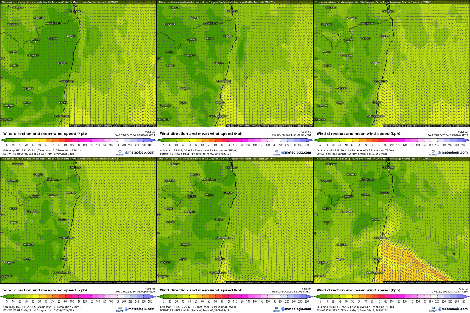
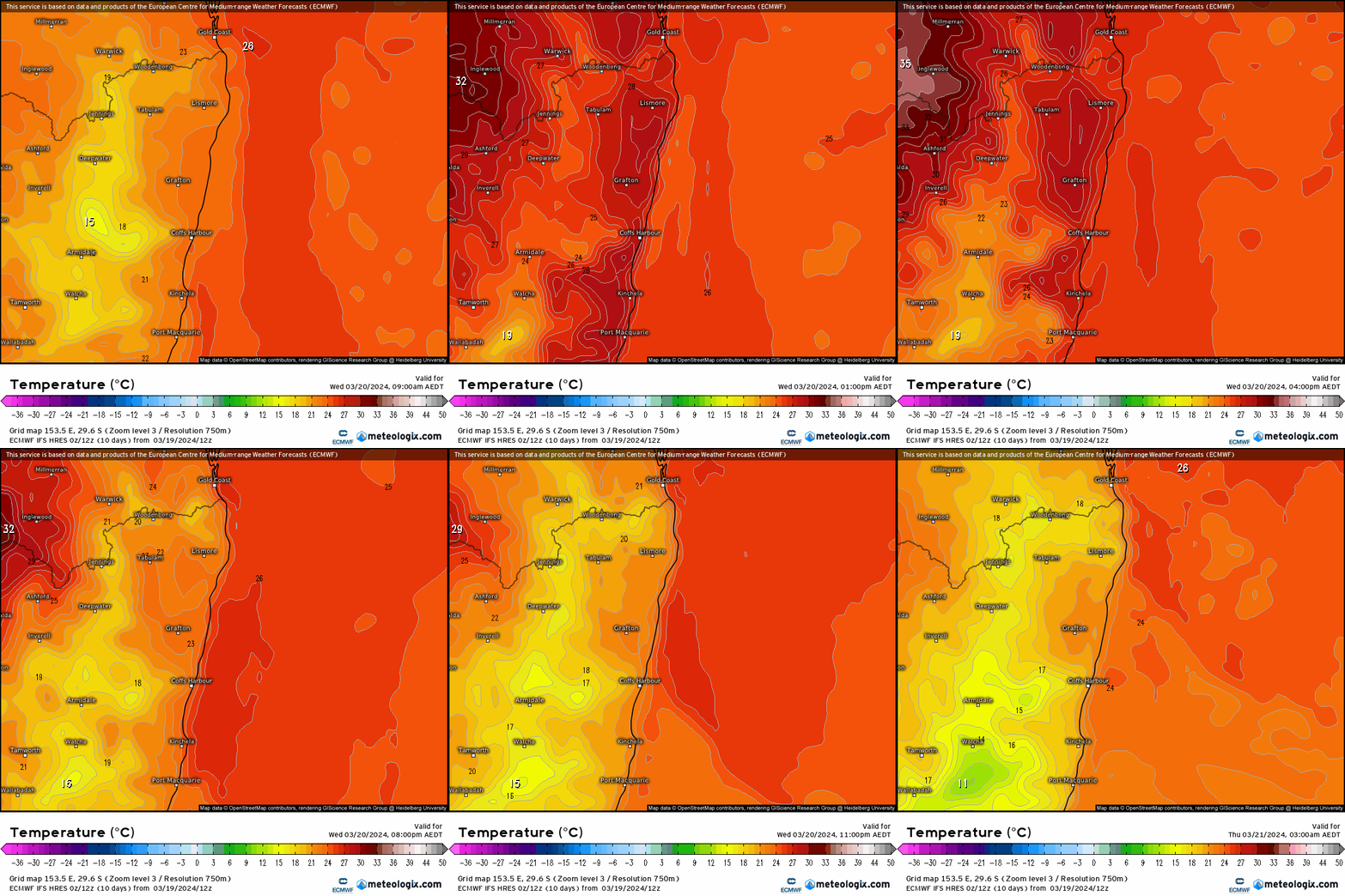
Quite a decent change moving up to rattle a few windows in the early hours. Southerly changes like this only happen in a few places around the world and are great to experience! Temperatures today ahead of the change will likely crack the low 30s:
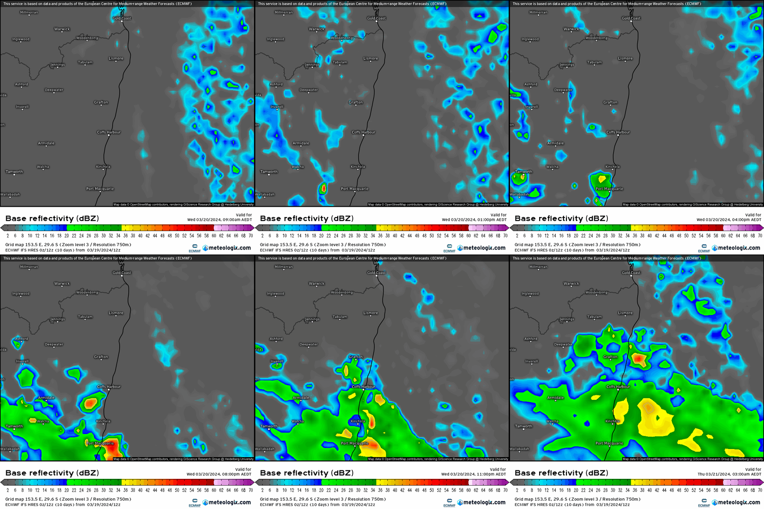
….and the chance of a storm early evening before potentially more widespread showers as the change moves through:
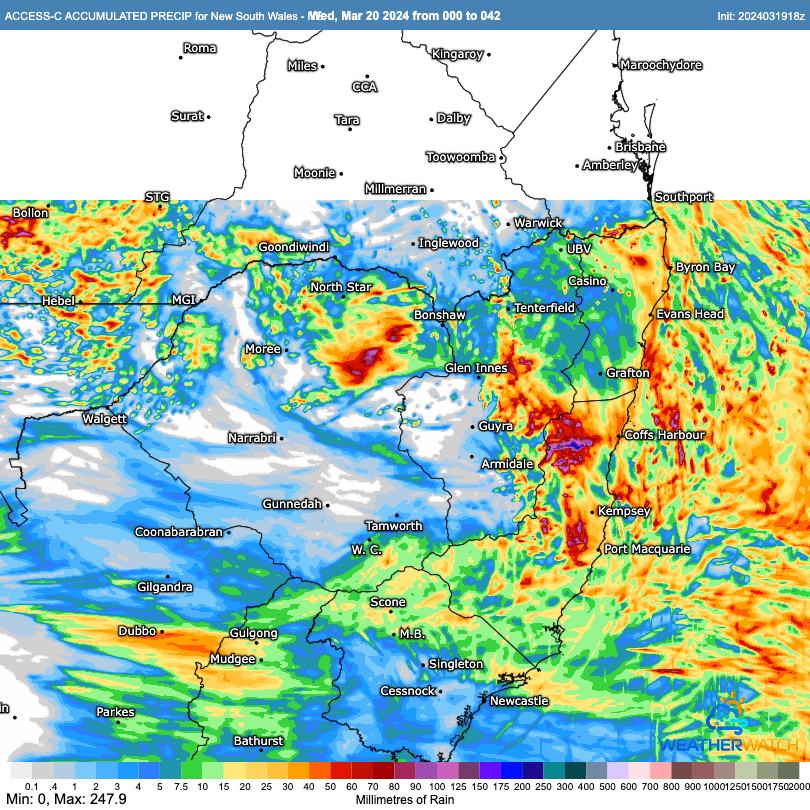
Local BoM high resolution models than run through the end of tomorrow indicate the chance of some decent totals accumulating over the hills / top of the Dorrigo – Coffs range and inland around Cathedral Rocks / head of the Bellinger by the end of tomorrow:
That’ll do for now. Always hard not to jump into medium term outlooks but models over the next couple of weeks show a whole range of outcomes…and until they settle down not worth getting too hooked in!
Thanks to Meterologix and WeatherWatch for images
Thanks to our sponsors and hosts 🙂

