Anyone else find it hot overnight? The high humidity levels led to a very uncomfortable night for many of us. Here’s the lowest I could find for overnight in the centre of town:

Just after 7am this morning and the temperature was in the low 20s, with the feel like temp of over 25C. The warm night followed a hot and very sticky day yesterday. The centre of Bellingen has more black cover and less trees than outside the CBD so gets a little hotter than other areas even just a 100m away…but the humidity was for everyone and wow was it humid. Here’s how it looked yesterday afternoon:

The temp was sitting at just over 37C at 3pm yesterday…but with a dewpoint of 23.7C it felt like 42.3C. Humidex is used as a measure of perceived heat that results from the combined effect of excessive humidity and high temperature – especially for those carrying out physical work…and yesterday arvo it hit a value of 48.4C – not a day to be working outside.
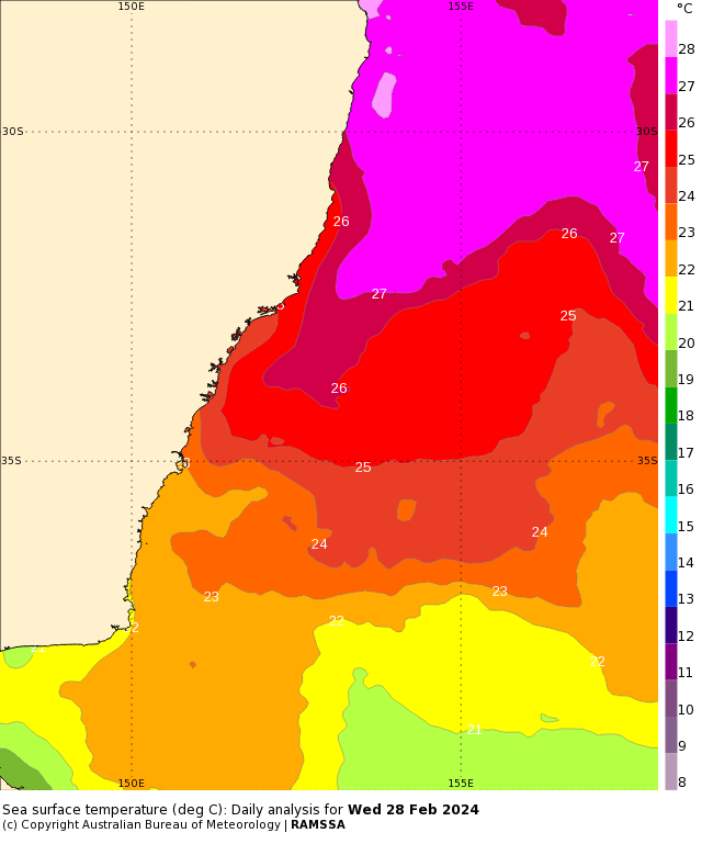
Today is looking fairly similar – perhaps slightly cooler – but then hotter again tomorrow. The reason why it is so humid – very high ocean temperatures around our coast:
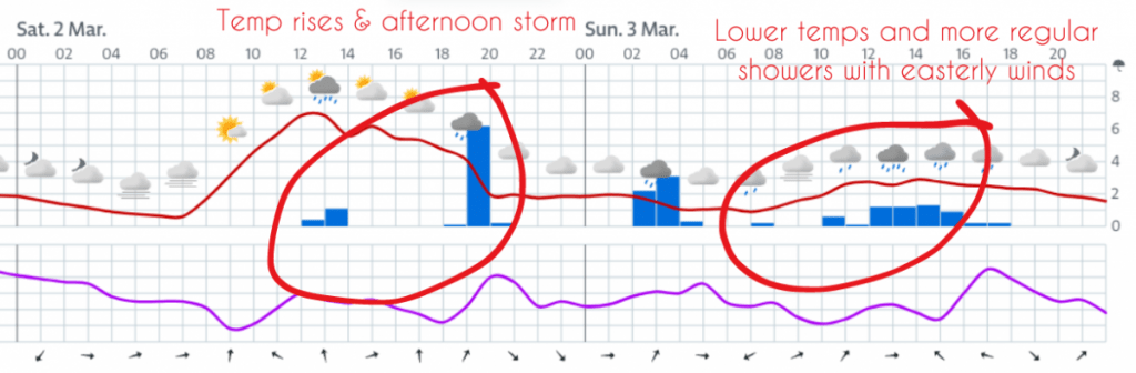
We’ve got a welcome change moving in over the weekend and those ocean temperatures are going to offer some decent energy for showers and storms on Saturday with onshore showers to follow Sunday. You can see the hint of this with the forecast from the European model:
We’ll likely see onshore showers continue for a time next week, giving some decent accumulations for some. The average across all models to the middle of next week looks like this:
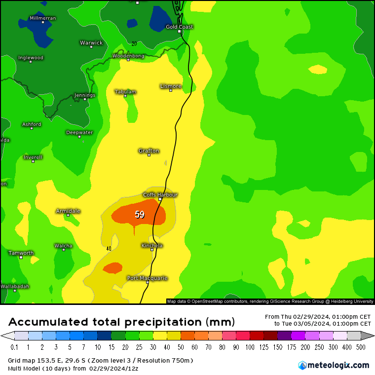
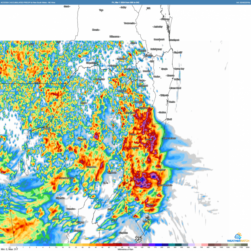
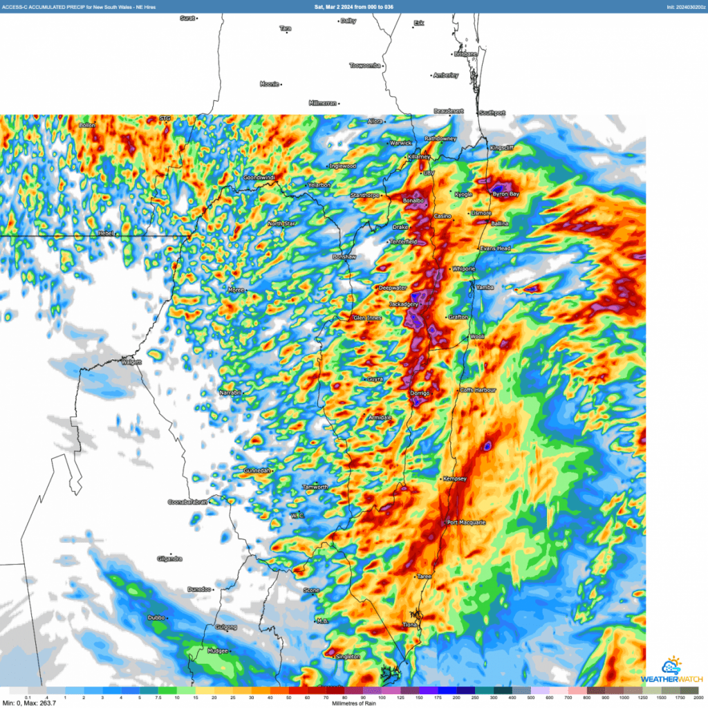
…however it is worth noting that the totals vary considerably across the models, with some showing much less and others a lot more. The BoM high resolution model (that one runs out to the end of tomorrow and does not yet include onshore showers through Sunday) is better at picking up storm totals at a local level and indicates the risk of some decent downpours across our region:
<EDIT – now posted> I’ll update this post tomorrow morning and post the forecast 2 day totals below:
Unlikely to see significant flooding from the change this weekend but if we do see some heavier showers and storms river rises are possible….which is probably a good time to flag that we’ve added a YouTube stream to the Kombu floodcam – you can check it out in the Kombu Floodcam page:

Looking further ahead and the BoM seasonal outlook for April through June has been released. Temperatures are (not surprisingly) looking higher than average through the day:

…and overnight:

Rainfall is forecast to sit below average across Autumn – though as is always the case it would only take one big event to change the seasonal totals considerably:

As we move into winter a La Nina is looking possible – which would likely increase rain totals and drop daytime temperatures a little…but too far away to be sure at this time. More on that over the coming months…
Thanks to BoM / Kombu Wholefoods / MetCentre / Meteologix / Bellingen Weather / EC for images
Thanks to Kombu Wholefoods and Snapfrozen for hosting and sponsoring this site