The upper patterns over recent weeks have been fairly benign with little change over time…but that’s about to change over the coming couple of weeks with at least two pools of very cold upper air forecast to swing up and across SE Australia. You can see them easily in this 10 day animation:
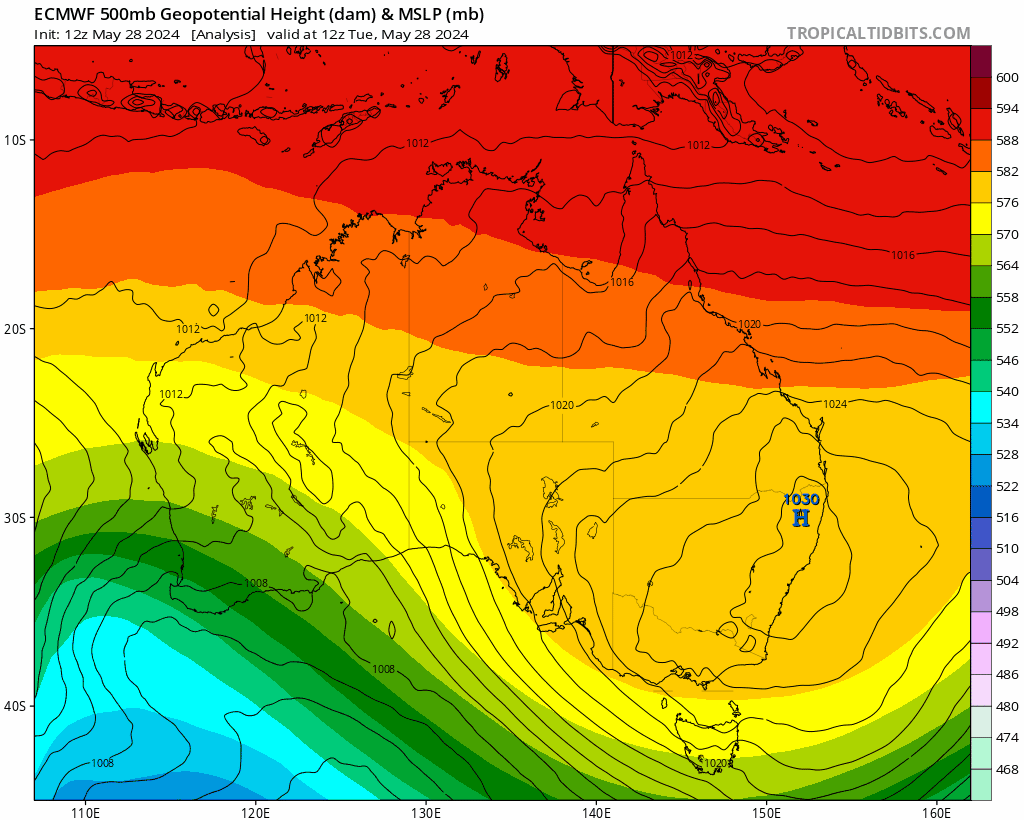
Combine those cold upper temps with onshore flow along sections of the east coast and you know some regions are going to see some good rains. With an East Coast Low also possible you can also add strong winds into the mix. The good news for us is that it looks like the worst of the weather will be to our south – but regardless we’ll still likely see a lot more cloud streaming across our region, initially from the west as the upper feature moves in, and then from the south east as it moves away. At this time we’re not looking at huge totals across our region (at least from the initial cold pool – too far away at this time to know for sure how the second one will play out) but higher totals are likely further south. An average across models over the next week gives the following totals for our region:
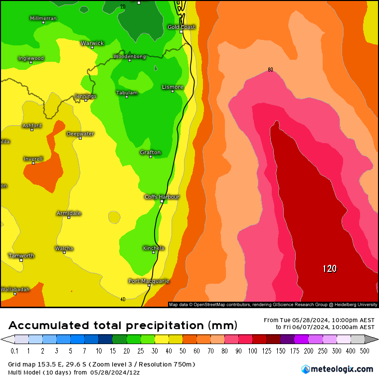
…but there is quite a bit of variation between models so it’s something we’ll keep an eye on. Another way to look at the forecasts is to add the totals from the main models to a graph:

You can see the totals build from the first upper pool, and then a further increase as the second one moves in. The same graph for Sydney highlights the higher totals possible across that region:

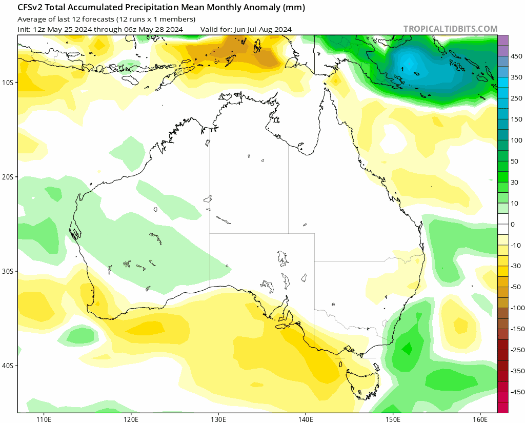
Looking further ahead and the models still show us trending wetter as we head into spring / summer:
Looking at the bigger picture – and global ocean temperatures are still off the scale. Remove 2023 and you can see just how much hotter than average the globe is currently running:
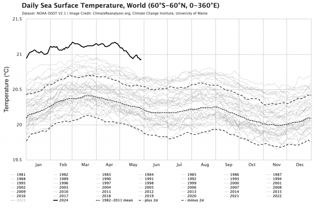
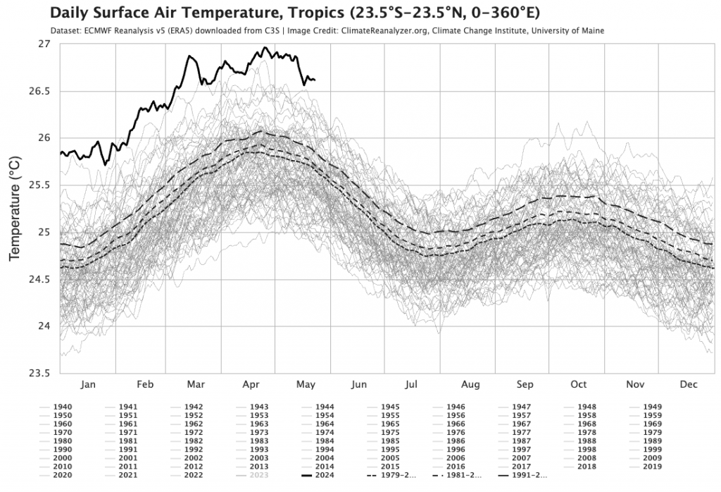
Those hot ocean temperatures are particularly reflected in the global tropical air temperatures, which are likewise running very hot:
The best time to reduce global greenhouse gas output was a few decades ago…but after missing those deadlines the next best time is now.
Thanks to Meteologix / Tropical Tidbits / Climate Reanalzyer for images, and to our long term sponsors for keeping the site operational: