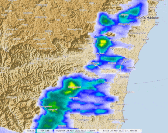
Wow, what an event. Here’s how the radar looked – you can see the initial band of showers that gave some flash flooding in the Kalang with the onshore rain and showers that followed – was relentless there for a couple of days:
And the subsequent weekly rain totals:
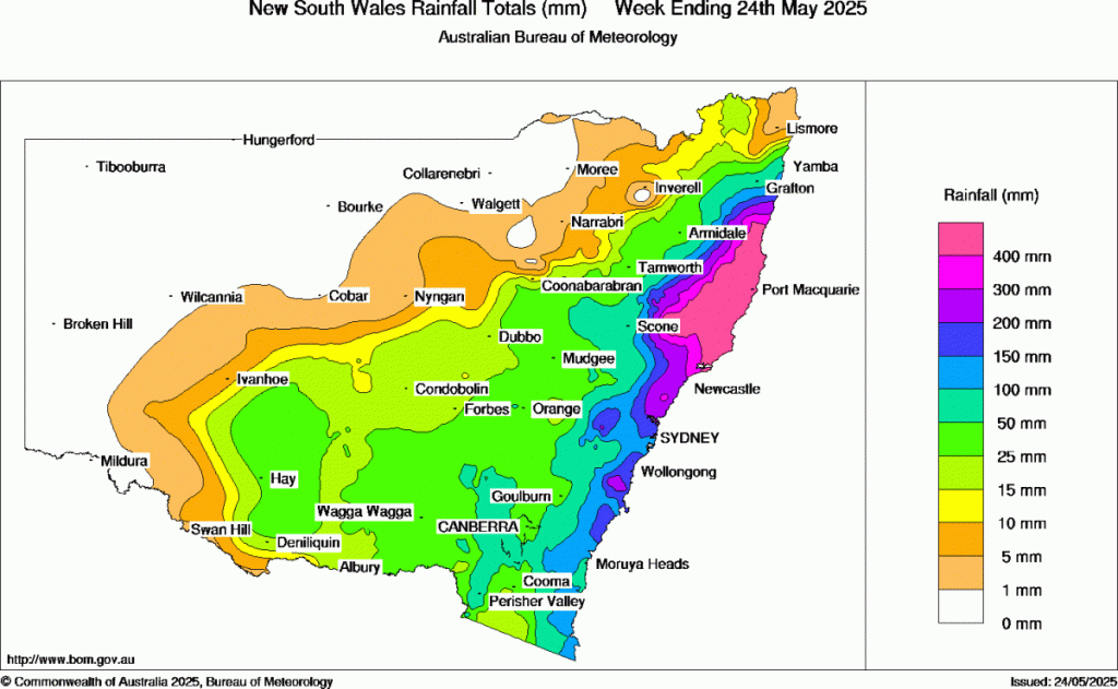
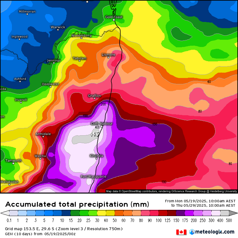
Monster totals across the Mid North Coast. You can see how quickly the rain totals decrease as you head north of our area. Was never clear if we would sit just north of the main rain or catch it – but the risk was always there and we ended up copping some BIG totals. Congrats to the Canadian model which came closest to the actual totals:
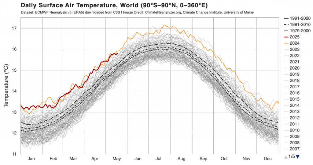
This event has climate change fingerprints all over it – positive SAM, warmer than average ocean temperatures. The current global temperature anomaly is sitting below last year but still well above average:
This event also adds to an already wet year to date:
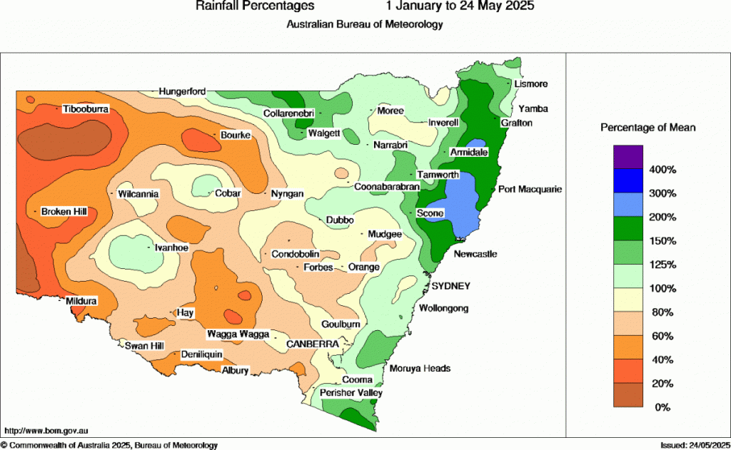
We’re sitting at between 150% and 200% of what we would normally see to this point in the year. The good news is that (after a quick positive burst) the SAM is turning neutral / less positive for the next couple of weeks:
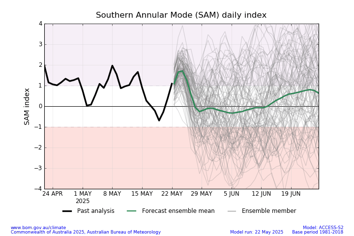
…and that means we should see a more westerly flow across much of NSW – that means wetter to our west and south, but (finally) a little drier for us. The SAM turning negative doesn’t guarantee dry weather but it does increase the chances of it happening. Here’s the current 2 week outlook from two of the key models:
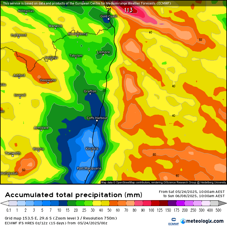
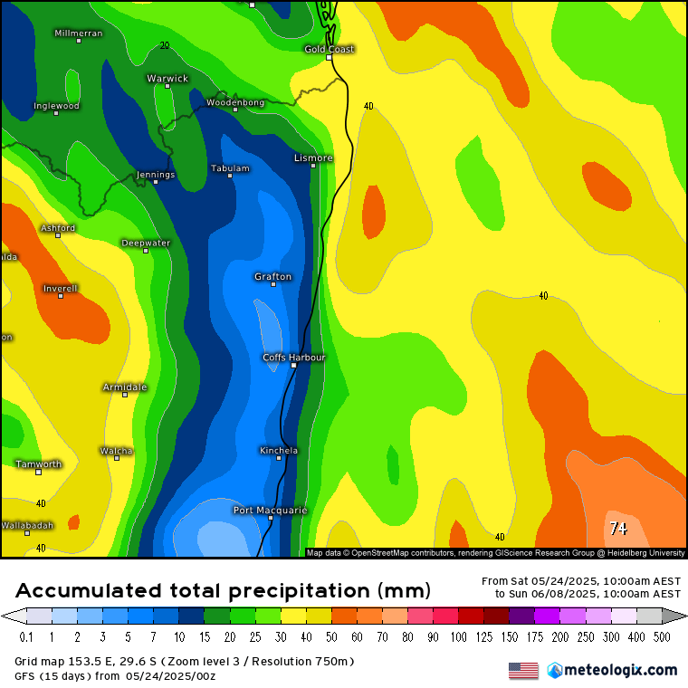
You can see the classic drier-east-of-the-divide pattern emerging at last. There is no guarantee it will be dry all the time, but we should see some sunny weather at times – and with some cold nights also possible it’s time to get that firewood dry!
I’ll be back when the next interesting weather pattern looks like coming through / when the next monthly outlooks are released. Until then hope you get to enjoy the sunshine.


