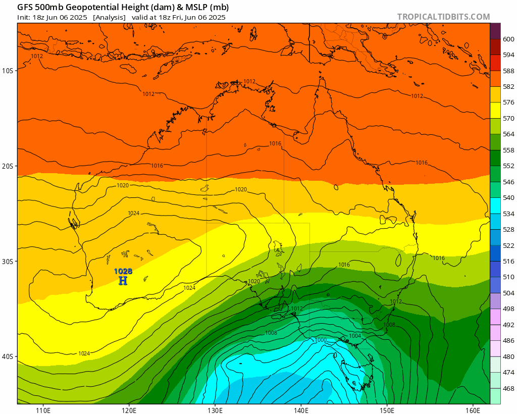
Wow what a change in the weather – drier and cooler weather is here at last! One of the reasons why – the Southern Vortex (band of winds around the south pole) has weakened, allowing cold air to spill north, and allowing the band of westerlies to likewise move north. We can see the weakening in this chart from the BoM:

…and that translates into more westerly winds and cold air pushing up from down south over coming days:
Going to be a LOT of snow on the mountains down south and a great start to the ski season. Looking further ahead however and we can see the SAM forecast to strengthen again over the coming weeks:

…and that once again increases the chance of wetter weather across our region once again. Worth emphasising that it only increases the chance of more rain rather than guarantees it will happen – but it’s a decent signal so worth keeping an eye on. Looking at other drivers and whilst the Pacific doesn’t show much of a signal when looking at the regular sea surface temperature anomalies:
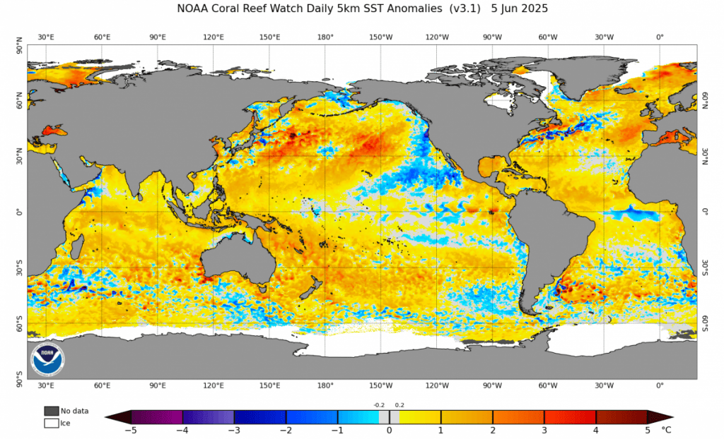
….however once you remove the impact of climate change from the charts you can see a La Nina-esque pattern still remaining in the Pacific:

Modelling for the upcoming months show a continuation or even deepening of this pattern. The GFS clearly shows colder than average temperatures developing once again in the Eastern Pacific:
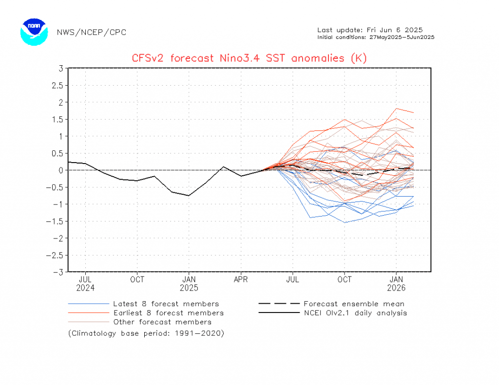
…and whilst the European model isn’t as clear / strong it also shows neutral to potentially negative conditions likely through the same period:

We’re still in the season where small changes can have significant longer term implications, but models are definitely trending cooler for the key Nino regions. This would likely result in an increase in rainfall once again over the coming spring and summer – not really what we need! The BoM also see this with their latest outlook indicating:
“Above average rainfall is likely (60 to 80% chance) for much of Australia, including south-east Queensland and northern NSW. While above average rainfall is expected for the July to September period as a whole, it is likely that above average rainfall will occur mainly from August.”
Their current three month outlooks certainly confirm that theme:


Despite the forecast rain temperatures are looking to sit above average through much of the period, with overnight minimums in particular likely to sit well above average.
Thanks for reading and hope you get a chance to enjoy the sunshine 🙂