A beautiful day today with a top of 23C in town…Spring is definitely incoming! As such thought it might be useful to look at what’s coming up…as further changes over the next couple of weeks are likely to draw down some increasingly warm weather from inland. Here’s how the charts look for the next couple of weeks – you can see changes sweep in from the west from time to time:
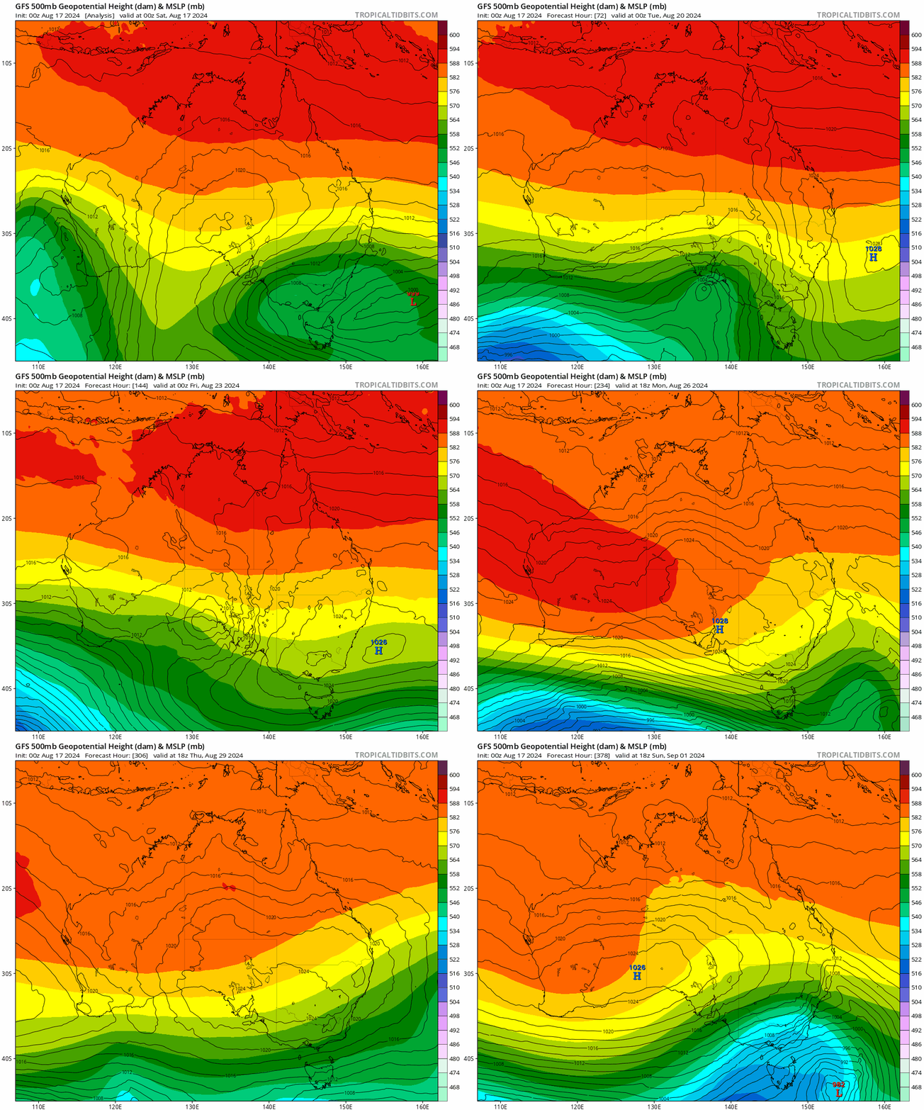
Doesn’t look like much from that perspective – but now the same charts again with the surface temperature anomaly displayed, and you can see warmer temps from the inland getting drawn SE ahead of the changes and bringing us some quick warmer temps before the colder change moves through:
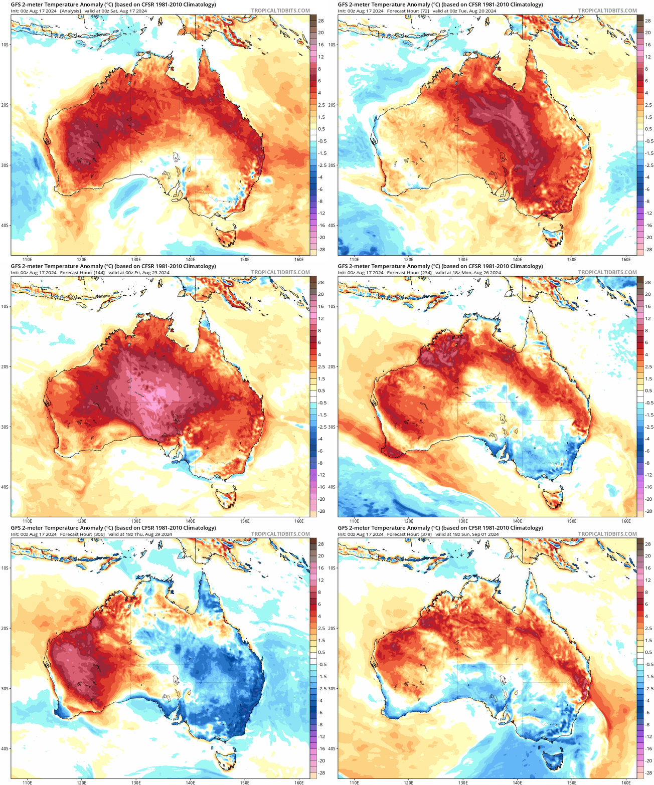
It’s still Winter so nothing too hot – more a first hint of Spring. The first of those warmer blasts will move through during the middle of next week, and this is how the forecast maximum temperatures look for Wednesday:
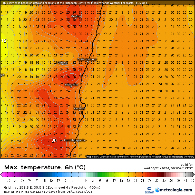
We’ll definitely notice that temperature spike – hope you get some time outside to enjoy it! Little fire risk right now but fine fuels will likely dry out fairly quickly with the warmer temperatures. We are however in a very different position to the same time last year:
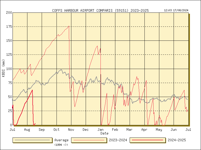
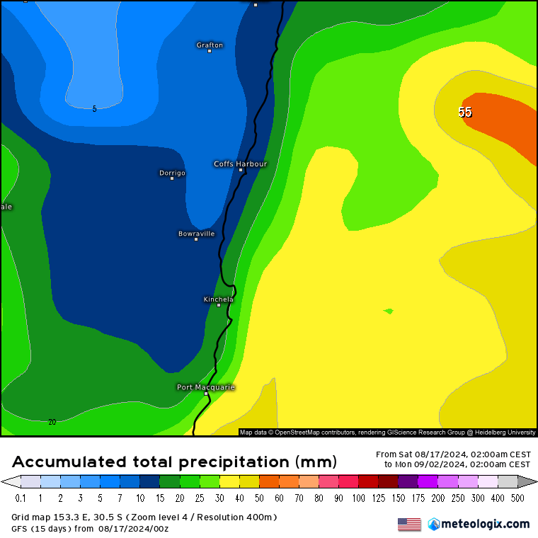
You can see the top line showing the KDBI (an estimate of heavy fuel dryness) over 100 at this point last year (Extreme) – but with recent rain we are currently sitting just above 0 (Mild). This is great news as we head into fire season – though things can dry out quickly if we don’t get much follow up rain. Talking of rain the next 2 weeks is looking fairly dry:
The Southern Vortex is returning to near-normal conditions, but there are some signs of more warming over coming weeks – something we’ll keep an eye on as that can result in more westerlies across our region as we head into Spring:
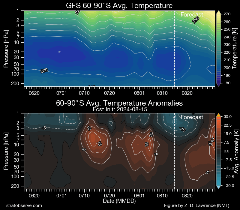
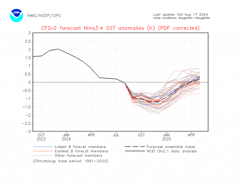
….but that is some way off so still a lot of time for change. Models are still indicating a weak La Nina over coming months before a return to warm neutral conditions as we head into 2025:
We’ll keep watching the bigger picture with updates to come. In the meantime a couple of quick updates on the Bellingen Weather site:
A new Lightning Map page, which shows live lightning strikes across our region. The content comes from an outside source and may contain advertising.
A new Emergency Information page, containing links to key sources of emergency information. If we have missed some please feel free to let me know.
Thanks to Tropical Tidbits / BoM / NWS / NCEP / Meteologix for images
Thanks to Snapfrozen and Kombu Wholefoods for making this site possible

