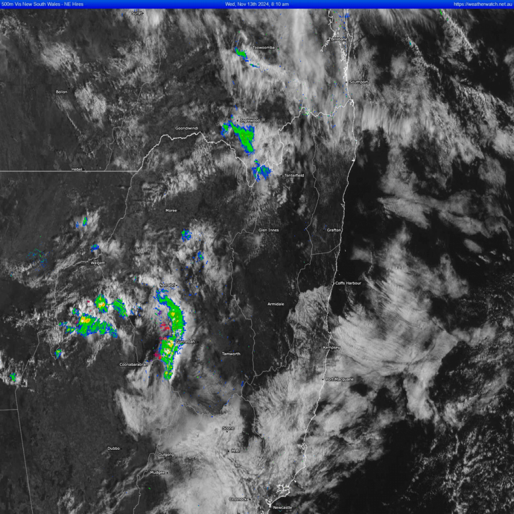
Good morning and welcome to Wednesday! We’ve still got some cloud in the valley but it’s not that thick…and elsewhere it has already cleared. There’s an upper trough moving in and a heap of deep moisture to play with – so yet again a chance of storms this arvo / evening. Looking at the satellite image you can see the clear air around us with the low cloud in the valleys – and you can also see a line of storms out west that are moving our way…worth watching that one as well as development that may kick off ahead of the line:
The forecast radar for early this arvo shows storms kicking off right across NE NSW:
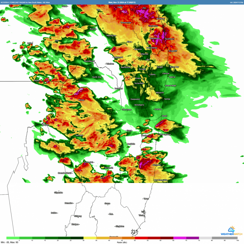
….Don’t pay too much notice to the exact location of the storms – more an indication of just how unstable it is out there – but there could be some severe storms in some locations in NE NSW and SE QLD through today. As is always the way some locations will see a decent downpour while others miss out altogether. In the words of the BoM:
Severe thunderstorms are possible across the northeast quarter with the potential to produce damaging winds (gusts > 90 km/h). Across the Upper Hunter, Southern and Eastern New England and the far north coast, additional moisture brings the additional risks of localised heavy rain and large hail (diameter > 2 cm). In the far northeast storms are expected to be more frequent and possibly very dangerous with giant hail (> 5 cm) and destructive winds (> 125 km/h).
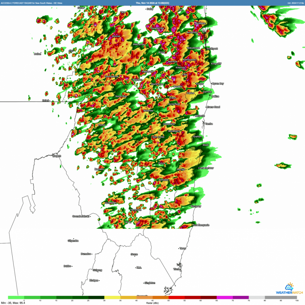
Tomorrow – more showers and storms, but likely to be fewer severe storms than today:
Talking of rainfall – there has been, as forecast, a LOT of rain over the last week. As its the way with storms the majority has been over the hills, but decent falls over the valleys as well. Here’s the 7 day total from local radar:
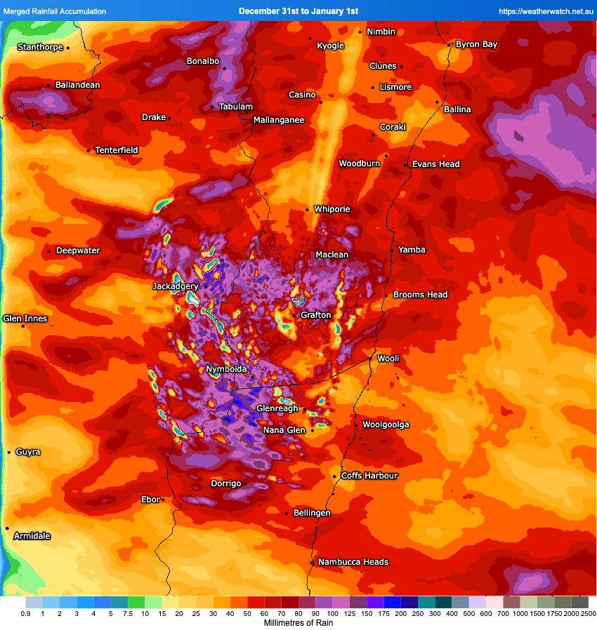
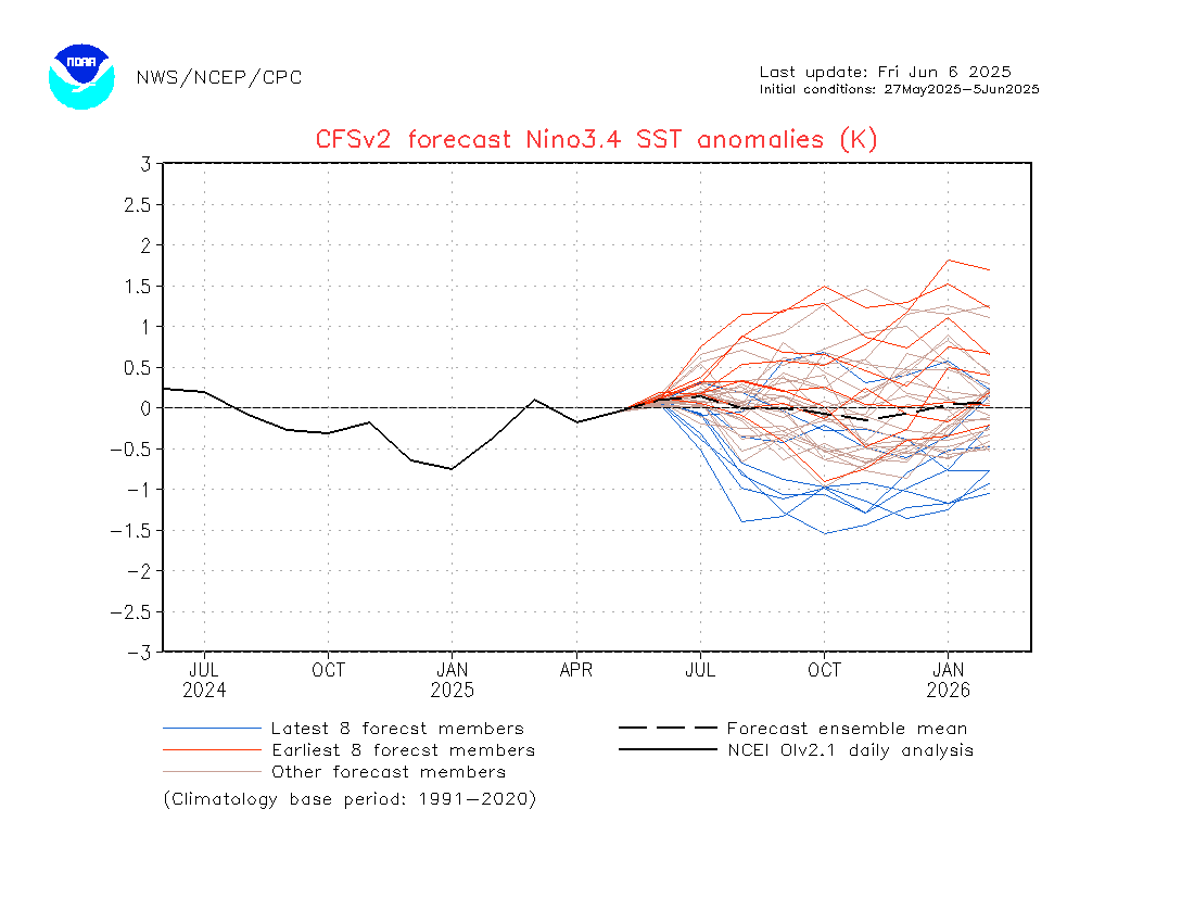
Great to be able to follow the range and the path of individual severe storms. Looking further ahead and we’ve got more wetter weather likely over the coming weeks – with a potentially wetter spell in a week or so to keep an eye on – more on that over coming days if it looks like coming together. The longer term models are also indicating the weak La Nina persisting into summer, but slowly further weakening over time:
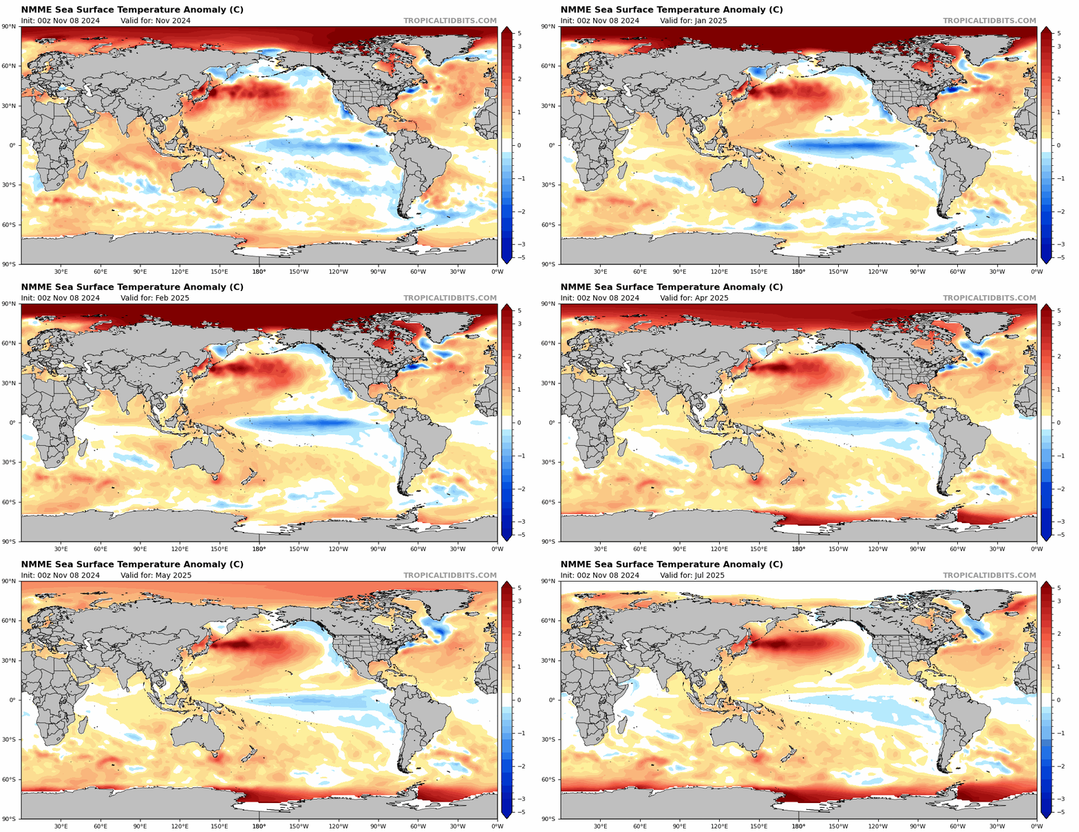
The forecast polar anomalies are a certainly eye opening! In terms of Australian weather we can expect wetter weather at times over the coming months as a result of the oceanic temperature patterns:
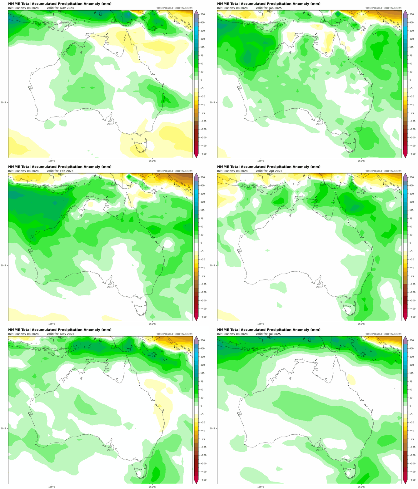
…but the upside is that we’ll likely see less fires, and maximum temperatures could be on the moderate side as cloud and rain keeps a lid on the heat:
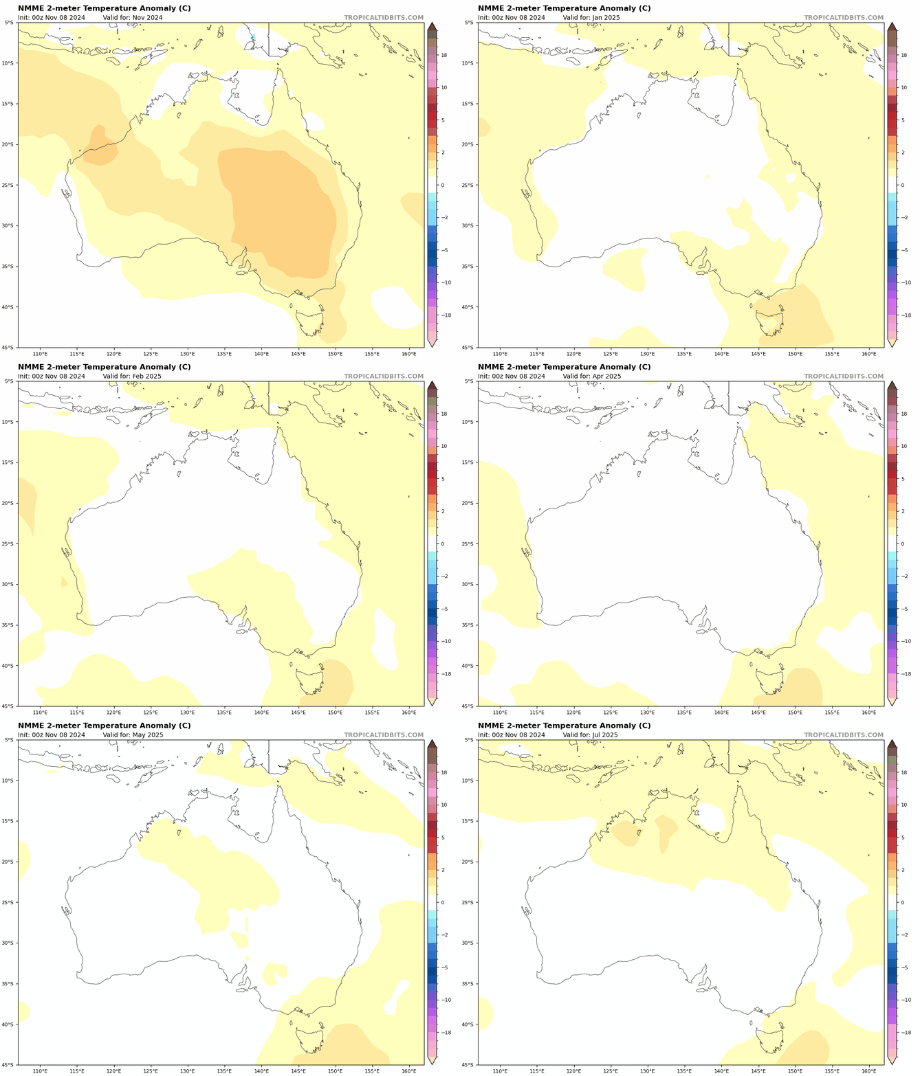
That’s it for now. Keep an eye on the radar today and tomorrow and enjoy any storms that roll through – hopefully not too severe for our region.
Thanks to Tropical Tidbits / Meteologix / MetCentre for images 🙂

