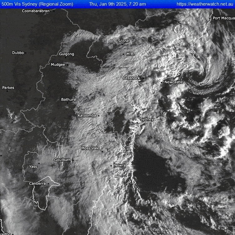
As promised by the models we have a cute little low develop offshore over very warm waters to our south. That turned surface winds offshore across our region, bringing a few storms but less in the way of onshore showers. You can check out the low moving ashore in this satellite loop from this morning:
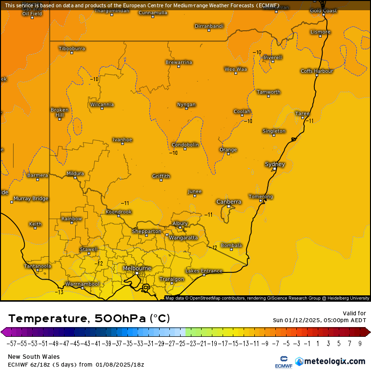
Very cool to see 🙂 That westward moving low will now dissipate over land whilst drawing some warm, wet air back across NE NSW. Combine that with a broad, slack, upper trough:
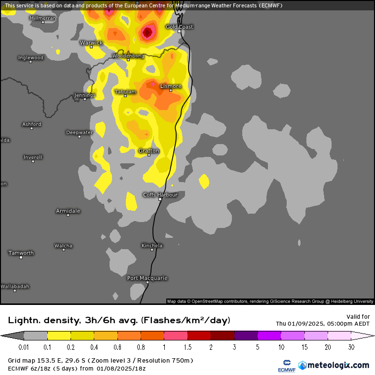
…and we’ll see the chance of storms over the coming week. Here’s the lightning forecast for coming few days – mainly inland but possible (and then increasing) closer to the coast over coming days:
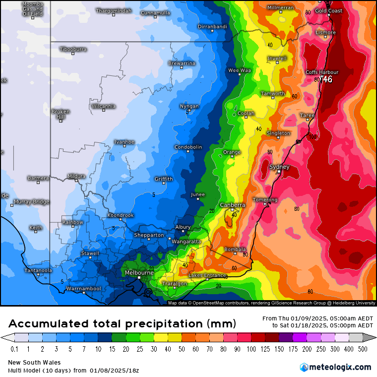
With slack upper and surface pressure it’s almost impossible to say how much rain we’ll see, so an average over the coming 9 days is probably the way to go (while being aware that some places will likely see considerably more, while others see much less):
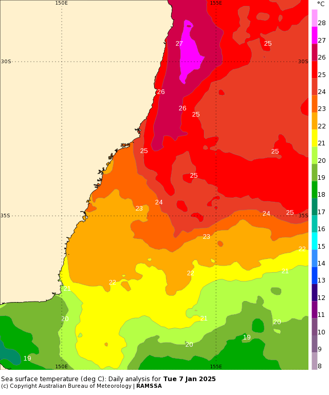
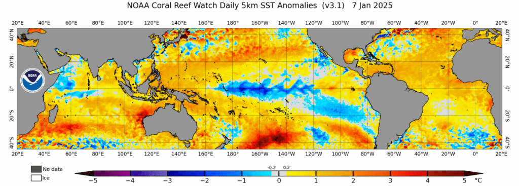
Why so wet? Ocean temperatures continue to look toasty off our coast:
…so for the time being whenever the triggers are in place we’ll have adequate moisture and energy to fire off some exciting weather. Looking at the bigger picture we’ve also now got a decent La Nina in place across the Pacific:
…and have the MJO slowly moving back towards Australia:
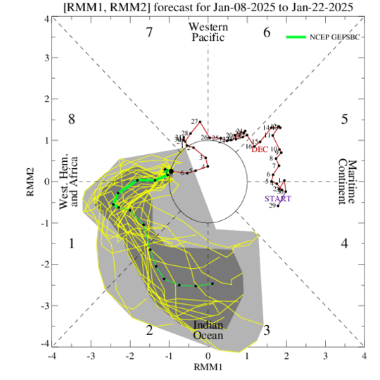
…so it’s going to be worth keeping an eye on the tropics late January / early Feb for some tropical activity to our north – just in case anything decides to sneak down this way 👀
For now enjoy the storms, be prepared to either watch them go either side of you or get an absolute dumping, and see you again when more interesting weather looks likely 🤓


