A bit to get through today. We’ve got the chance of some decent storms later today as well as wet weather to finish the week. More on that below, but first-off the fires in LA. Whilst no single events can be 100% caused by climate change, the changes in the climate over time make these events more likely – both here, in the USA and elsewhere around the world. There’s a fire season in California and an offshore Santa Ana wind season. There used to be some separation between them – but as the climate has warmed the fire season has expanded, and now overlaps the Santa Ana season:
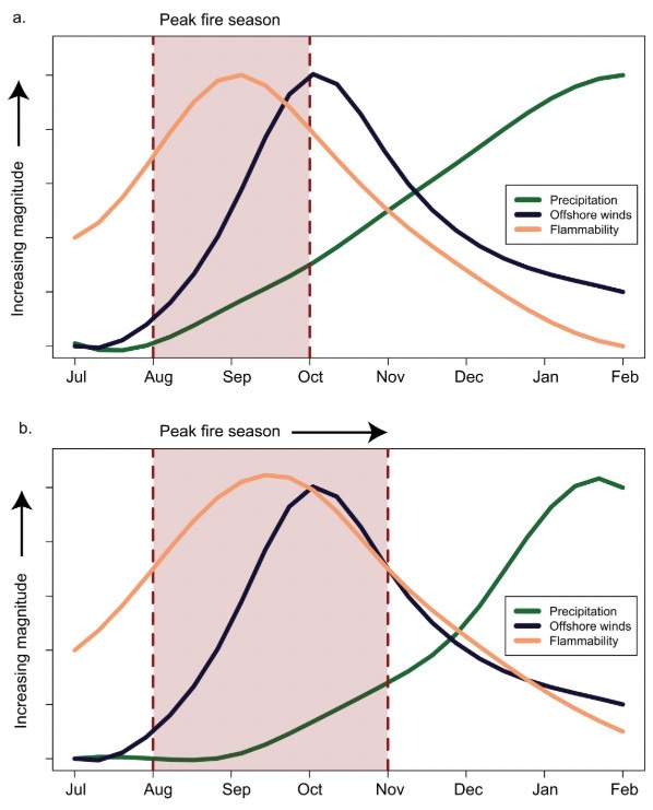
The top graphic shows how things used to be with the orange flammability peak seperate from the Santa Ana wind peak…but with a warming climate the peaks are now more closely aligned. Whilst that doesn’t mean big fires every season, it definitely increases the risks as well as magnifying the outcomes when fires do start. Here in Aus we’re likely to be impacted in multiple ways – less glabl fire fighting equipment available for use in our fire season (as their extended season now overlaps with our season) and the increased fire risk across our region as fire season expands.
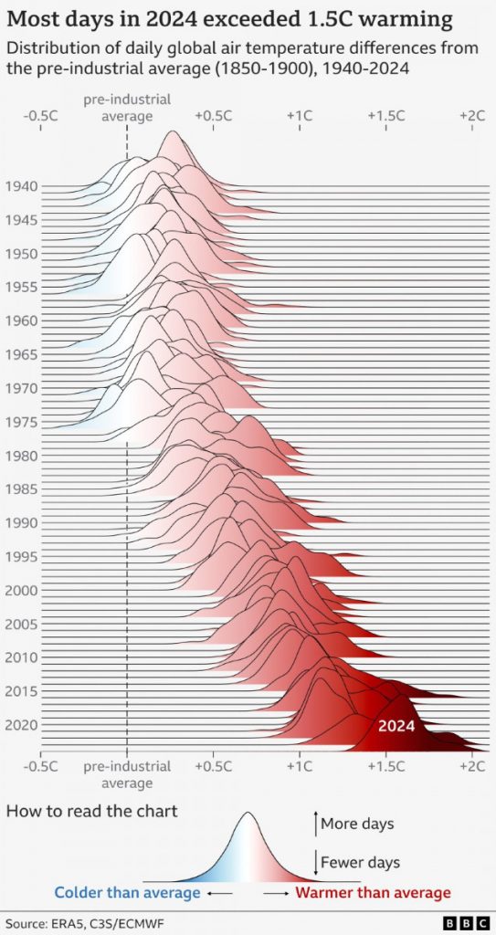
The annual global climate report has also just been released – and it shows that once again 2024 broke records. This graphic (inspired by Joy Division apparently!) highlights just how warm 2024 was:
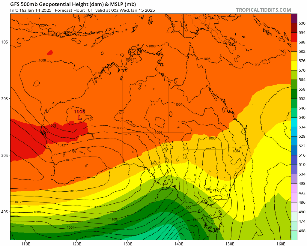
Heading back into local weather…and we’ve got a strong upper trough (cold air) moving into our region – and that upper trough is likely to break off into a cold pool that moves pretty close to us over the next few days:
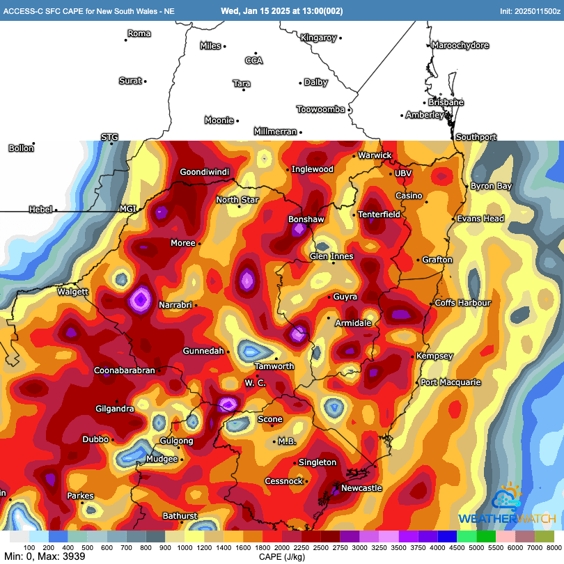
Upper cold air combined with very warm oceans and hot temperatures over land are usually a pretty explosive mix…and sure enough there’s going to be quite a bit of interesting weather around over the next few days. CAPE is used to measure how much energy is available for storms to form – and right now across our region it is pretty much as high as you’ll see it:
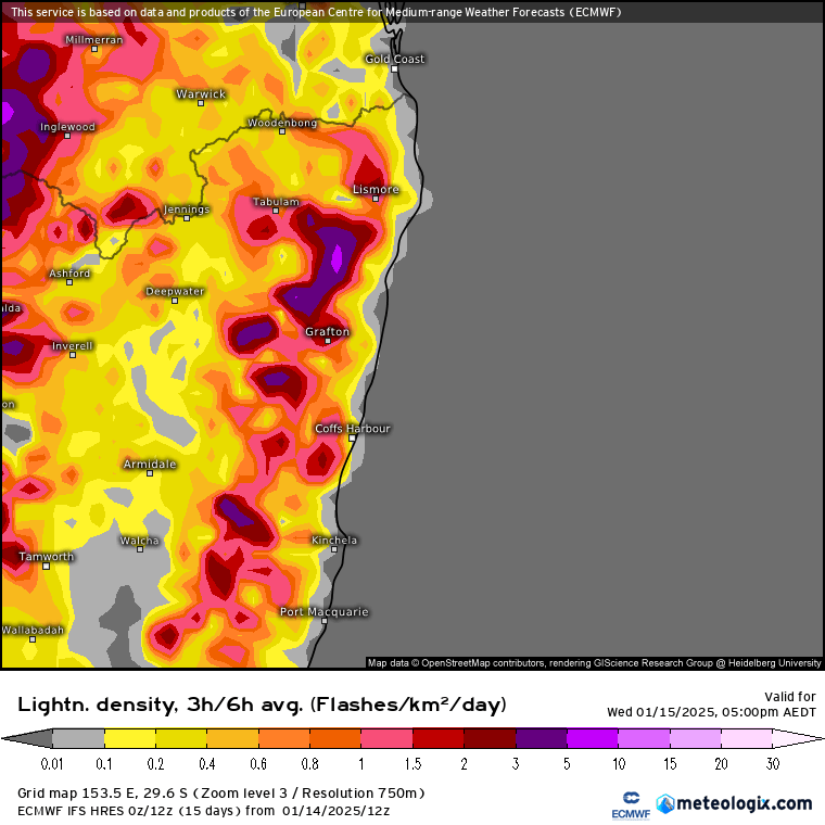
That doesn’t mean we’ll definitely see storms as mid-level warm air can put a ‘cap’ on the air and stop it rising…but as cold upper air moves closer we’ll see capping erode and the risk of storms increase. Models show a good chance of lightning across our region later this arvo:
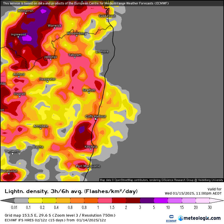
…and interestingly even as we move into tonight the risk of storms continues – even though the surface air will cool through the evening the upper air will be cooling even faster, maintaining instability and the risk of storms well into the night:
We’ve got the risk of hail, heavy rain and strong winds today…so whilst (as is always the case with storms) there is a chance that we’ll miss out…there’s also the risk of strong storms through the remainder of today and into tonight / tomorrow.
That pesky upper cold air is going to hang around for a few days, and whilst the risk of severe storms will decrease as cooler surface air moves in, we’ll see onshore winds (moving in off a very warm ocean) combined with cold upper temps – the usual recipe for onshore showers and the odd storm. With winds moving from the south / south east the heaviest falls will likely be across the Dorrigo / Coffs range with 100mm+ possible before the end of the weekend (including falls from storms today and tonight) which would increase the risk of some river / creek rises, particularly in flashy creeks such as the Never Never:
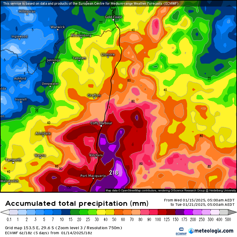
Worth keeping an eye on the radar / warnings over the next few days – initially for storms later today and then for rain totals into the weekend with the risk of river and creek rises…
EDIT: And BoM has just issued a Flood Watch for our region:
14:44 Wednesday, 15 January
NSW Flood Watch: Northern Rivers, Mid North Coast, Hunter and Central Coast
Details:
NSW Flood Watch: Northern Rivers, Mid North Coast, Hunter and Central Coast
Initial Flood Watch for parts of the Northern Rivers, Mid North Coast, Hunter and Central Coast
Issued at 2:39 pm EDT on Wednesday 15 January 2025
Flood Watch Number: 1
ISOLATED MINOR FLOODING POSSIBLE IN THE NORTHERN RIVERS, MID NORTH COAST, HUNTER AND CENTRAL COAST FROM THURSDAY EVENING
A strong cold front and its associated trough are forecast to cross the state today, moving offshore early Thursday morning. Following the passage of the trough, a low pressure system is expected to develop offshore along the central coast, resulting in increased rainfall about parts of the Hunter, Mid North Coast and Northern Rivers.
Bellinger and Kalang Rivers: minor flooding
Thanks to Daniel Swain / BBC / Tropical Tidbits / Meteologix for the images


