We’ve been fairly quiet recently…but it’s been a different story up north where they have seen some HUGE rains in NE Qld, where the monsoon trough has hung around without moving too much, resulting in rain that is being measured in the metres. They’ve got more big rains this weekend before drying out a little next week. Very wet up there usually means a little drier down here, which has been the case this time around. There is always the chance of a tropical low moving our way, but that’s pretty unusual (though spectacular when it happens)…but no sign of that right now.
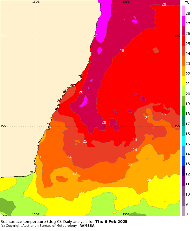
We’ve got some warm water just offshore:
…and it looks like we’ll see an upper pool of cold air move north across NSW through next week:
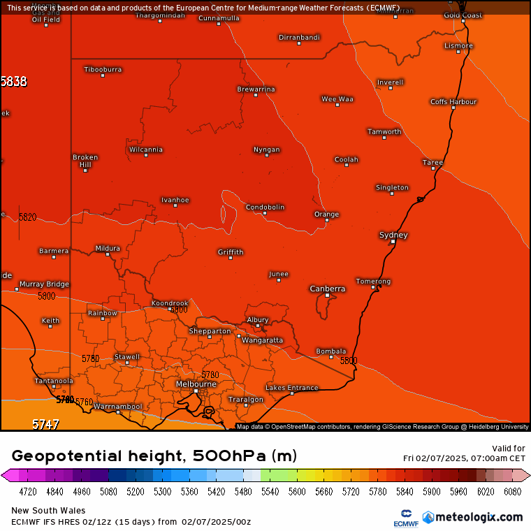
Combine upper cold temps and warm, humid air at the surface and you’ll see some decent instability at times through next week…so expect wetter weather than we have been seeing, with decent storms a possibility and higher rain totals also a chance. Right now it’s hard to be sure how much we’ll see as the models are still working out the details…so a model average is probably the way to go…and that looks like this for the coming 9 days:
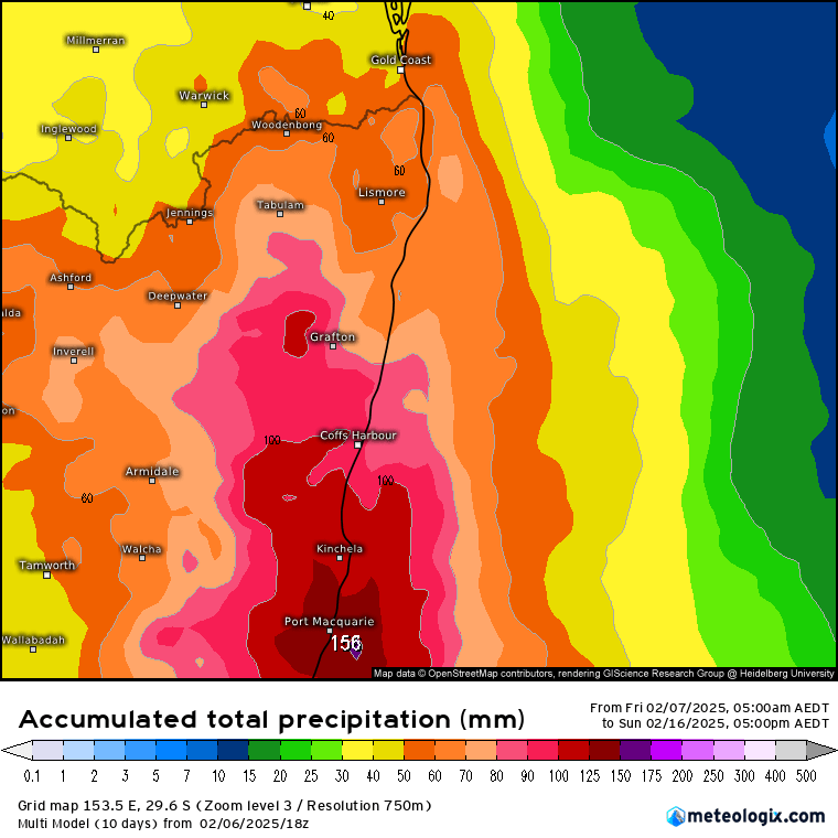
…however it’s a feature that is worth paying attention to as there is the risk of some higher falls – and just as much a chance of a flop with little rain. For example the current GFS model has these 9 day totals:
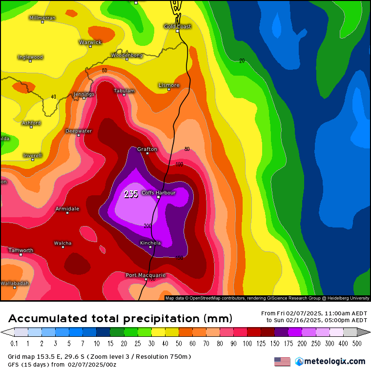
…while other models show much less. For example the ICON model has these 180hour totals:
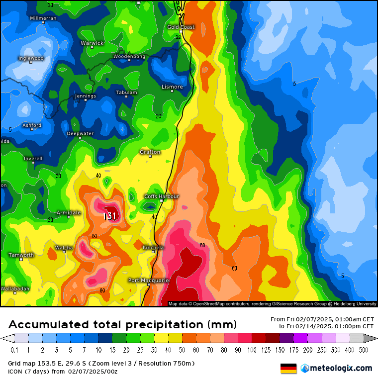
…and with much of the forecast rain due within this time frame you can see the uncertainty – in which case the model average is usually the way to go. I’ll post again if it looks like higher totals are likely.
Looking further ahead and global models show the current cooler ocean temperatures in the central Pacific warming up again through the winter. For example the EC model forecasts these ocean temperature anomalies for February -> August:
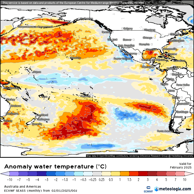
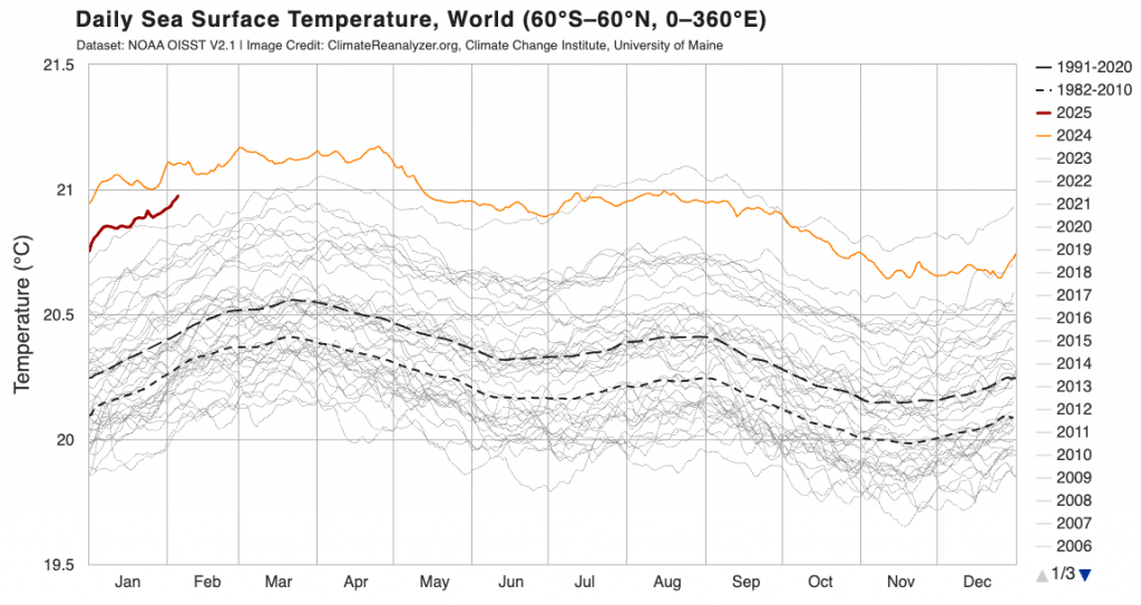
…so expect the risk of wetter conditions along the Australian east coast to continue through the next few months before likely returning to average values as we head into winter. It looks like above average ocean temperatures will remain off the east coast right through, so higher temperatures / humidity levels will likely remain a feature of our weather. Concerningly the current global ocean temperature anomalies are sitting at very high levels – you would usually expect them to drop during a La Nina:
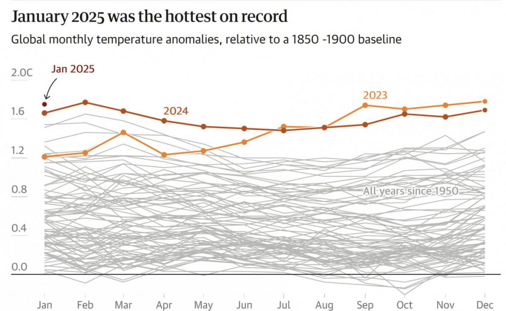
We’ve also just had January come out as the warmest in recorded history – despite the La Nina:
With warmer Pacific ocean temperatures looking likely later this year we are likely to continue to see global ocean temperatures remaining well above average for the foreseeable future.
Going to wrap up with a mention of the concerns around weather and climate data that originates from the USA. We source a lot of climate / weather data from the USA – such as the sea surface temperature chart above, the GFS weather charts etc. Recent government changes in the USA appear to be pushing towards the restriction / elimination of a significant proportion of that data. US climate scientists are currently working to privately back up data before it is deleted – but with the increasing risks from climate change the last thing we need is the commodification of previously shared data. Likewise removing references to climate change won’t stop it happening – it just means we’ll be less prepared for it.
With that sobering thought wishing you a good weekend – hope you have a chance to enjoy the sunshine before showers and storms move in next week.
Thanks to our fantastic weather sources for the images – not taken for granted. Thanks also to our community sponsors 🙂


