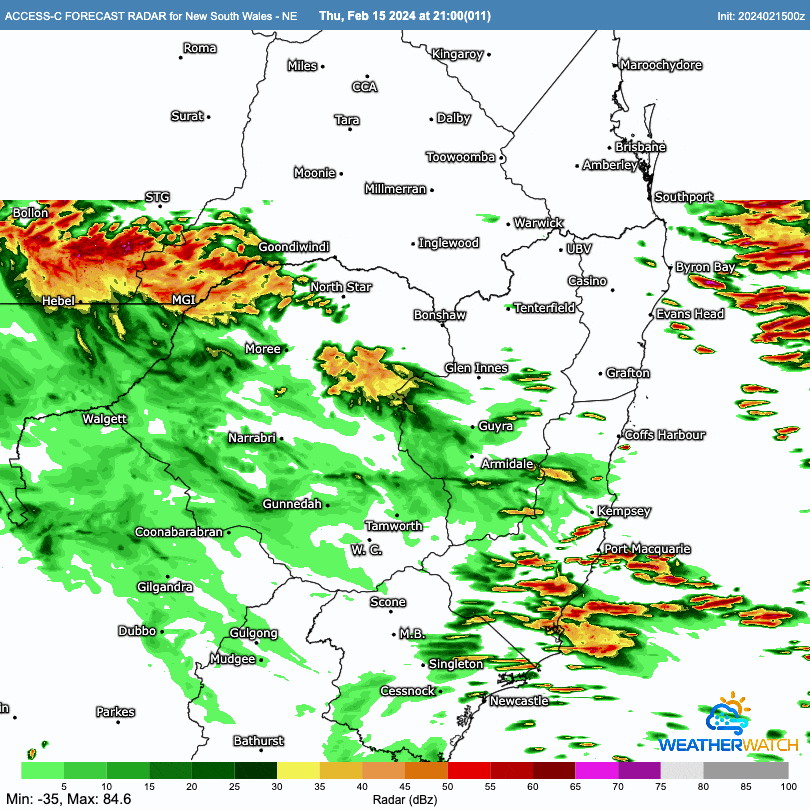
We’ve got a trough moving onshore into tomorrow and it’s likely to bring a band of showers with it – some of which could be heavy. An animation from the BoM high resolution model looks like this:
Could see some decent totals across some areas as a result of this trough. Totals looking like:
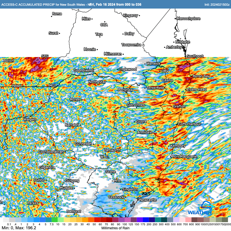
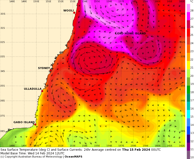
With showers moving in from the NE we could see a little shelter across our region from the Coffs / Dorrigo range with the higher falls sitting over the hills, but regardless all areas could see some heavier showers at times. One of the reasons for the likely heavier falls (despite only limited upper support) is the much warmer than average ocean temperatures off our coast. Ocean temps still sitting in the upper 20s:
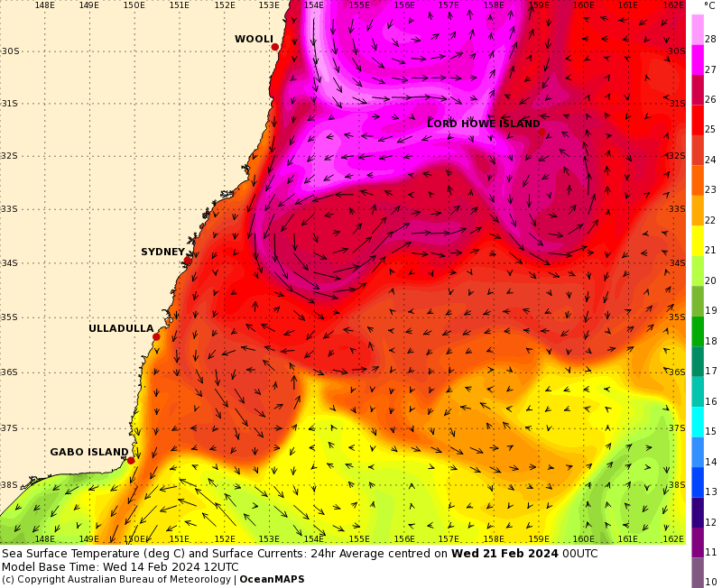
Looking a week ahead and those warmer ocean temperatures have spread even further down south:
…so expect to see increased humidity levels with the risk of decent downpours whenever we get onshore winds and a little upper support!
The forecast showers should clear out for the weekend before the onshore winds (and showers) return early next week. I’ll be keeping a close eye on the forecast – with this pattern and very warm ocean temperatures any upper support will quickly lead to decent accumulating totals.
Looking further ahead and La Nina is still forecast to develop through 2024. Good news if you are looking for something to temporarily put a lid on rising global temperatures…but bad news if you are looking to avoid increasing rainfall and likely flooding across parts of eastern Australia! La Nina becomes more likely in a warming climate. Current forecast looks like:
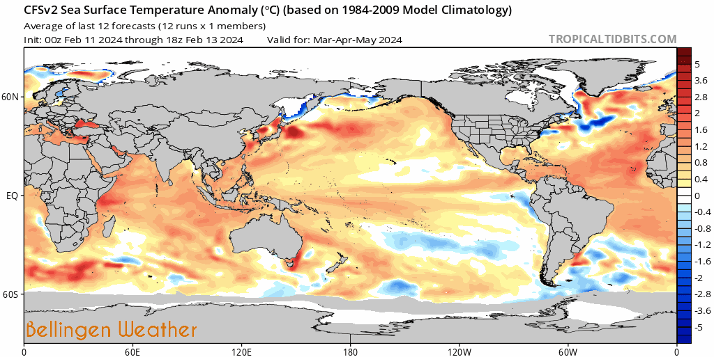
That’s it for now. Thanks to Tropical Tidbits / WeatherWatch / BoM for images.
Thanks to Snapfrozen and Kombu Wholefoods for their ongoing support, without which this site would not exist.