A quick update on how things are looking for our region. We’ll kick off with ocean temperatures, which are still at record levels for parts of the NSW coast. There’s a strong East Australia current pushing 27C water close to the coast:
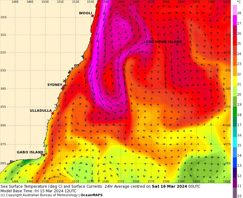
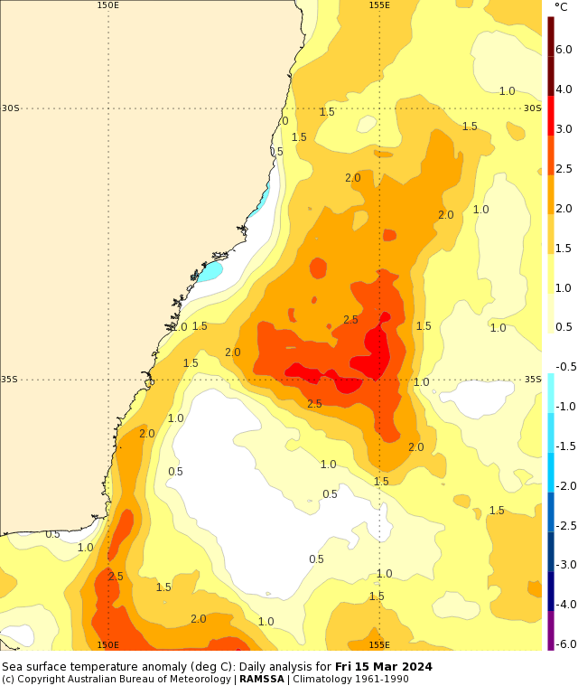
…and that strong current is helping keep ocean temps above average right through the Tasman:
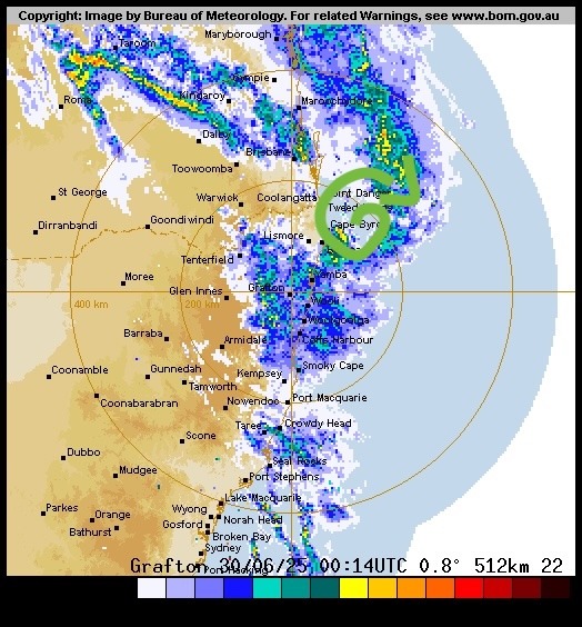
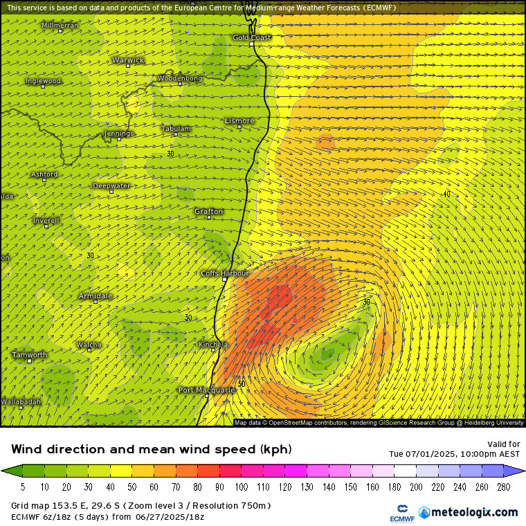
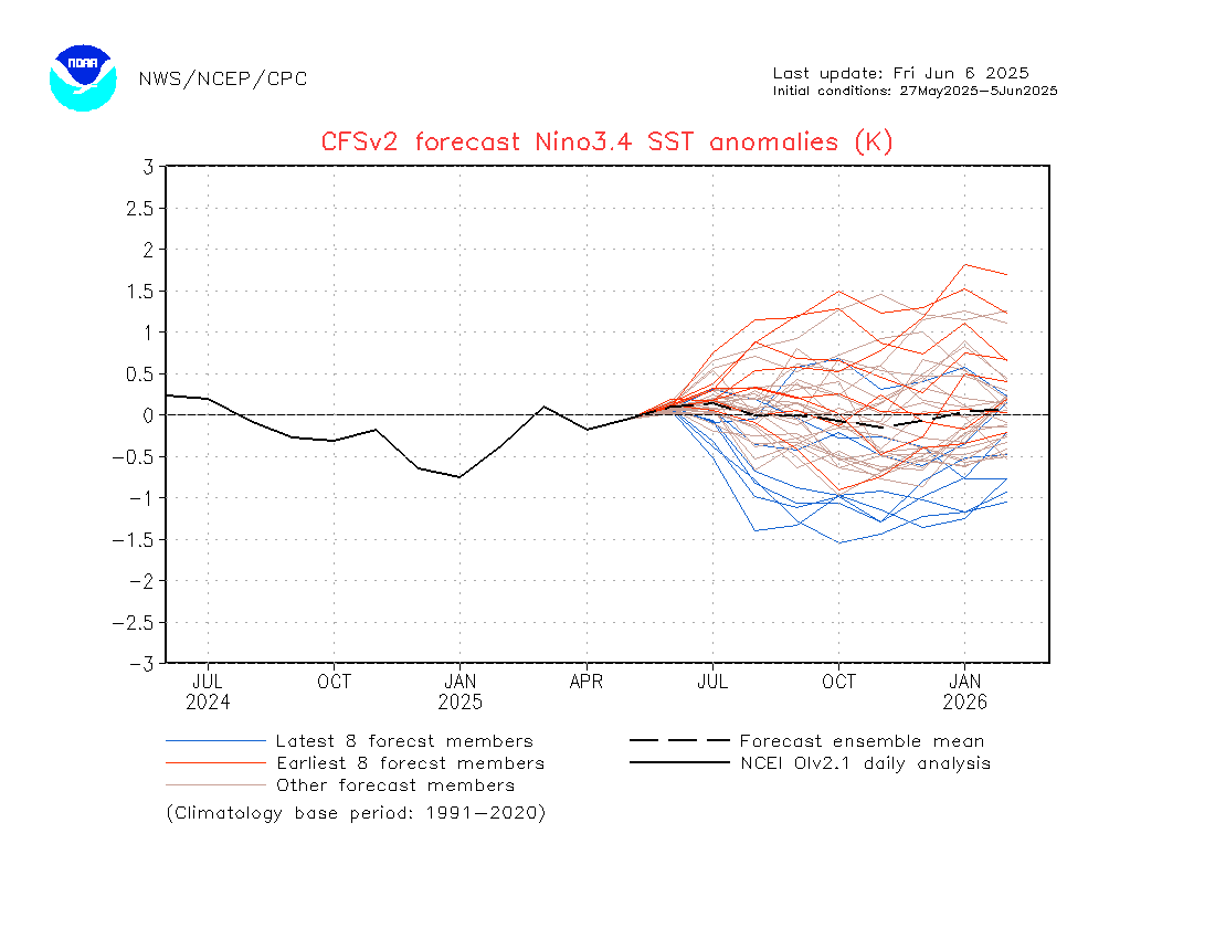
With winds coming in from that warm ocean for much of the coming week we’ll see a risk of daytime showers / storms and overnight showers pushing in from the ocean. Some locations could see some decent totals accumulate through the week. Looking into week 2 and there are some indications that we could see a much wetter spell…still some way off but something I’ll be keeping a close eye on and will post again through the coming week if a wetter spell looks likely. Talking of wetter weather – the latest model outlooks are still indicating the chance of a significant La Nina developing through late winter and spring:
…and needless to say if the event does develop as currently forecast we could be looking, once again, at some much wetter weather across eastern Australia. Here’s the current forecast out to November:
Also worth noting the forecast temps over the coming few months – with warmer than average ocean temps around Aus the BoM max temp outlook looks like it’ll be at the top of the scale right across Aus:

Talking of flood cams – and the streaming Kombu cam is back. The growth in front of the camera over the last 10 years has been significant – I am currently working with Bellingen Council to see if we can get permission to trim it back a little!
2013:

2024:

That’s it for now…showers and a few storms possible through this week, then a chance of wetter weather to follow…but still a long way off. I’ll be back through the week with a more detailed outlook if significantly wetter weather looks likely.
Images thanks to BoM, Tropical Tidbits and Kombu Wholefoods
Thanks to our sponsors for keeping us alive and happening 🙂