A quick end of the week post flagging some showers to come through this weekend as an onshore flow develops and moves up the coast. Cooling upper temps and a VERY warm ocean will also help. Here’s the current ocean temps off our coast:
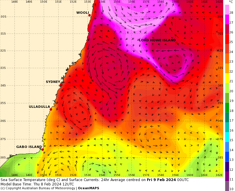
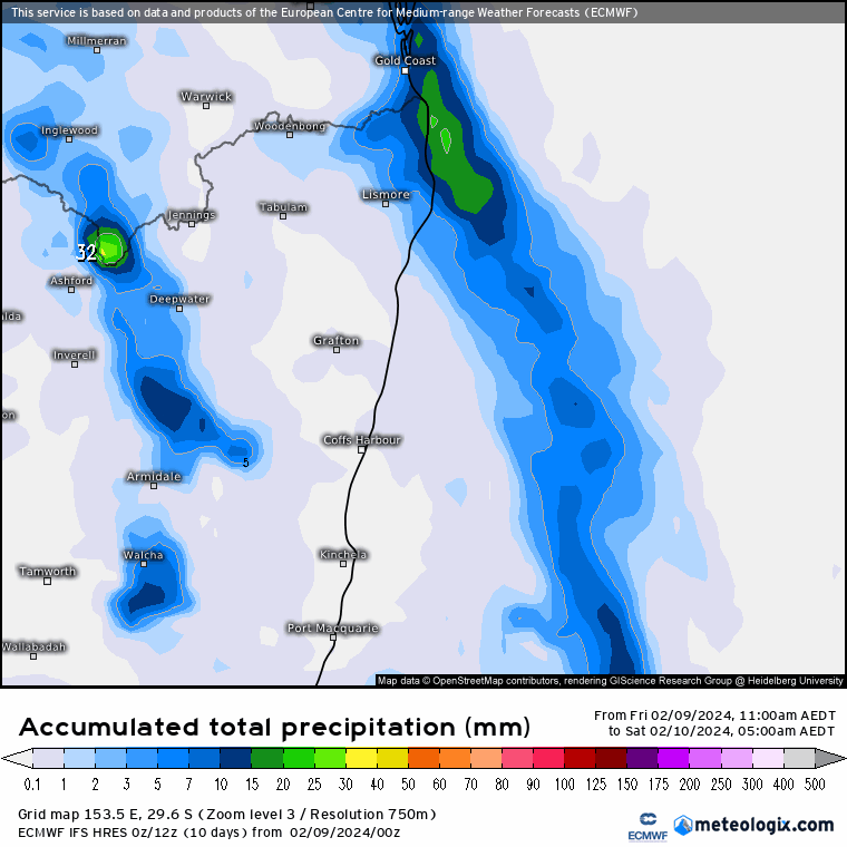
Yep , that is a big blob of 27 to 28c ocean temperatures just offshore – hence the recent humidity. Rainfall accumulations will vary, as is usually the case with showers…but the EC model gives a bit of a guide. These are accumulations through to the middle of next week, with a focus over the hills and over this weekend:
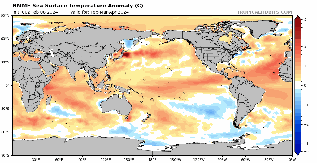
Looking further ahead and showers clear into next week, before onshore winds and the chance of more showers returns late next week. Even further ahead and monthly models are now out – and continue to forecast the development of a decent La Nina later this year. This is the NMME model, which is an ensemble of a number of models and offers one of the best guides:
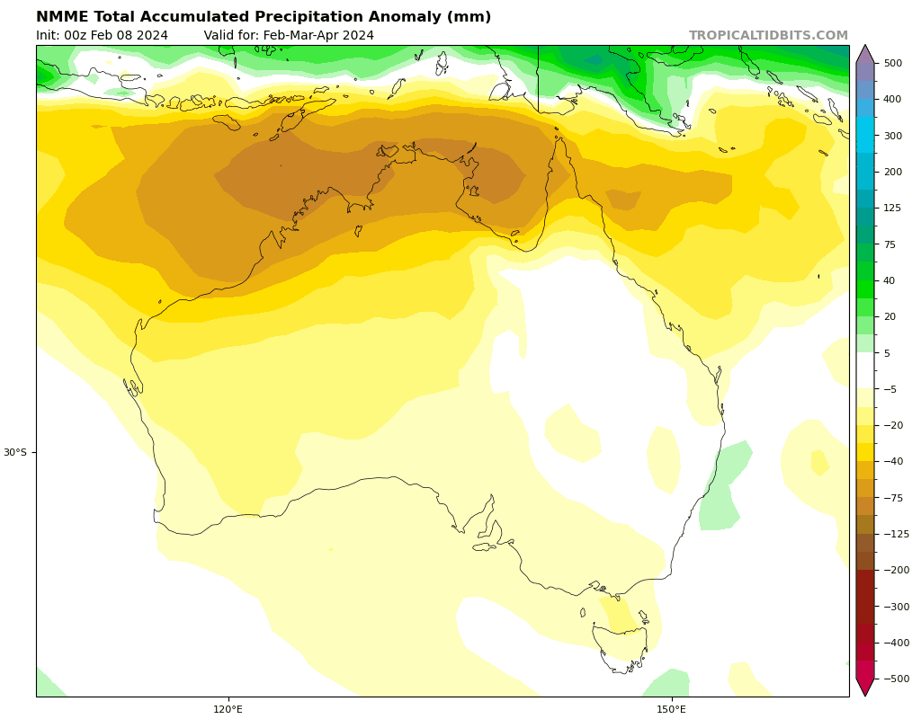
…and sure enough models are also forecasting a return of wetter than average conditions for our region if the La Nina forms:
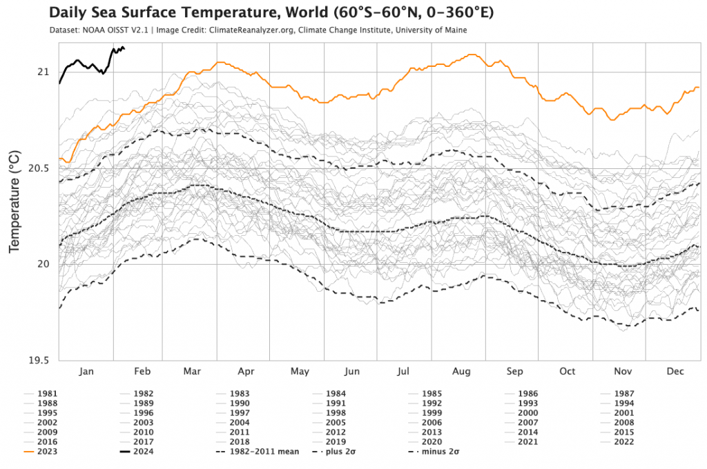
Definitely one to watch over the coming months – particularly with ocean temperatures at record levels:
If / when the La Nina forms I’d be expecting to see a slight reduction in the overall ocean temperatures as the cooler water surfaces across much of the tropical Pacific, however ongoing warmer than average ocean temperatures close to Australia will give the forecast wetter conditions a boost.
Thanks to BoM / Metelogix / Tropical Tidbits / NOAA for the images
Thanks to Kombu Wholefoods and Snapfrozen for sponsoring the weather station and this website / blog