We’ve talked a few times recently about upper cold pools wandering across E Australia, and increasing the risk of some showers / rain if they combine with onshore winds. As per a couple of posts ago it looked like next week could offer one such opportunity, and at this time it is still on the cards.
Forecast models show a series of upper troughs and lows moving across over the coming 10 days:
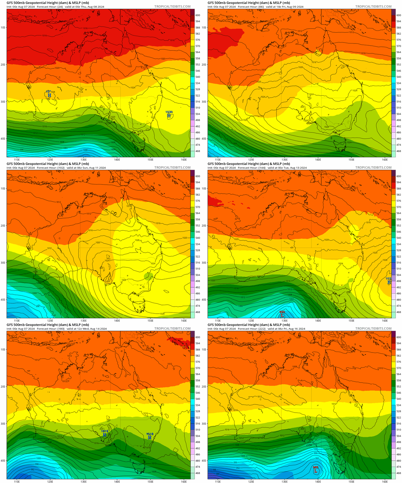
….and with onshore winds for some of that period we’ll see showers move onshore when the upper and surface conditions combine.
Here’s how models show rain totals accumulating over the coming week – and you can see a few seperate bands of showers moving in across NE NSW over that period:
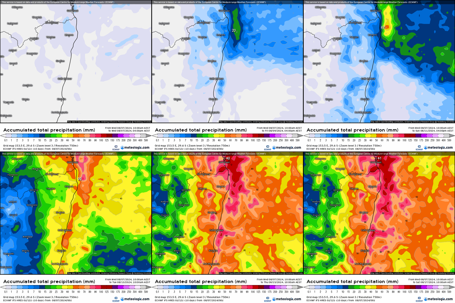
As is always the case with these events some locations will see a heap more than others, and forecast totals will likely change over the coming days…but worth being aware that we could see some decent rain next week – the first for some time. Here’s how the totals stack up against a range of models:

As you can see some models show much higher totals than others – so it’s still up in the air as to how much we receive…but they all show some rain over the coming week. Great timing as we head towards fire season!
Thanks to Meteologix for the images, and our usual thanks to our hosts and supporters 🙂

