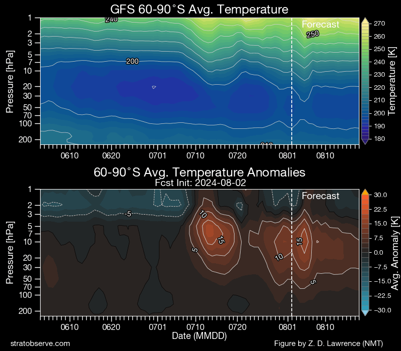
Good morning Bellingen. As promised a weekend update on the rain potential. The vortex around the South Pole is still warm and weak, but it looks like it should return to more-normal values over coming weeks. You can see the two warm events in this chart, with the second one likely to finish soon:
…and we can see the resultant impact on the strength of the vortex, where negative means a weaker vortex (with cold / westerly winds more likely to move away from the polar region):
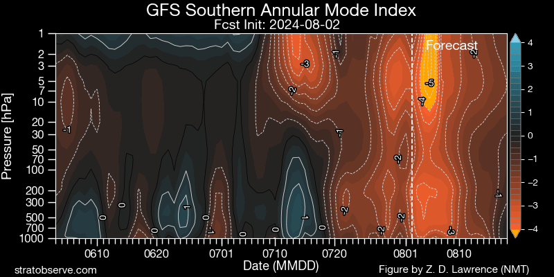
…so while we should see a continuation of the negative event for some time to come, it will likely return to neutral values eventually. Right now those wandering upper cold pools are still likely to impact our weather…but for us to see decent rain totals from them we need to have them in the right place with the right combination of surface conditions. Here’s how it looks over the next couple of weeks:
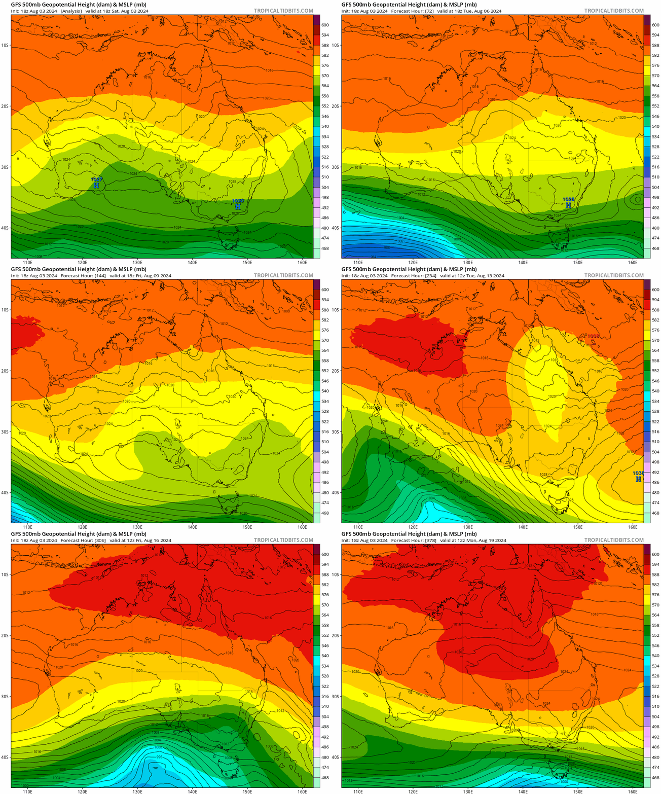
…and sure enough you can see lots of disturbances early on before it settles down late in the period. The first change moving through early next week could still bring a few showers, but higher totals are looking much less likely. Here’s the forecast totals running through this week from one of the top weather models:

…and you can see totals between zero and 15mm predicted, so nothing too wet. As we head into the following week it’s harder for models to have a real handle on what will happen, but once again there is the chance that we’ll see some higher totals if conditions align. You can see the variations in the run through the following week:

Lots of variations out there – so what that means for now is that we know there is a chance of some wetter weather the week after next, but right now there is very low confidence in what will actually happen. The usual outcome is somewhere in the middle, which for now means the chance of another 20 to 25mm in week 2. I’ll keep an eye on the forecasts and update when things settle down…
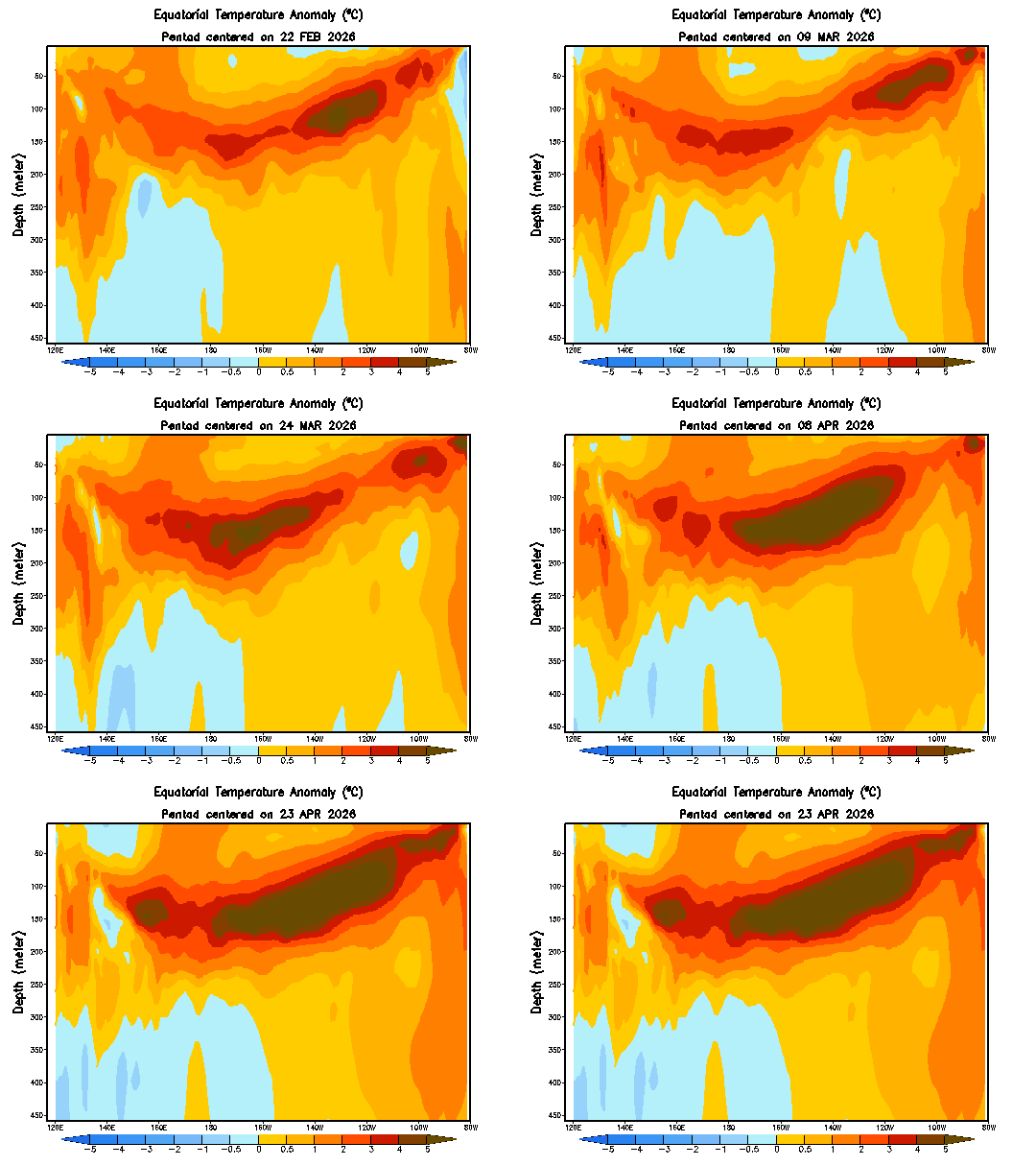
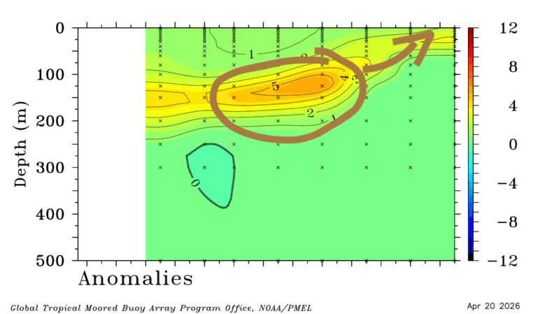
Looking further ahead and there is a large cool pool now under the central Pacific:
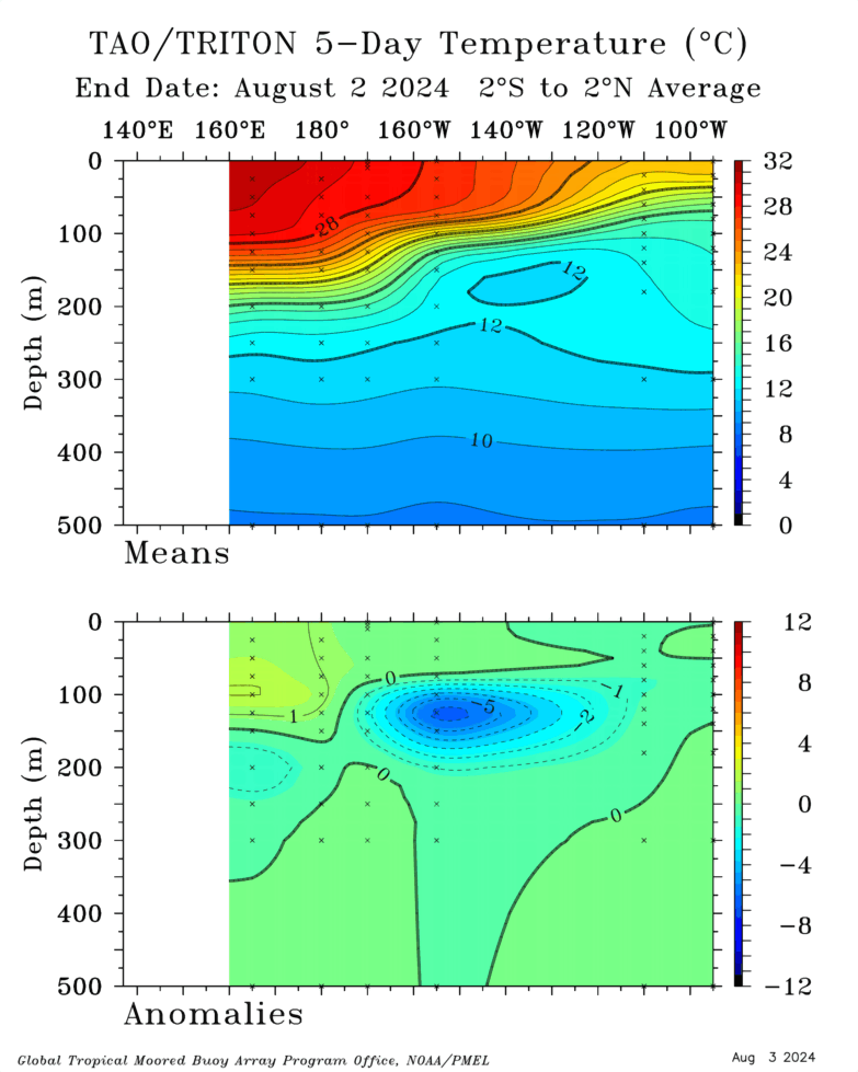
That cold pool is likely to move east and then surface over coming months before weakening as we head into our Autumn. Here’s how the latest model runs show it developing:
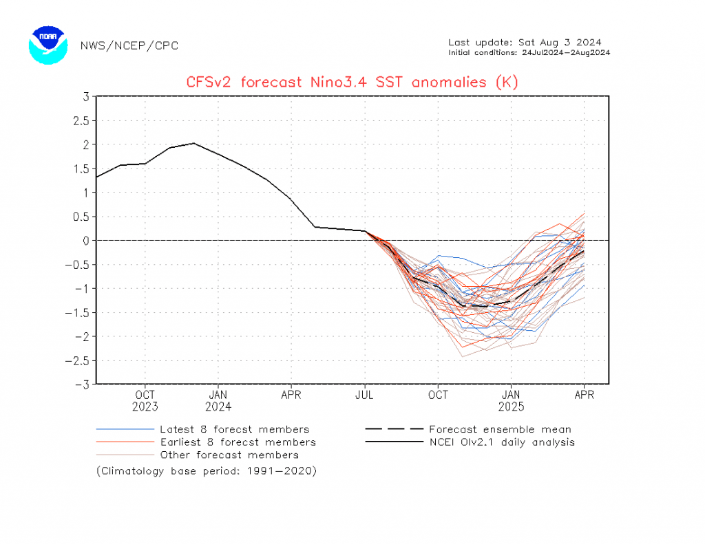
Right now it looks like it will come in quickly, and then likely disappear just as quickly…but could have some decent impacts while it is around – not necessarily in our region but somewhere on the east coast is likely to see some big falls as we head into Summer….
Worth noting at this point that global sea ice is at record low levels:
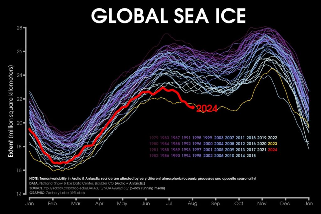
…and this can impact not only global weather patterns but also our local weather in unexpected ways. In next-level-hold-my-beer action the latest research indicates an increased risk of a slow down / collapse in the Atlantic Meridional Overturning Circulation (AMOC), or Gulf Stream, within the next 20 to 30 years, which would have massive implications for weather patterns world wide. We really want to avoid that scenario.
With apologies for that sombre note I’ll finish by wishing you a decent Sunday. I’ll be back with another post next week as more monthly seasonal models come out.
Thanks to Zack Labe / Tropical Tidbits / NSW / Meteologix for images.
