The latest seasonal outlooks have been released and are trending wetter for our summer with a stronger La Nina now being forecast. As we head into summer the state of the Pacific is the biggest influence across our region so definitely one to watch. Here’s how the GFS model sees the Pacific temperature patterns through March next year:
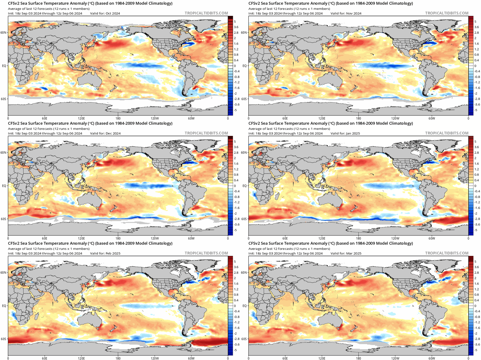
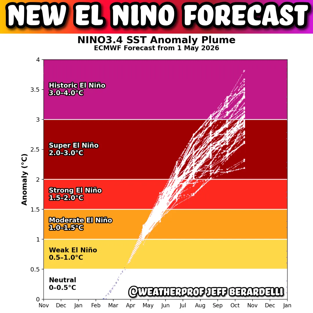
…and the EC forecast is looking fairly similar:
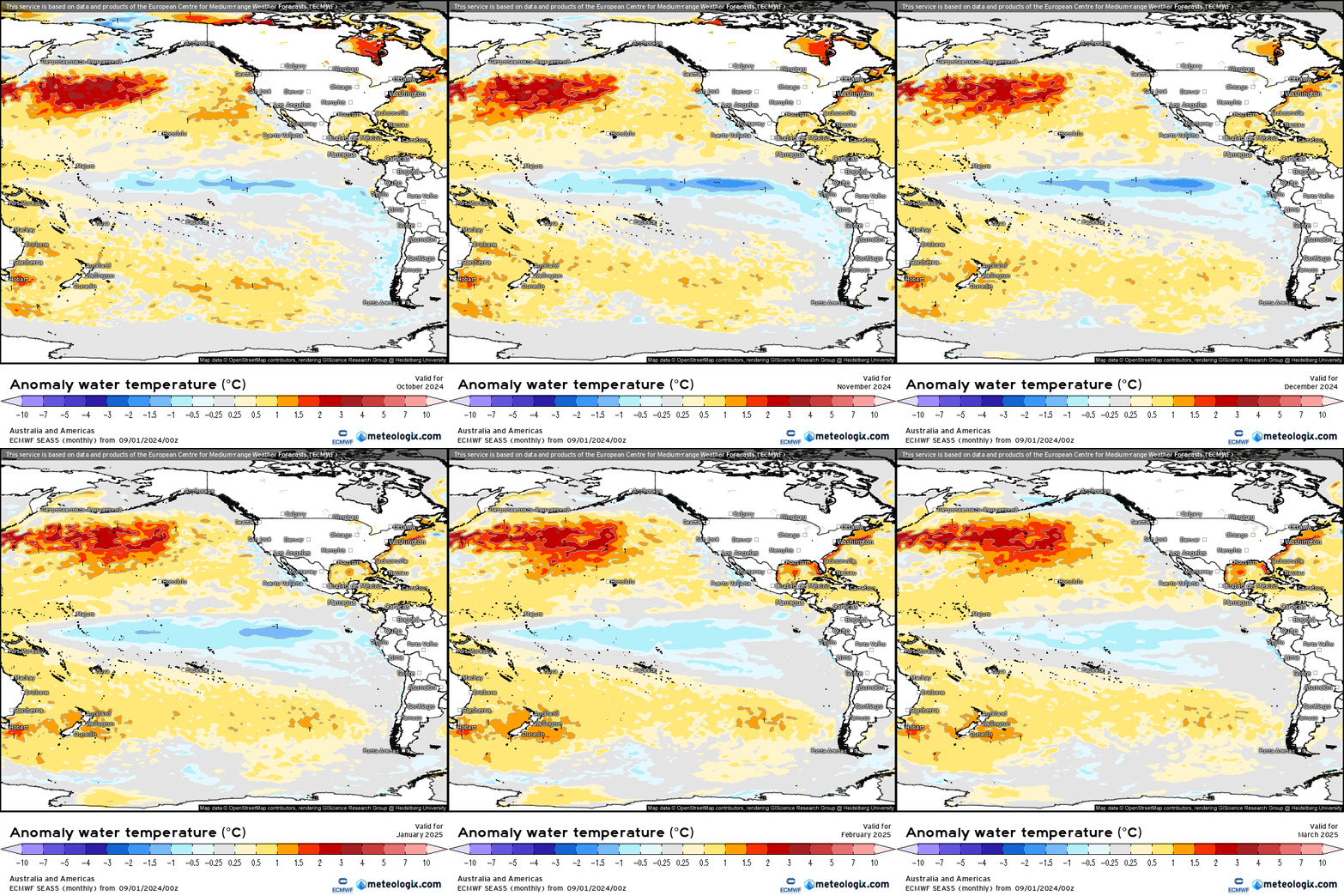
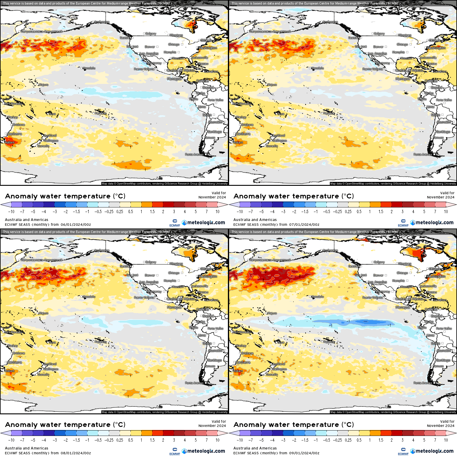
…so currently looking more likely that we’ll see a reasonable, if short lived, La Nina event through our summer. Worth noting that the EC model has the La Nina a lot stronger this run that it did previously. Doesn’t mean it will continue that trend but as we move closer to events models tend to have more accuracy, so worth noting. As an example this is the EC model forecast for November from the 4 monthly runs – you can see it strengthening significantly in the current run:
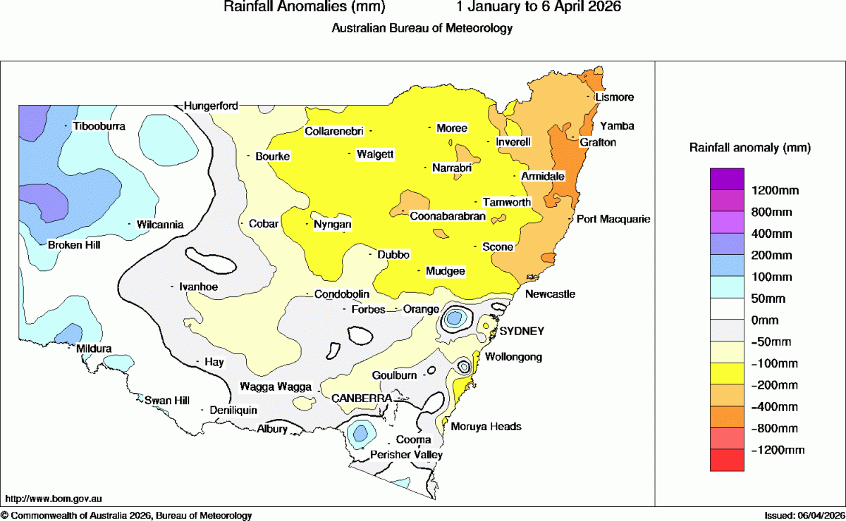
SO what does that mean for us? A likely wetter than average summer – in fact the latest EC run is suggesting December and January in particular could be very wet along the east coast:
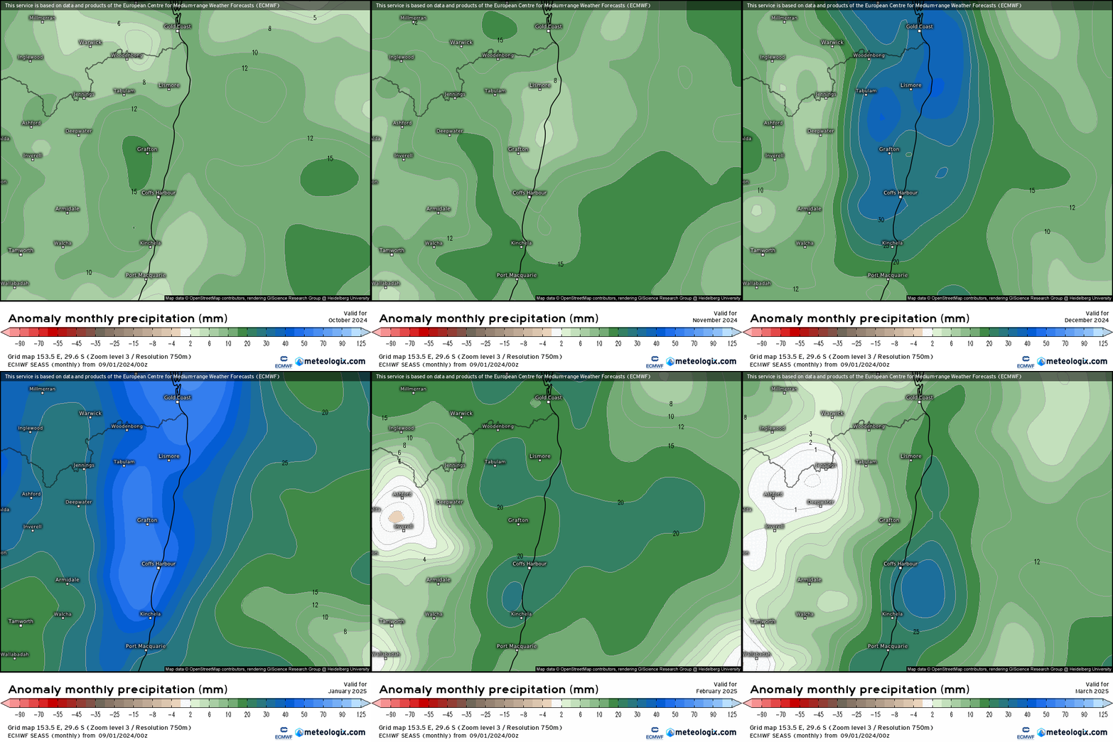
No guarantees that it will play out as forecast, but worth being aware of the risk of wetter weather and flooding as we move into summer.
One thing to also be aware of – there is another upper atmosphere warming event forecast to commence shortly over the Antarctic:
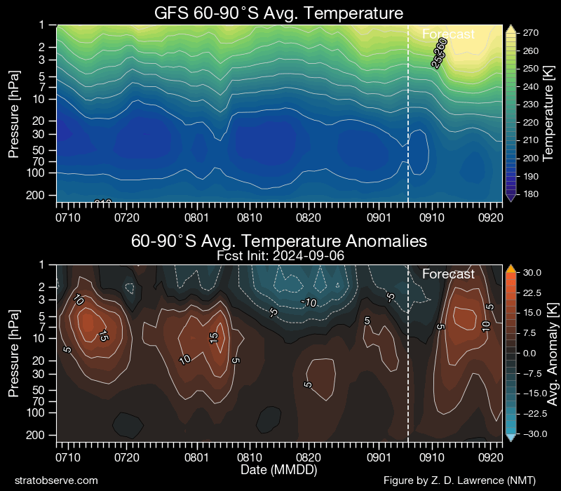
Whilst significant the current forecast doesn’t show it impacting the lower atmosphere at this time:
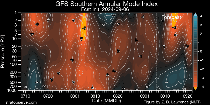
…but worth watching to see if it does end up propagating down towards the surface – as this would increase the short term risks of hotter weather, westerly winds and bushfire weather. Definitely interesting watching the different climate drivers compete against each other in the short term, with one pushing for wetter weather while there is a risk that the other pushes for drier…but with the influence from the south diminishing through summer whilst the influence from the Pacific increases we should eventually see the wetter weather rolling in.
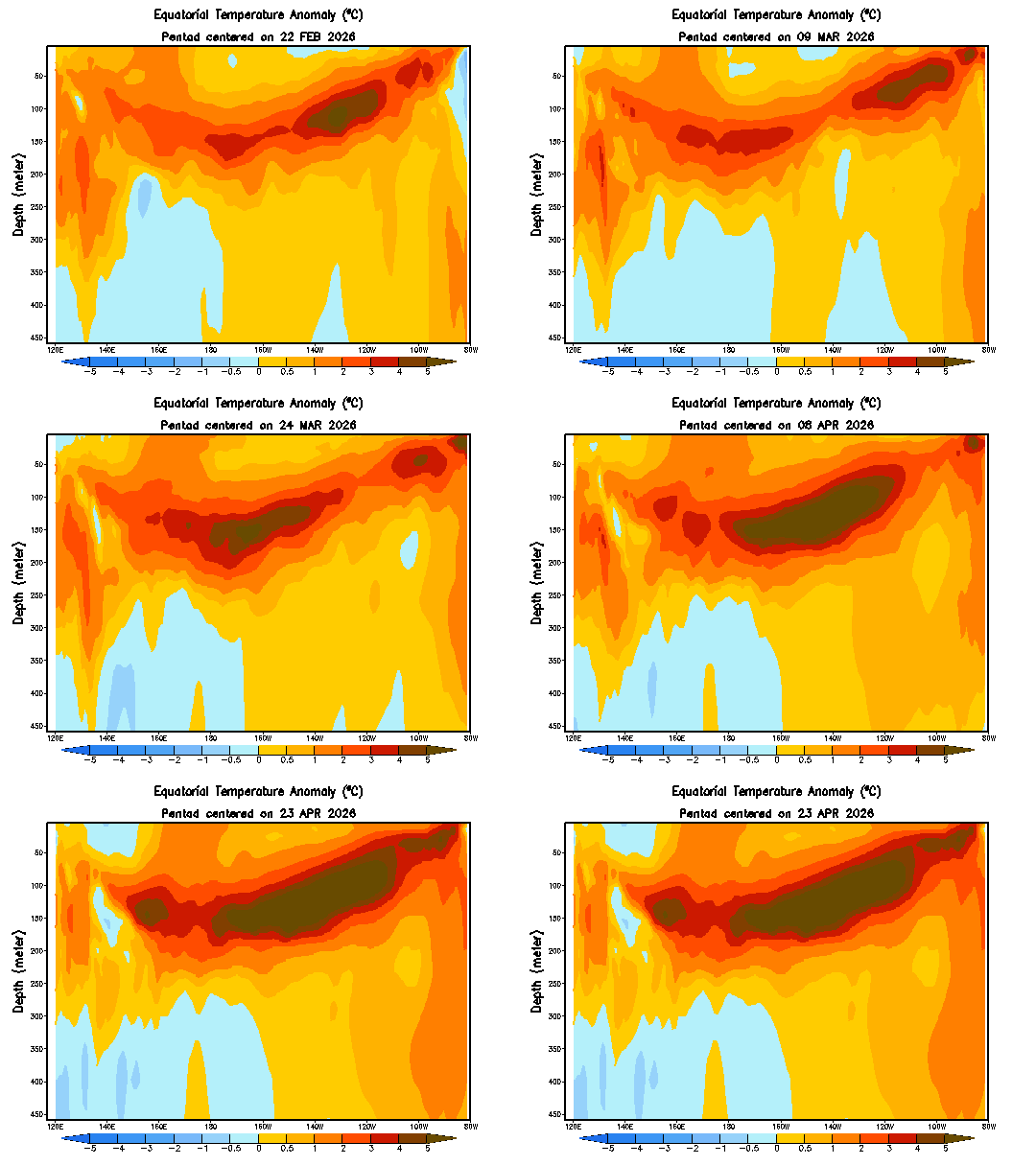
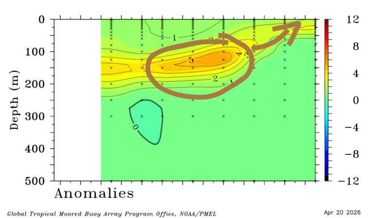
Looking even further ahead and we could see some warmer sub-surface water move across the Pacific as we move into next winter:

If that does happen we’ll likely move back towards either warm neutral / El Nino as we move into the following summer – something we’ll keep a long term eye on. Also worth noting that all three key greenhouse gases continue to increase, with longer term climate forecasts more complicated (and outcomes likely more extreme) as a result:

We can see this already playing out with Antarctic ice heading towards record lows once again – which will definitely impact our weather – likely in unexpected ways:

That will do for now. More posts coming up as short term events draw near and if longer term forecasts differ significantly from the details above.
Thanks to the numerous image providers – ECMWF / Meteologix / NOAA / Zack Labe / Tropical Tidbits / CFS
Thanks to our long standing sponsors, without whom this site would not be possible:

