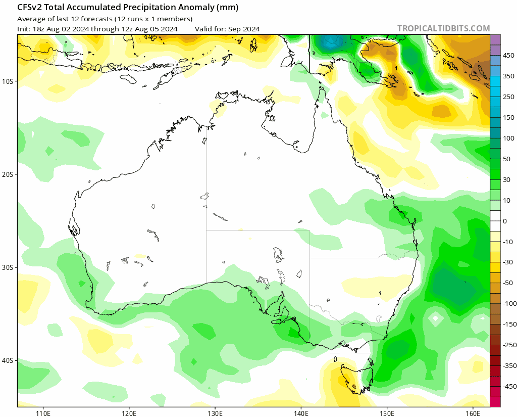
The latest monthly forecasts are now out – and there is some variation in them! What that tells us is that competing influences are at work, and there is less certainty than usual in the forecasts. First up CFS, which shows wetter than average conditions likely right through Spring and Summer:
….but the just-out EC monthly model shows it much drier than usual during Spring, before a change to much wetter conditions through Summer:
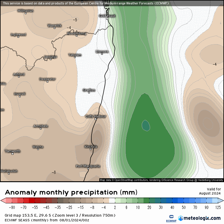
If I was putting money on one of the models it would be with EC. The current negative SAM would usually indicate drier conditions along the coast…but (literally) up in the air for now as that same SAM can help send rogue cold pools way further north than usual with a resultant EC low…kinda all or nothing in terms of rain! What they both agree on are wetter conditions through Summer – get ready for the likelihood of another wet hot season. In the meantime worth being bushfire aware, with some models indicating a drier fire season for us before we transition to wetter conditions…
Thanks to Tropical Tidbits and Meteologix for images. Thanks to Kombu Wholefoods and Snapfrozen for ongoing support 🙂