It’s quiet for now – after what felt like weeks of rain – so a good time to have a look further ahead. Seasonal outlooks are great in that they give us an indication of what we’re likely to see in the months ahead. What they can’t do is tell us for certain what we will see…They’re worth thinking of as a loaded dice…so if they indicate likely wetter then there is a good chance we’ll see wetter spells – but there is still a (lower) chance it will be drier than average…and vice versa. The outlooks are also averaged across a region – so while wetter weather is likely it doesn’t mean everyone will see wet weather, with some areas seeing more than other. Those details will play out in the day to day / short term forecasts.
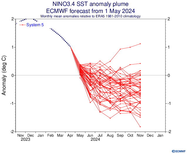
First off – the current ocean temperature outlook. We’ll focus on the Pacific as it is (1) easier to forecast on a seasonal basis and (2) has the biggest (but not only) impact on the east coast of Australia. The latest outlooks still indicate the likelihood of an La Nina event through our upcoming summer:
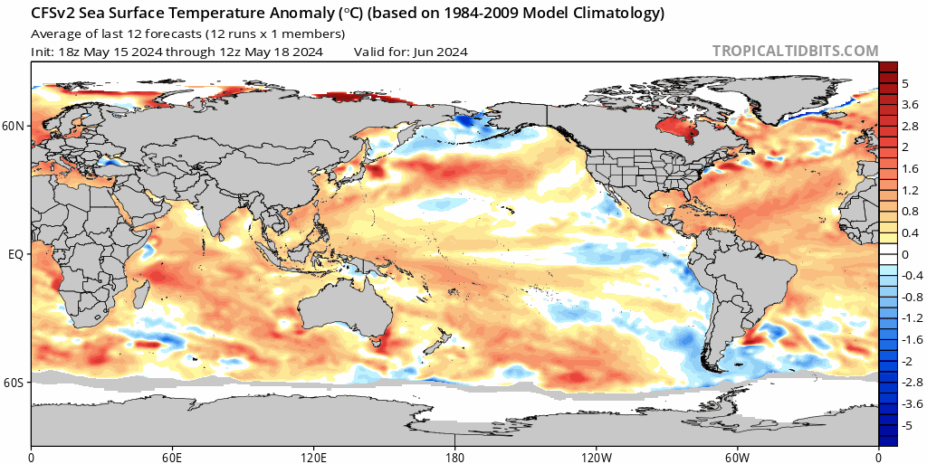
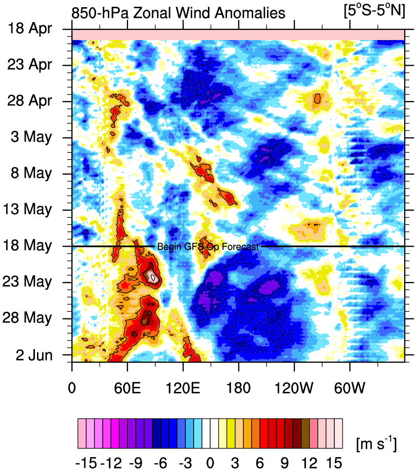
You can easily see the colder temperatures develop across the tropical Pacific, with warmer waters elsewhere around the world. This will significantly increase the chances of wetter weather across our region with rising air above and to the north of Australia, with sinking air more likely across the central and eastern Pacific. Latest wind charts across the tropical Pacific also show a significant easterly wind anomaly incoming (blue section in the chart below) – this will help push surface waters west and draw cooler subsurface waters up to the surface close to the central American coast, further cooling the Pacific surface temperatures:
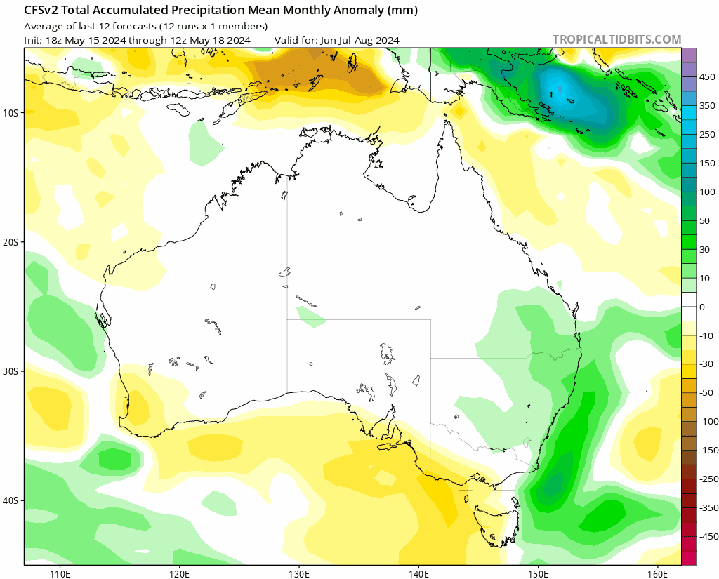
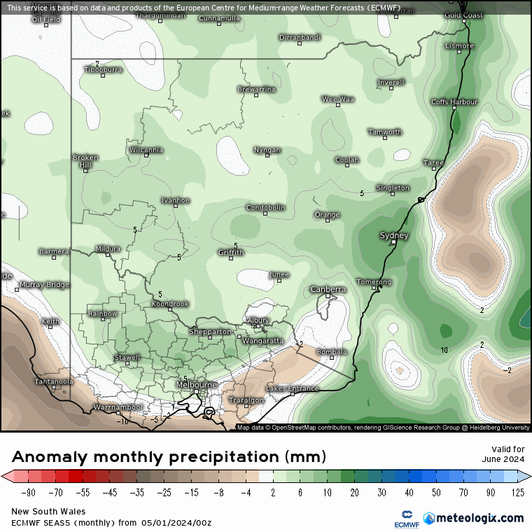
And the result? It is forecast to become wetter than average across our region right through into summer. It certainly will not be wet all the time, with drier and hotter spells still likely through the season…but overall wetter and cooler is looking to be the winner. Forecast rainfall through to early 2025 looks like this (with dates across the top of the animation):
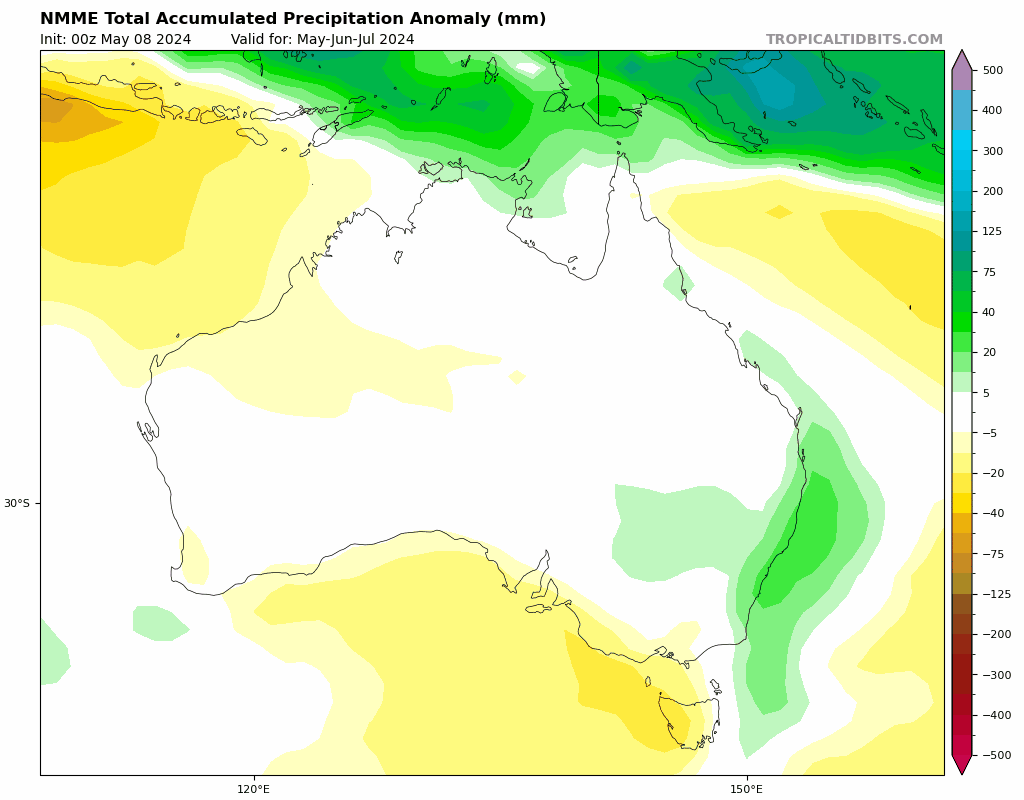
It’s always worth checking a range of models to check for consistency, and at this time they are looking fairly similar. The NMME (North American Multi-Model Ensemble) looks like this:
A third opinion is always useful and the European model also shows the tropical ocean temperatures dropping as we head into our spring and summer:
…with wetter weather also forecast as we move towards summer (with dates at the bottom right):
…and sure enough the BoM seasonal outlook (which only runs to spring at this time) also shows wetter weather as the likely outcome from July through September:

I’ll update the outlook again as we move through winter and the forecasts settle down, but right now the consistency between the various models is a decent indicator of what we’ll likely see over the coming months.
Outside our region but one thing we are also likely to see this year is a significantly higher than average Atlantic hurricane season. The ocean temperatures and global atmospheric patterns appear aligned for a bumper season. It’s not going to impact us, but a good chance you’ll see stories on the news over the coming months.
Going to finish with a flag that global ocean and air temperatures are currently at record levels:
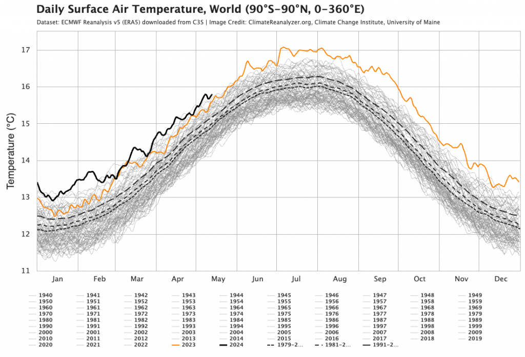
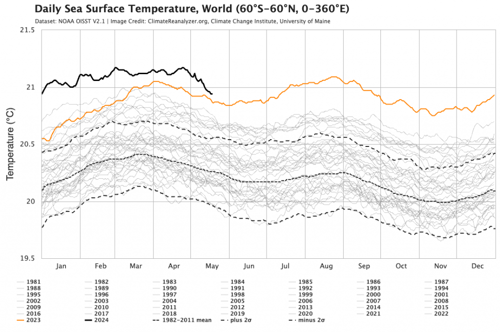
These record temperatures can create unusual outcomes – hotter weather can become hotter, wetter weather even wetter and drier weather even drier. They can also change the expected outcomes of global climate patterns such as El Nino / La Nina…so something else to add into the mix and keep an eye on over coming months.
Thanks to Tropical Tidbits / Climate Reanalyzer / BoM / Meteologix for images.
Thanks also to our long term supporters / sponsors Kombu Wholefoods and Snapfrozen