Not much happening locally weatherwise…certainly some cold mornings but nothing too cold…and a little rain around but again nothing too bad…so until that pattern changes we’ve got time to look at the bigger picture.
Global sea surface temperatures are at record levels, and you can see that in this animation of sea surface temperature anomalies. We’ve got three images here, July through September, October through December, and January through March:
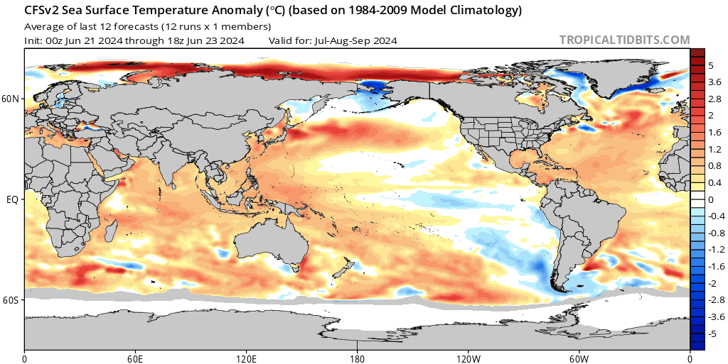
Key points to note:
* The La Nina still forecast to form over coming months, but then weaken quickly as we head into 2025
* Warmer than average ocean temperatures across much of the world
* The much warmer than average ‘blob’ off the NSW coast
It’s worth looking at the forecast ocean temperatures around Australia in more detail:
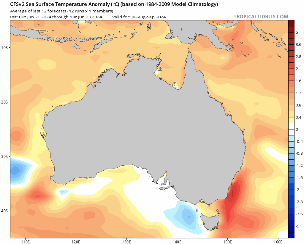
We can see:
* Warmer than average ocean temperatures around the entire coast
* Significantly warmer than average temperatures forecast off the NSW coast
Warmer than average ocean temperatures can result in warmer and much more humid than average air temperatures. The humidity is also a key comfort indicator, so higher humidity levels through our hot season can also make for much more uncomfortable conditions. Those higher ocean temperatures can also increase rainfall across Australia however, which can help moderate temperatures over land. If the heat ‘blob’ off the NSW coast develops are forecast (likely as a result of a stronger and warmer than average East Australia Current) then it may have an impact on weather patterns across our region, and can certainly impact rain totals, which could be significantly higher than normal across parts of the east coast.
Looking at forecast rain totals and (lo and behold) a combination of forecast La Nina and very warm ocean temperatures off our coast means we’re likely to see wetter than average conditions this Spring and Summer:
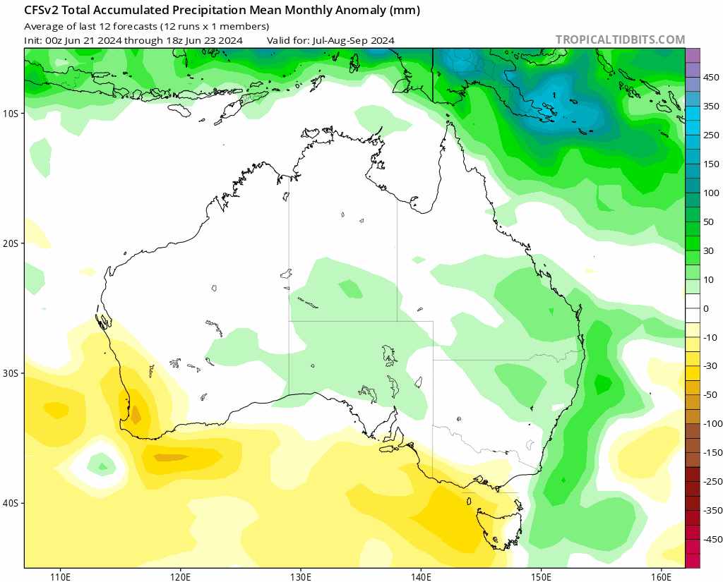
We will still see some drier spells from time to time, especially early on…and these forecasts are only an indication of which way the totals are likely to land…so while we’re likely to be wetter than average it doesn’t guarantee that that will be the case. One to watch…
Our warmer oceans are part of a global pattern of above average temperatures, both in the air and on the surface of the ocean. Current global ocean temperatures are at record levels:
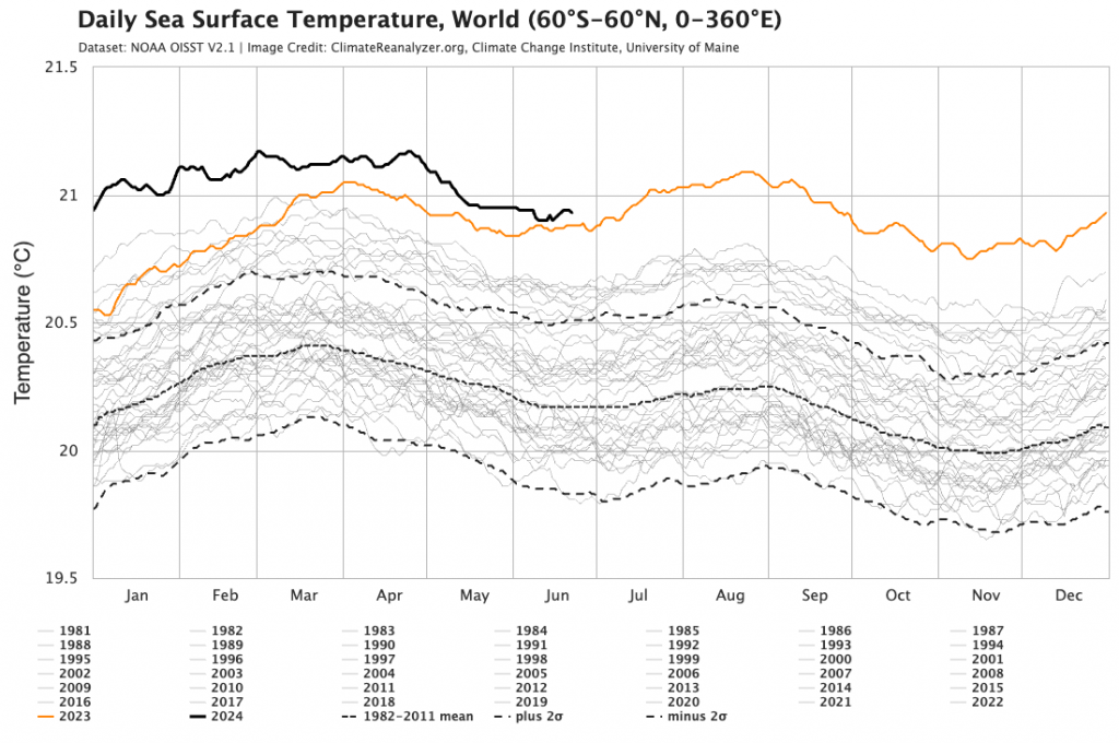
…and other than last year are way outside anything previously recorded. Likewise air temperatures are also at record levels:
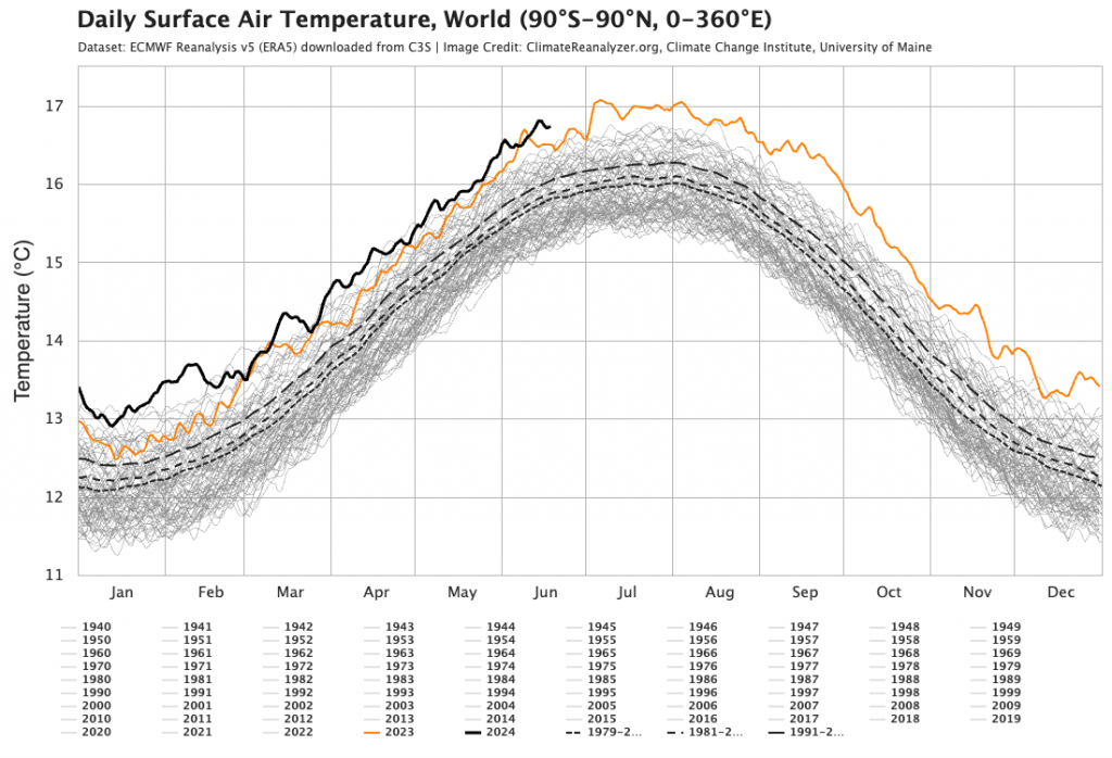
Such extreme anomalies are outside anything we have seen before, and will likely impact our weather in ways outside that which we would normally expect, thus adding another element to the difficulties of seasonal forecasting…
Will finish on a more cheerful note, with blossom already out on our peach tree at home:

We might be in the middle of winter but trees are already preparing for Spring. We’re through the Winter Solstice now so the sun is already strengthening day by day. Enjoy our cold season while you can! I’ll post again both when more significant local weather events look likely, as well as when the latest seasonal outlooks land at the end of week 1 in July.
Images thanks to Bellingen Weather | University of Maine | Tropical Tidbits
Site hosting and support thanks to Kombu Wholefoods and Snapfrozen