A quick post flagging the upcoming hot (for winter) weather coming up. It’s happening as a result of (1) the warming sun, (2) a lack of decent cold fronts moving through Australia and pushing out the heat and (3) climate change. We’ve got one pulse of hotter air moving in for this Wednesday, with another moving through on Saturday. You can see how much warmer than average the temperatures will be on this anomaly animation that runs from now through Sunday:
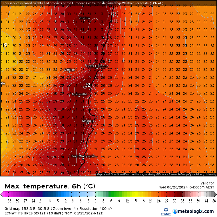
…and here’s the resultant maximum forecast temperatures for this Wednesday:
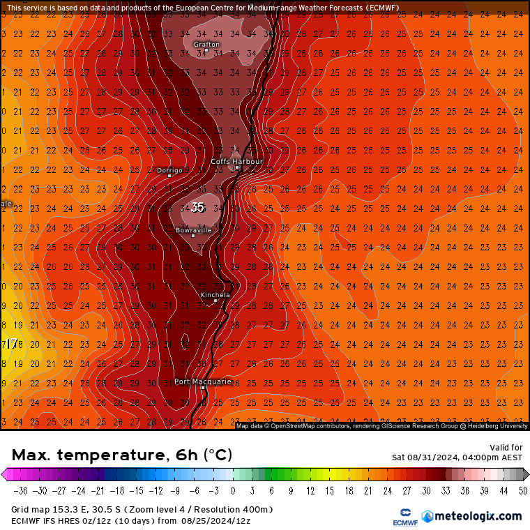
…and then for this Saturday:
Still time for those figures to change, particularly next Saturday as the forecast temperatures are (1) more extreme and (2) further away…but worth being prepared for the first real hot blasts of the upcoming warmer season. Could be some records broken across parts of SE Aus with this heat. Fire permits come in this Sunday – definitely good timing.
Looking further ahead and the predicted warming around the south pole is not looking as strong as it did a few days back – this animation rocks between the forecast 5 days ago and the current forecast:
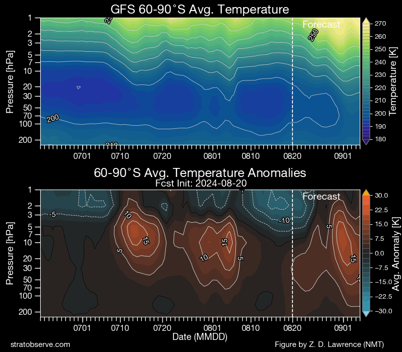
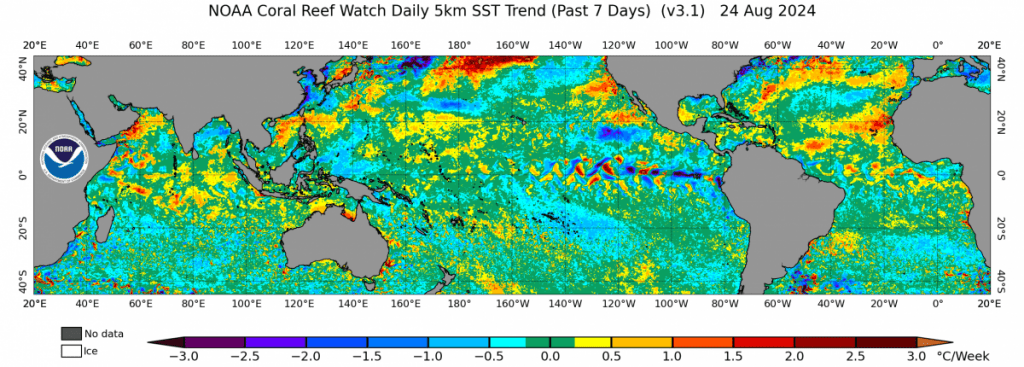
…and you can see how the forecast warming moves from 15c above average to only 5c above average – and that means that the SAM is likely to not go quite as negative as first forecast over coming weeks…but still looks like it will sit between neutral / low negatives, which will continue the risk of hotter and drier than usual weather. The Pacific however is slowly moving towards a more La Nina-type state, with more cold anomalies surfacing in the east as seen in this image (which shows changes over the last week):
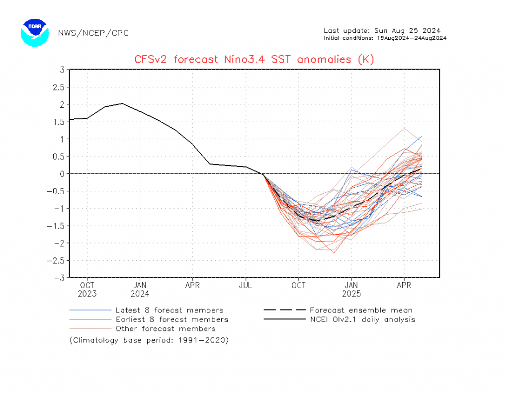
…with models showing ocean temperatures in the key areas of the equatorial eastern Pacific continuing to decline over coming months before a quick rebound as we head into 2025:
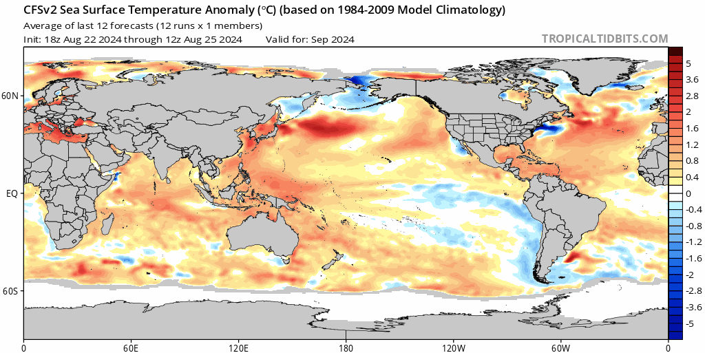
…and you can see that happening in this sea temperature anomaly forecast for the period through to next May with that quick burst of cold surfacing and then dissipating:
All of which means we’ve got that initial push from the Antarctic circulation to bring us warmer and drier weather, with the Pacific then exerting a push towards the chances of wetter than average weather as we move into summer, before both patterns likely return towards neutral as we head into 2025. Interesting times ahead!
That’ll do for now. Images with many thanks to NOAA / Tropical Tidbits / NSW / Stratobserve. Animations made in-house by Bellingen Weather.
Thanks also to our longterm sponsors and to everyone who has got in touch to say they are enjoying these posts – it’s a pleasure to put them together for community 🙂