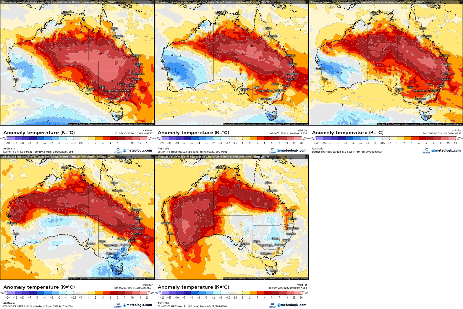
Hot in town yesterday with temps into the low 30s through the afternoon. Cooler today but the temperature anomaly animation for tomorrow through next Tuesday shows more very significant winter heat incoming before a cooler change sweeps through for Tuesday:
On a local level that means we’ll see some decent afternoon temperatures right through to next Tuesday:
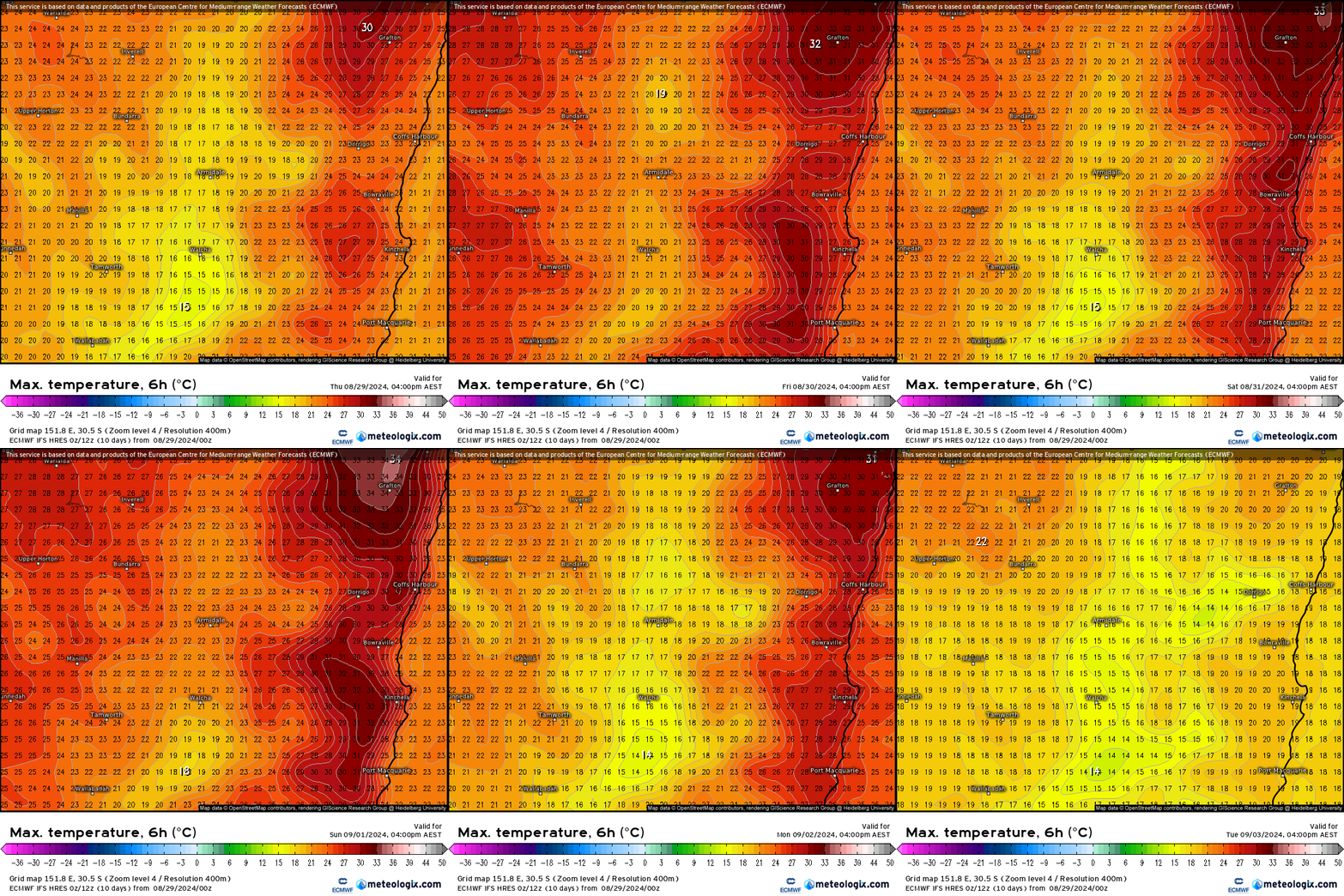
Wild temperatures for winter with records likely to continue to be broken through until early next week with peaks into the low 30s likely every day from Friday through Monday. Worth noting that fire permits come in from midnight Saturday – despite recent rain it is drying out quickly.
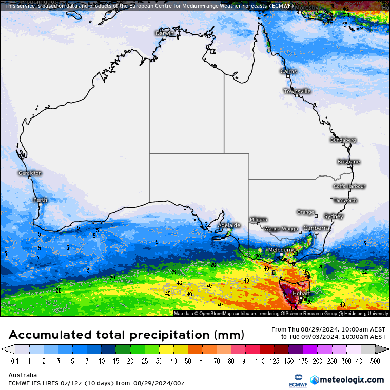
No rain is likely over the coming 10 days across much of Australia:
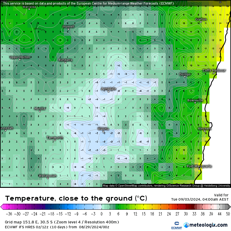
The cool change early next week will bring in a couple of cool nights, with frost likely up on the hills on Tuesday morning:
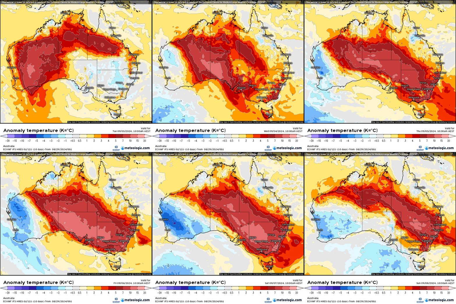
…but the cool temperatures won’t last for long with above average temperatures moving back in from as early as Wednesday and lasting right through the following weekend:
Some models indicate a chance of some showers the following week but too early to put much weight on those forecasts at this time. We’re reaching the end of the month with seasonal outlooks released over coming days – I’ll update once again when they are to hand.
Thanks to Meteologix for the images 🙂

