A quick post to note the potential upcoming out-of-season heat incoming. We’ve got the sun rapidly getting stronger and that means heat building up across the centre and north west of the country. Without strong cold fronts to push that heat away it tends to build up and intensify (as much as it can for this time of year). Checking out the 10 day forecast for Alice Springs and you can see some (very decent for winter) heat building up:

We won’t see it quite that hot, but westerly winds may bring some of that heat across our region, and without a cold front to clear it out it could stick for some time. Here’s the forecast from one model for the week commencing this Friday:
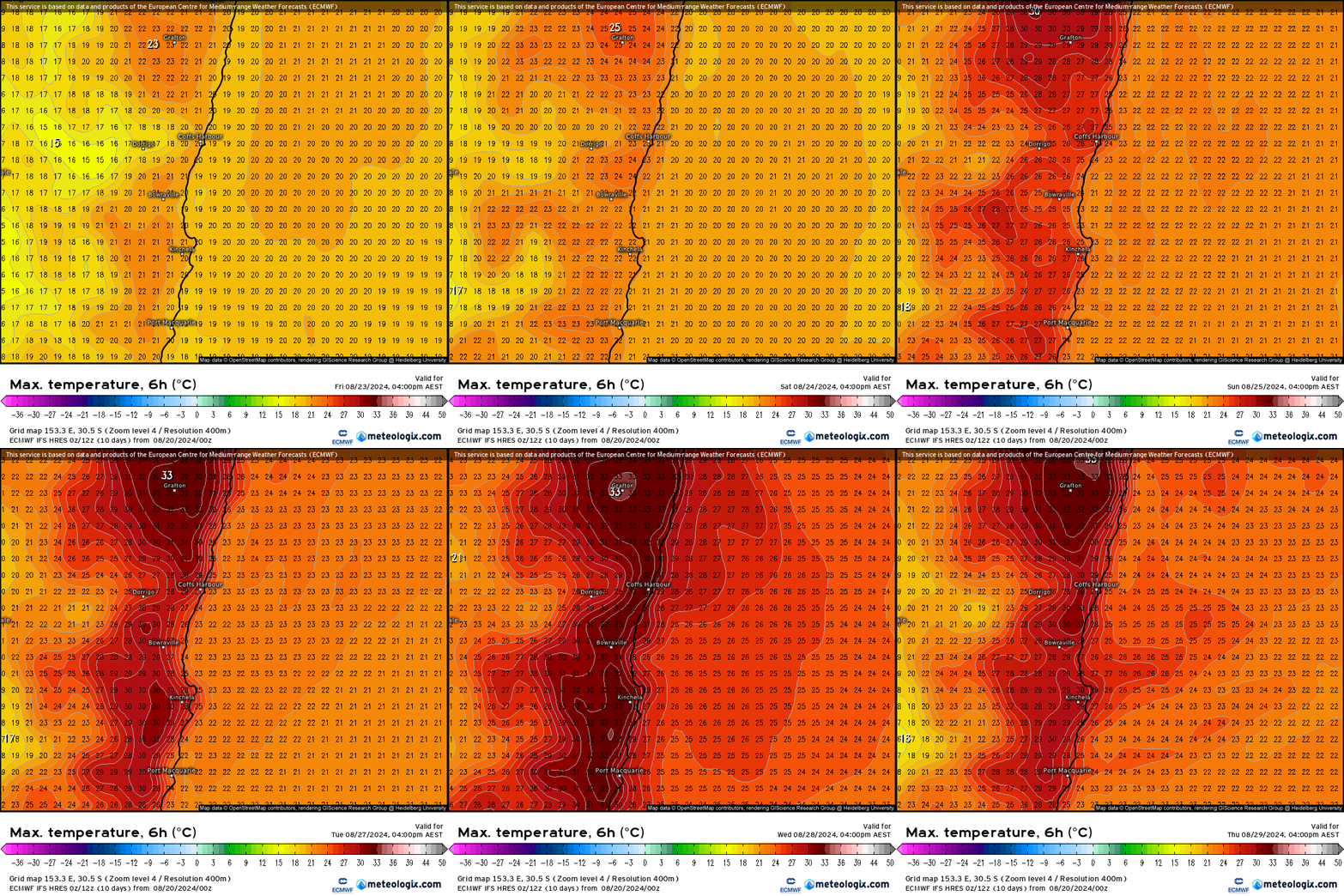
Some decent heat in that forecast with temps potentially building into the 30s through next week. Still a long way out and that also means some decent time for the forecast to change with temps either peaking a little lower / not lasting as long…but with us still in winter I thought it worth a post as it’s well outside what we would usually expect for this time of year. Recent rains will certainly help moderate fire danger ratings, but despite the potential for showers at times we could still see fine fuels drying out fairly rapidly in the late winter sunshine should the heat arrive as currently forecast.
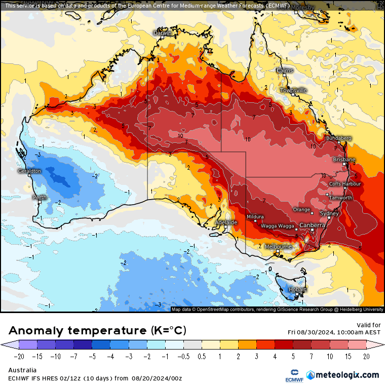
Finishing with a wider map of the potential heat anomalies later next week – way above average across much of SE Aus – worth noting again that this is the 10 day forecast so it will change over time:
Looking further ahead and there is the potential for another warming event for the southern vortex, which, if it comes off as currently forecast, may have implications for us as we move into spring…but more on that as models settle down…
Images: Thanks to Meteologix, Animations by Bellingen Weather

