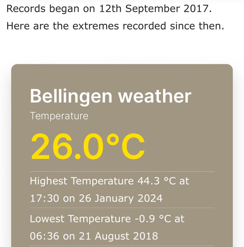
Starting off with a record high temperature for the Bellingen Weather station yesterday:
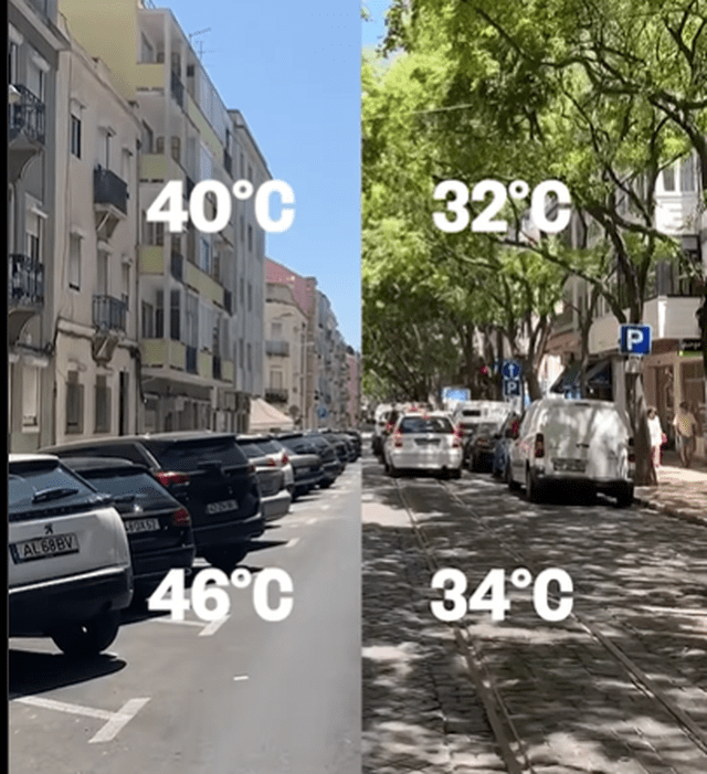
A very hot day, made worse by the humidity. There were some great questions yesterday about the temperature readings from the station. It’s located in the back of the Ambulance Station so is surrounded by car parks and is showing the correct temp for right in the centre of town (I’ve checked it against analogue gauges at the same location), but is only representative of the centre of town. As soon as you move out of town – even just as far as Lavenders Bridge and definitely somewhere like the Golf Club – you’ll see it a little cooler – hence the range of temperatures recorded across our region yesterday (from 47c through to around 39c). Studies show that tree cover in cities can cool air temperatures by up to 8°C and soil temperatures by up to 12°C. Have a look at the expanse of black tarmac in our car parks and you can understand the reason for our higher temperatures – and you can see the change a few trees make in this image:
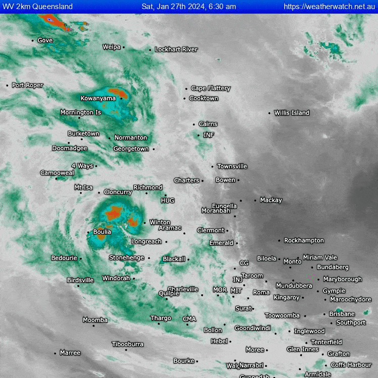
The southerly came through last night and has brought cooler conditions today…however humidity levels are still right up there. The reason? Check out the cloud and moisture streaming across our region from the ex-cyclone (now located in central Queensland) that crossed the Townsville coast a couple of days back:
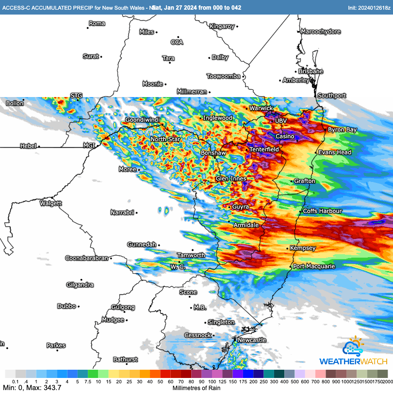
That deep moisture is going to available to any storms that develop through today, with the BoM high resolution modelling showing the potential for some decent totals later on today and through into tomorrow:
As is always the way with showers and storms some areas could see higher totals while others see less. Looking further ahead and the combination of the moisture from the ex-cyclone and a convergence line / possible coastal low development close to our region has the *potential* to offer some big totals across parts of SE Qld and NE NSW over the coming few days:
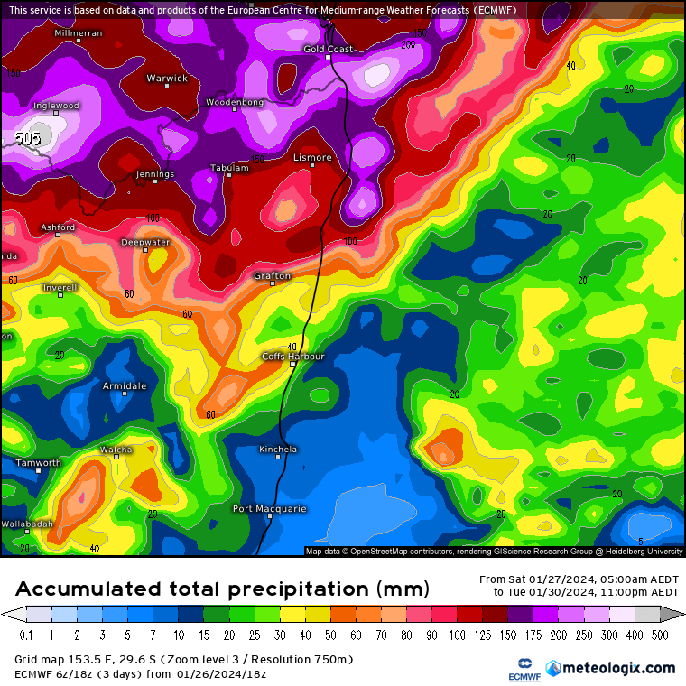
At the moment it looks like the heavier falls will be just to our north…but with potential totals looking significant it’s definitely one to watch and see, as it would not take much for the heavier falls to move a little south and across our region. I’ll post again if that looks likely. Looking even further ahead and models are still showing the potential for a significant La Nina event later this year. Here’s the latest run from the GFS model through to October:
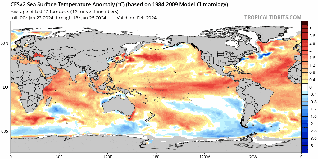
Combine La Nina with record high ocean temperatures:
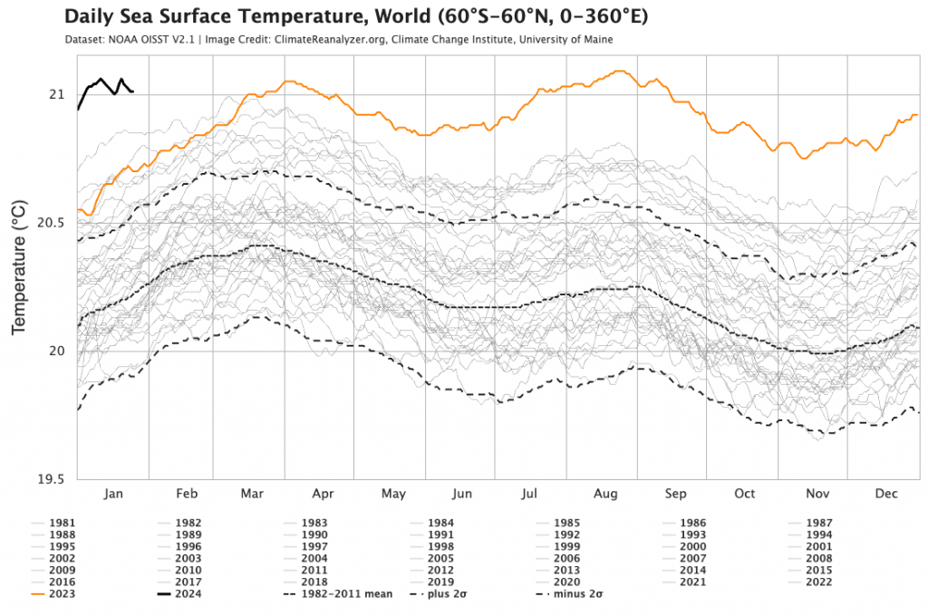
…and the risk of heavier falls (and an increase in humidity) will likely increase later as the La Nina kicks in. That’s some way off though, and there is a lot of time for change before we hit that seasonal change. Right now the focus will be on storms today and the risk of flooding across parts of far NE NSW and SE Qld.
New to this page and want to know when new posts come out? You can sign up for email notifications in the box at the top right. No spam, only local weather posts.
Thanks to BoM / Meteologix / Tropical Tidbits / University of Maine for images
Thanks to Kombu Wholefoods and Snapfrozen for ongoing support, hosting and coding.