It’s been a wet week for us with those forecast showers and storms rolling through and giving some decent totals. here’s the one week radar-derived total for our region:
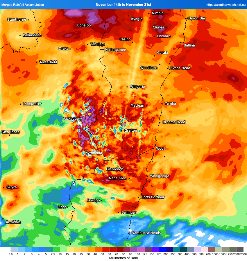
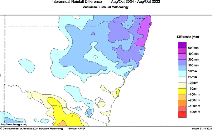
As expected some higher totals on the hills but the valley still saw some decent falls – though looks like Nambucca missed our on many of the showers. If it feels wet that’s because it has been much wetter than this time last year – here’s the difference between Aug to Oct this year compared to the same period last year:
A chance of a few more onshore showers tonight and tomorrow before it dries up a little. There’s a the chance a coastal trough will form just to our north overnight which would offer some much higher totals in those locations:
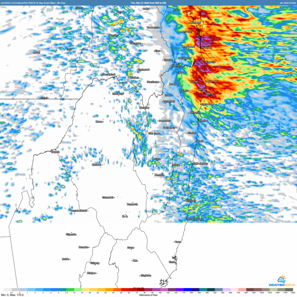
Looks like the higher falls will be to our north but worth watching – and even if we miss the higher falls we could still see a few showers clattering in overnight before it starts to dry up.In fact after a drier few days it looks like much of Australia will see some big totals over the coming two weeks as tropical moisture streams south through the continent:
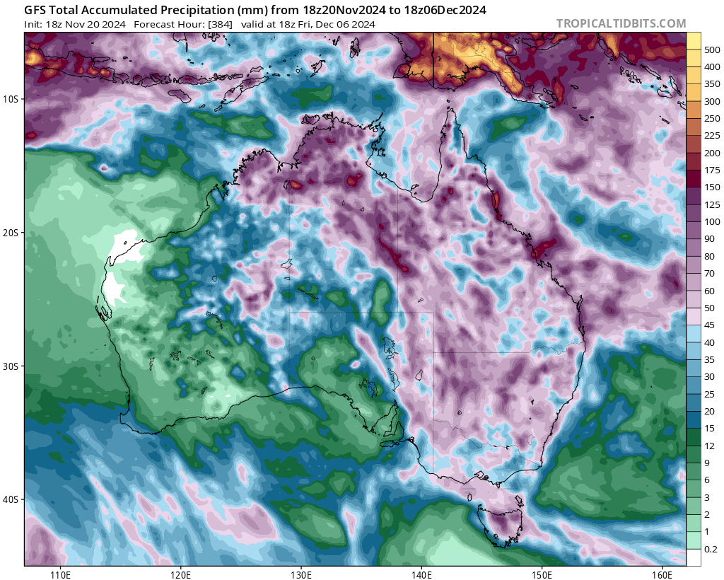
All key models show the same general picture but differ on the location of the higher falls – but regardless much of the inland should see some wet to very wet weather over coming weeks. We’ve got an active phase of the MJO moving our region (which definitely helps trigger the larger falls) but also have much higher than average ocean temperatures across the NW and SE of Aus – and this provides the energy to fuel the falls.
Looking ahead and models flag that we’re likely to see even more warm water moving down the East Australia current over the coming weeks – worth checking out the ‘blob’ of warmer water near Sandy Cape that will likely be drawn south over coming weeks:
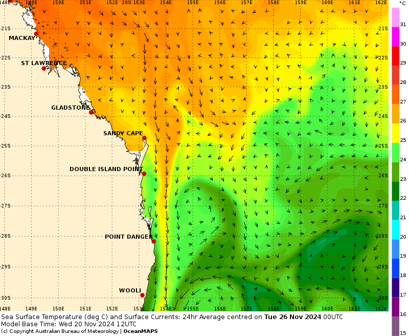
Worth flagging at this point just how big the East Australia current is. The current is approximately 100km wide and up to 500m deep, and flows at approx 7km/hour – which is really fast. To put that into context it transports approximately 30 million cubic metres / 16,000 olympic swimming pools of water past our coast every SECOND. As the water moving south is heading from the tropics towards the poles it thus also transports a huge amount of heat south – giving us the sub tropical environment we (mostly) know and love. Climate change has seen the East Australia current warm even further and extend further south – hence the hot ‘blob’ off the NSW coast in climate outlooks, such as this one for June 2025:
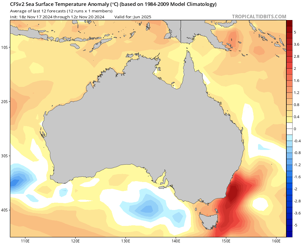
Warmer oceans mean higher temperatures day and night, and higher rainfall – so this is one we need to keep watching.
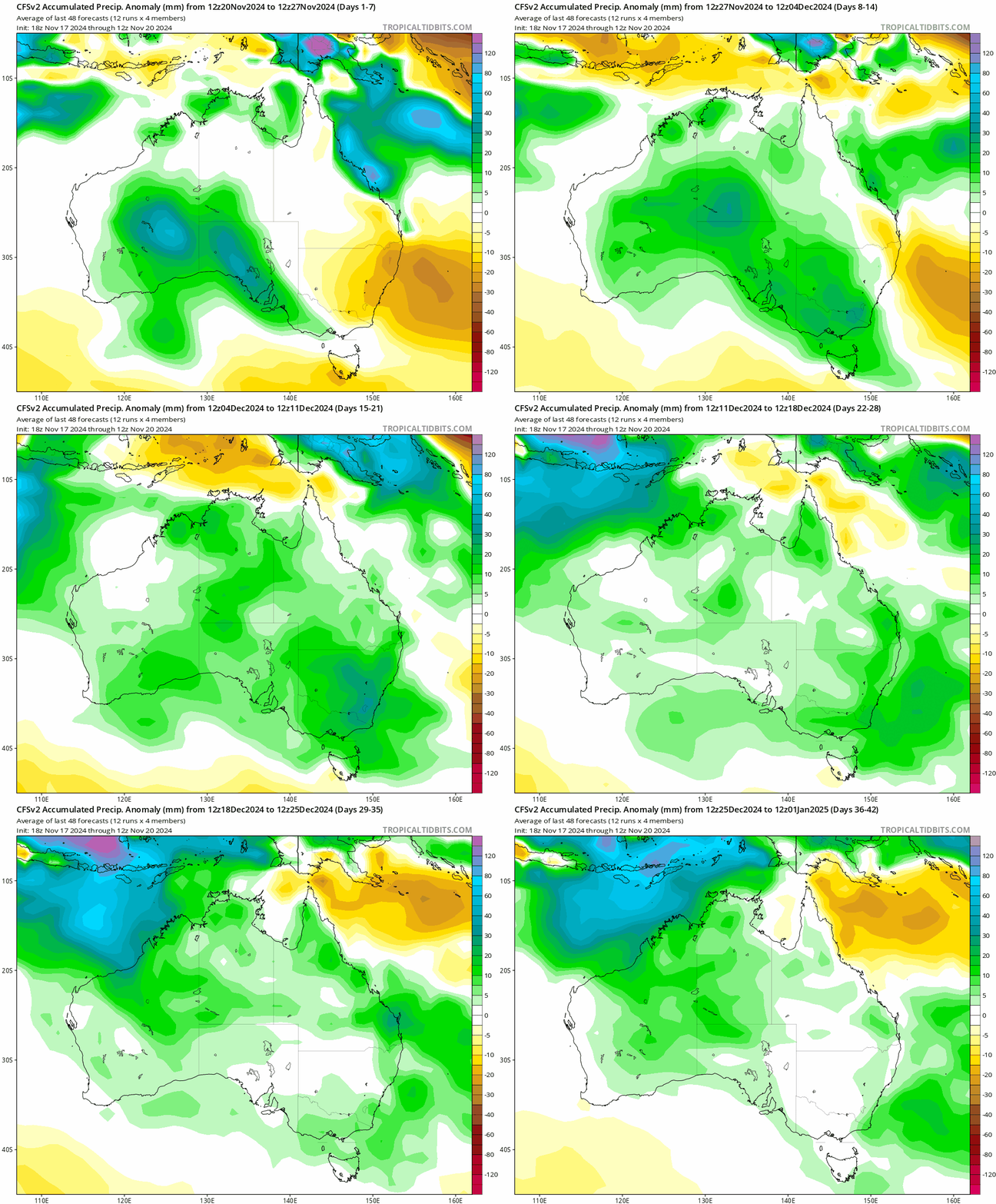
Looking ahead for us and we’ll see drier (though not necessarily totally dry) weather over the coming week, before that wetter weather slowly moves east across the country. You can see this happening in the 6 week forecast, with the wetter weather slowly moving east over coming weeks:
I’ll post again as and when more significant weather is looking likely. Until then going to flag that Bellingen Weather now has a presence on the fast-growing Bluesky social media platform…and with a name like Bluesky how could we not! You’ll find us here 🦋
Will also mention that we’ve also been able to increase the quality / resolution of the Kombu Floodcam – making it even easier to see when our bridge is going under.
Thanks to our usual image suppliers – Tropical Tidbits / BoM / WeatherWatch
Thanks to local businesses Snapfrozen & Kombu Wholefoods for ongoing community sponsorship 🙂

