So – the ocean off our coast is piping hot. You might not feel it when you jump in for a swim as the warmest water is just offshore…but it’s pretty toasty out there:
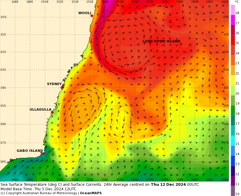
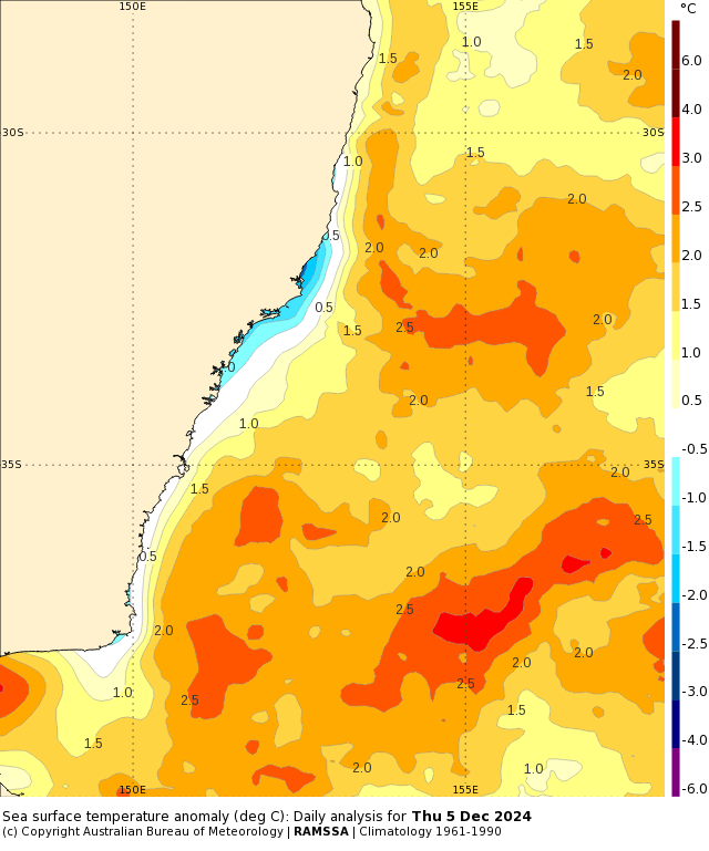
Check out that East Australia Current bringing in some 27c water from off Queensland…and the resulting anomalies look like this:
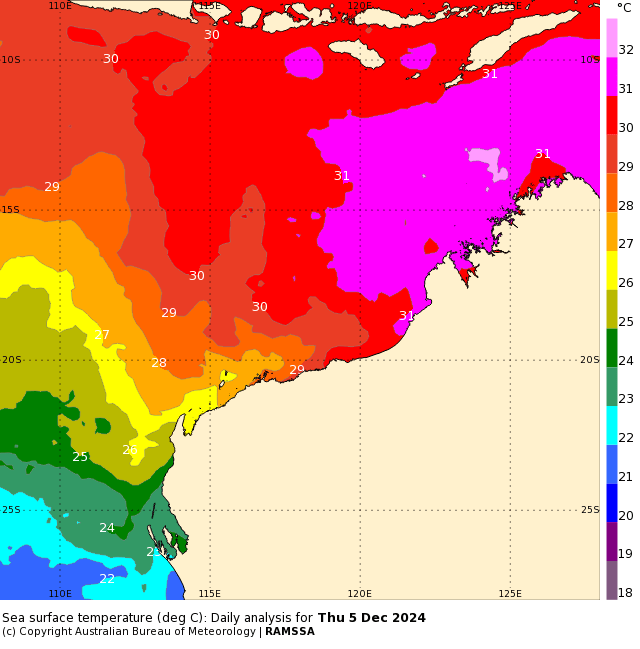
It’s also well above average off the NW WA coast, and we’ll be looking up there for the first cylone(s) of the year over the coming weeks. Looks like they’ll move off to the west, but one to watch. Here’s how ocean temperatures look over that way at the moment – with an amazing gradient from north to south:
Warm oceans mean higher humidity levels and the risk of higher rain totals when winds blow onshore – something we’ll keep an eye on. We’ve got one change coming through later in the weekend and another in the middle of the week, and they both bring the risk of showers and storms – once again with a focus on the hills to the north and west of the valleys. Could be some dumpers if you catch a storm, with further totals from any after-change showers that roll through. The current model outlook shows higher temps through the weekend before a cool down:

Looking further ahead and models indicate the weak La Nina will persist through summer, with higher rain totals likely across our region as a result…with the warm ocean temps just offshore adding some spice to the mix. Jan -> March looking like this right now:
I’ll post as and when higher totals look likely. In other news key components in the Bellingen Weather station have been replaced and upgraded, and the station has moved to a new home just out of town. This should give more accurate totals as well as more representative outside air temperature values. This means the rain gauge is just outside town as well – currently looking to add another gauge in the centre of town 🙂