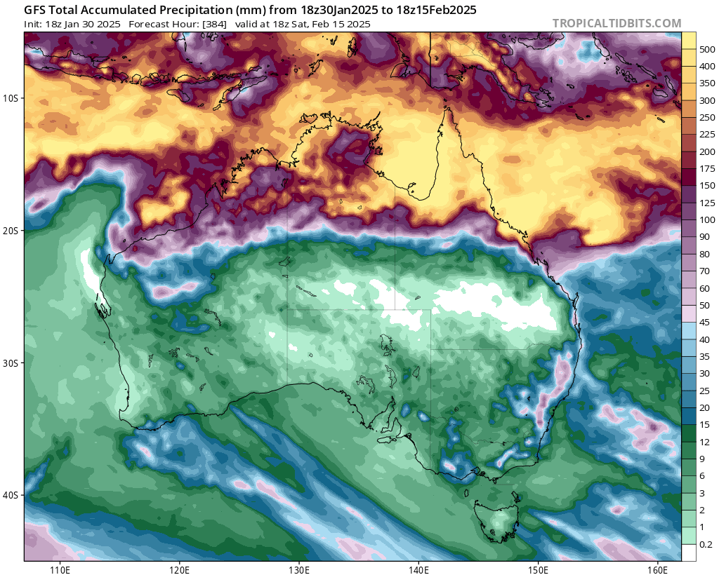
Not much interesting weather down our way recently, though the chance of decent storms today…but worth noting the very active tropics. Looks like some significant flooding is likely to our north over coming weeks. One look at the 15 day rain accumulations shows how active they are right now:
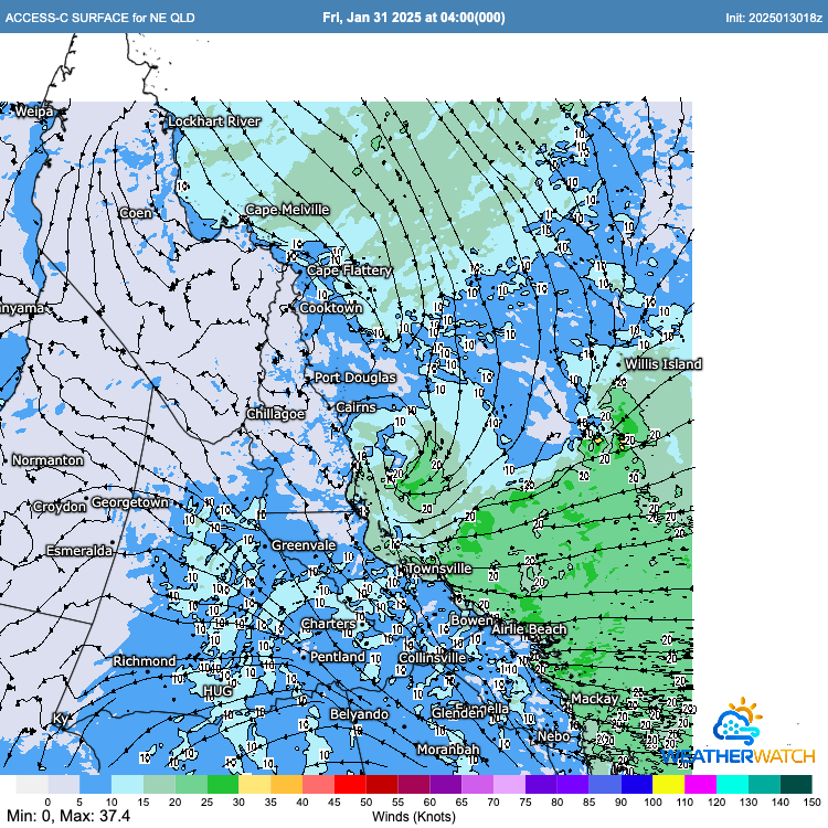
We’ll likely see a decent number of monsoonal lows – and potentially cyclones – over the coming couple of weeks. Just today and tomorrow a small low off the tropical north coast is likely to move onshore, bringing the risk of some huge totals to the region between Cairns and Ayr, including Townsville. Here’s the surface winds for 4am this morning – you can see the low just offshore:
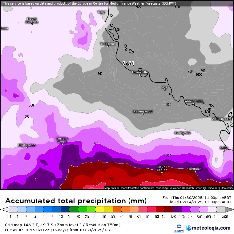
….and here’s the forecast rainfall for just today and tomorrow for that region:

…and yes, that is a forecast for totals over 800mm for some locations! According to the BoM warning: “6 hour rainfall totals of 100-180mm are likely, with isolated 6 hour totals up to 220mm. 24 hour rainfall totals of 200-300mm are also likely, with isolated falls of up to 500mm. The potential for heavy rainfall may continue into early next week.”
Expect to see reports of significant flooding over coming days – and potentially for the next couple of weeks as an active monsoon sits over the tropical north of our country. Even the 15 day surface charts shows significant action to our north:
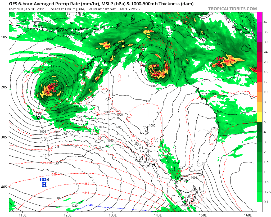
That chart will change a lot over coming days / weeks – but worth taking as a flag that the developing monsoon will likely continue for some time. The European model shows totals close to 2.5m over the next 15 days – massive falls!
When the tropics are this active there is a LOT of air moving up across that region…and that same air has to come down – and that usually means quieter weather for us….however with such active tropics we always need to keep an eye on what is happening in case a tropical low decides to come visit…Regardless of any tropical visitors…with very warm ocean temperatures off our coast:
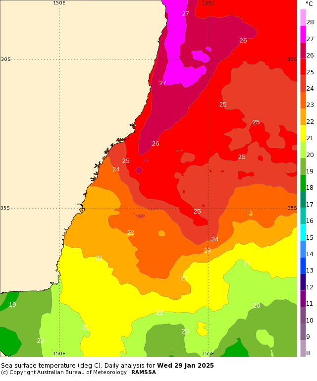
…we’re going to see more humid conditions / warmer nights across our region with the chance of showers and storms at times, particularly over the hills. There is a subtle change moving up the coast today, which will add to the instability across our region – expect the chance of some decent storms across the region this afternoon, with onshore showers to follow tomorrow. We could see some reasonable totals in some locations – more likely on the hills but elsewhere under any significant storms. Looking further ahead and we’ll likely see the risk of wetter conditions remain through February and March. The monthly outlooks will be released over coming days, and I’ll come back with another post at that time as we look further into the year ahead 🙂


