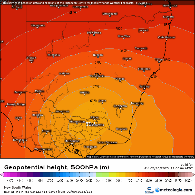
Welcome to another week! After a decent dry spell we’ve got some cooler upper air moving across NSW this week – as you can see clearly in this upper air temperature animation:
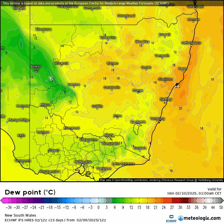
We’ve also got some humid and warm air hanging around at the surface over the same period:
…and that combination of increasingly cool upper air / warm and wet surface air will result in the risk of showers and storms for much of the early part of this week. In fact here’s the lightning forecast for the same period:
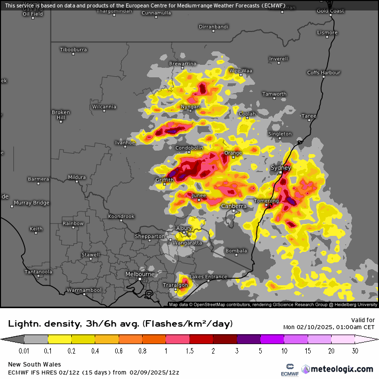
…and you can see that there will be numerous storms breaking out across much of eastern NSW this week. Those repeating waves of showers and storms will result in some decent rain accumulations over the same period:
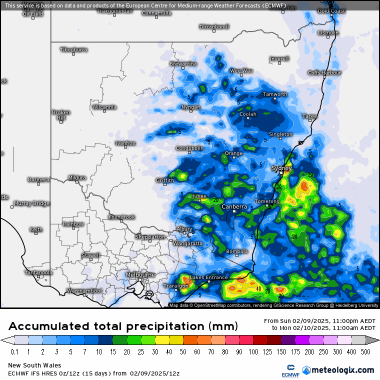
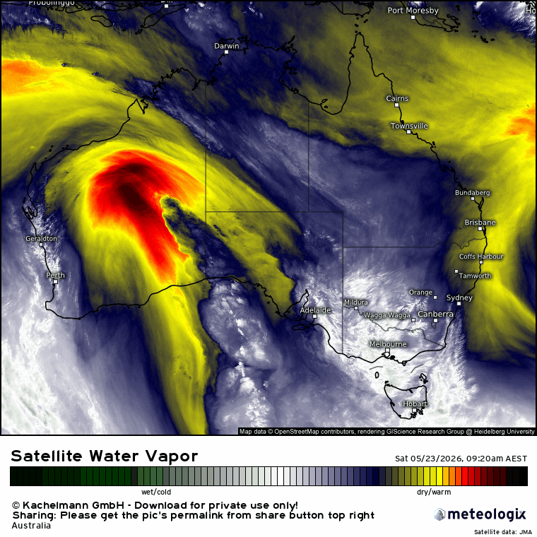
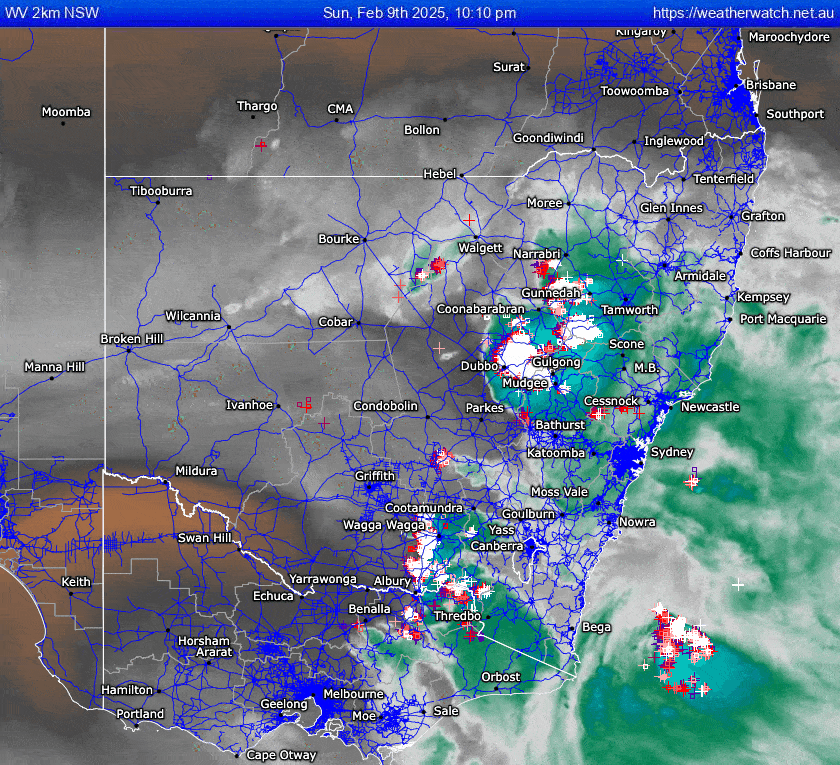
…and just at the end you can see a front sweeping in from the west (across western NSW) to clear it all away. As is always the case with showers and storms some locations will see some big totals, while others see much less. Those cold uppers could result in some hefty downpours in some locations however, so worth keeping an eye on the radar. Looking at the live water vapour loop right now and we can easily see the upper cold pool moving north – and generating a significant number of severe storms to its north and east:
Looking further ahead and the monsoon trough that’s been hanging across much of northern Queensland for weeks now will move further north mid-week…and that will give those areas a chance to dry out. That doesn’t necessarily mean dry for us however – in fact (other than when a tropical system moves a long way south) an active monsoon to our north usually means drier weather for us (as we sit under descending air)…so Northern Queensland drying out will increase the opportunity for more wet weather across our region. The current ocean temperatures will certainly allow any systems that do move through to bring some hefty downpours…in fact the forecast ocean temperatures for this Wednesday show a wide area of 27c temperatures with some creeping into the 28c bracket:
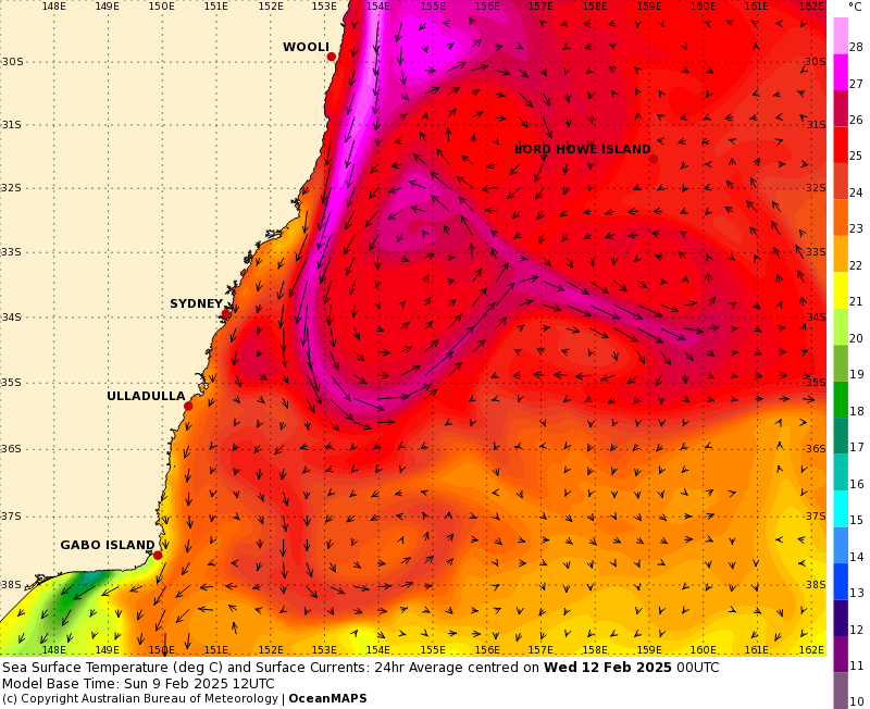
…so we’ve got enough energy available to bring decent totals should other factors align. I’ll keep an eye on the conditions and post again when the next interesting weather pattern looks likely. Until then hope you get a chance to enjoy the showers and storms this week 🙂
Images thanks to BoM, ECMWF, Meteologix