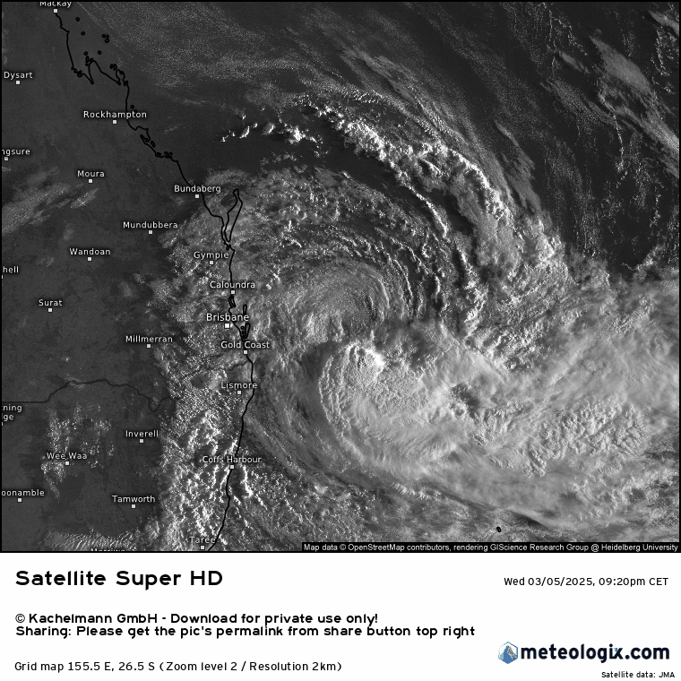
Yep, he is still circling around off our coast:
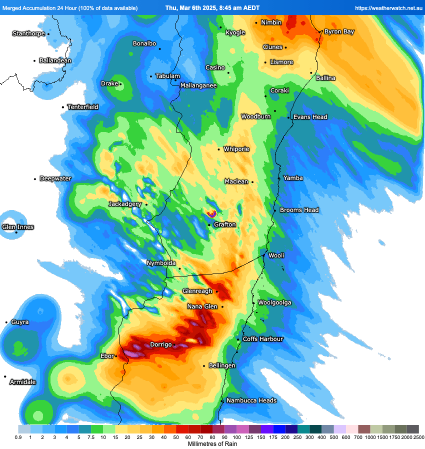
…and as we’re on the southern (onshore) side there have been some big totals fall, particularly over the hills. Dorrigo is well over 200mm since 9am yesterday:

…and if we look at the radar derived rain totals since 9am yesterday you can see the real focus along the east / south east facing hills:
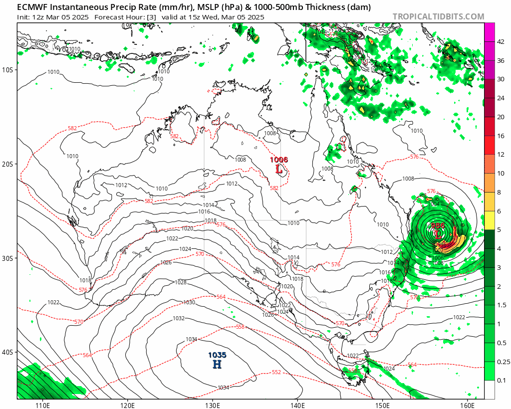
This is exactly the type of scenario that generates big falls on the hills, while we see much less in the valley / towards the coast. That will continue as the cyclone moves closer over coming days – as we can see in this animation from the European model:
The model – as do a few others – now show the system moving through a little more slowly, with rain gradually decreasing as we move through Sunday / Monday. There is also the chance that the storm will stall close to the coast or move a little more erratically as steering influences weaken through the weekend. That’s potentially good news in terms of wind strength to our north, but bad news in that it is (1) harder to forecast – we’ll have to watch it in real time to see what it does and (2) means the rain could last a little longer before clearing. In the meantime we’ll see rain totals increase through Friday with some big falls possible. The BoM high resolution model shows falls of up to 700mm on the hills between now and midnight tomorrow, with more to fall over the weekend:
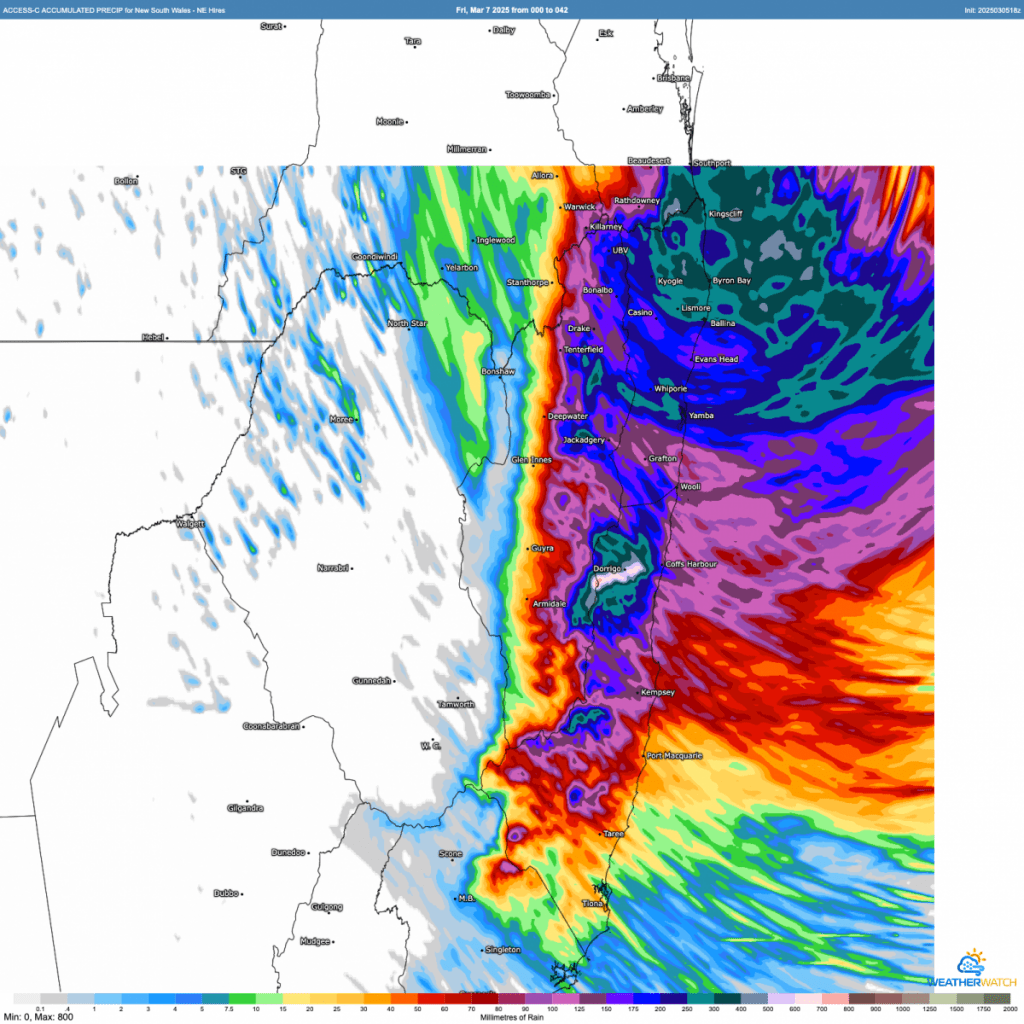
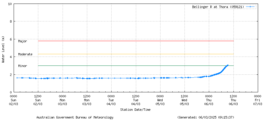
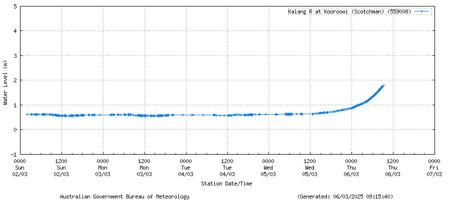
Don’t panic – those totals are likely a little high and are focussed on the hill tops – if we saw those totals widely across our region it would be a lot more of a concern…but regardless whatever falls on the hills makes it’s way down into the valleys, so we’ll see still see significant impacts. Local rivers are already on the rise, with the Kalang and Bellinger both on their way up – in fact the Bellinger is already at Minor Flood level in Thora:
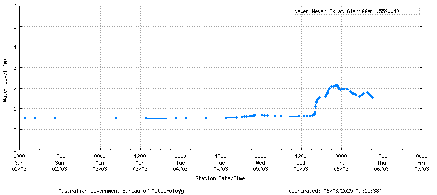
The Never Never is a flashy river and reacts quickly to heavy rain – as we can see:
With forecast rain we should see those rivers continue to rise. If the cyclone does slow down then we’ll also see the rivers slower to drop – as such worth making sure you have enough food for several days if you live in a flood prone valley.
With the cyclone moving closer we’ll see winds swing more easterly, then possibly north easterly over coming days. This will gradually move the focus of the heavier hill-falls to slopes facing more to the east, but regardless we will all see some ongoing showers and longer spells of rain for some days to come. It’s going to be worth watching a band of heavier rain that is likely to move across our region through Friday (dependent on the movement of the cyclone) as with ground already saturated from days of showers we could see some quick rises in water levels.
Great places to keep an eye on what is happening:
Bellingen Weather Live River Heights page – love river heights from across our region, updated every 30 minutes
Kombu Wholefoods Floodcam – live streaming of Lavenders Bridge and timelapses from a large number of other flood cams from across our region, including Dorrigo Mountain
NSW Bureau of Meterology Warnings Page – the go-to page for latest warnings
Bellingen SES Facebook page – for the latest local updates
Bellingen Shire Disaster Dashboard – latest updates from our local council
That’s it for now – take it easy out there! I’ll post again as this event continues.


