As historic (ex?) cyclone Alfred starts to curve back towards SE Qld it’s time for an update on what this means for us. I’ll post information on rain / wind / swell below together with some key links (most of which can also be found on the Emergency Info page).
Before we kick off a quick look at Alfred this evening. He’s had his top sheared off as he passed through the sub tropical jet so you can easily see the low level swirl of cloud, with most convection off to the south east:
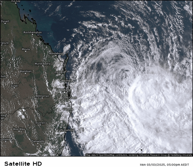
You can also see the stream showers that are starting to move across our region as they swing in from the south east. Alfred has been pushed east today by an upper trough (which is also enhancing our showers) but will start to swing back to the west through tomorrow as an upper ridge builds to the south of the system. Most models show the system making landfall somewhere close to Brisbane in the early hours of Friday morning before quickly weakening:
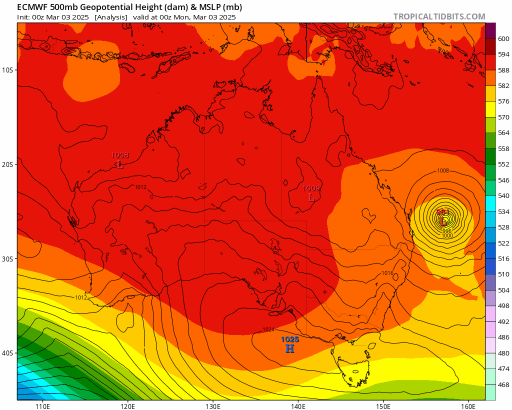
The latest model runs show this movement clearly:
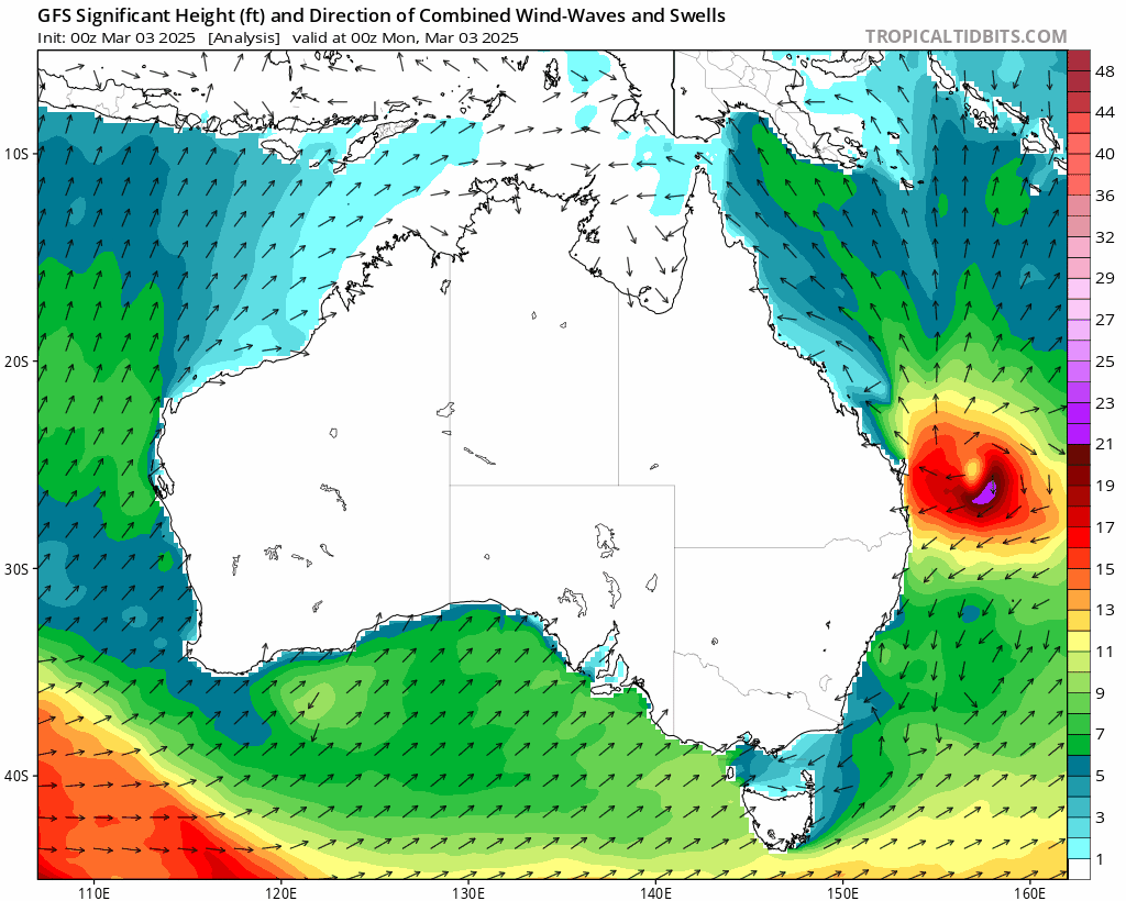
Swell: As it moves west this cyclone will continue to develop a damaging swell to the south of the system, with swell increasing across our region right through until the system moves inland:
There is a BoM warning out for coastal regions that covers this threat – please check the BoM Warning page for latest updates:
Coastal Hazard Warning
for ABNORMALLY HIGH TIDES and DAMAGING SURF
For people in parts of Northern Rivers and Mid North Coast Forecast Districts.
Issued at 4:38 pm Monday, 3 March 2025.
Weather Situation: Tropical Cyclone Alfred is moving southeast through the Coral Sea and is forecast to move west towards to the northern NSW coast from Tuesday. As Tropical Cyclone Alfred moves closer to the coast large and powerful east to northeasterly waves are expected as well as abnormally high tides. These conditions may lead to severe beach erosion for northern NSW coastlines from late Tuesday or early Wednesday morning with the most significant impacts expected on the evening high tide.
VERY HEAVY SURF which may lead to localised damage and severe coastal erosion is likely to develop between Tweed Heads and Smokey Cape from late Tuesday evening and extend further south to Seal Rocks during Wednesday. Water levels may also exceed the highest tide of the year by less than half a metre on Tuesday evening’s high tide and by around half a metre on Wednesday evening’s high tide. This may lead to minor flooding of the foreshore and coastal erosion.
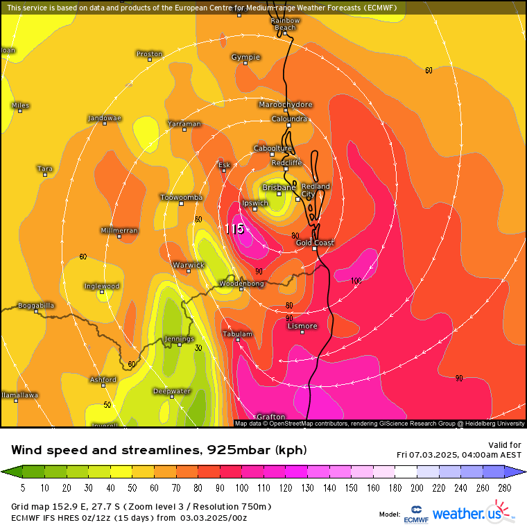
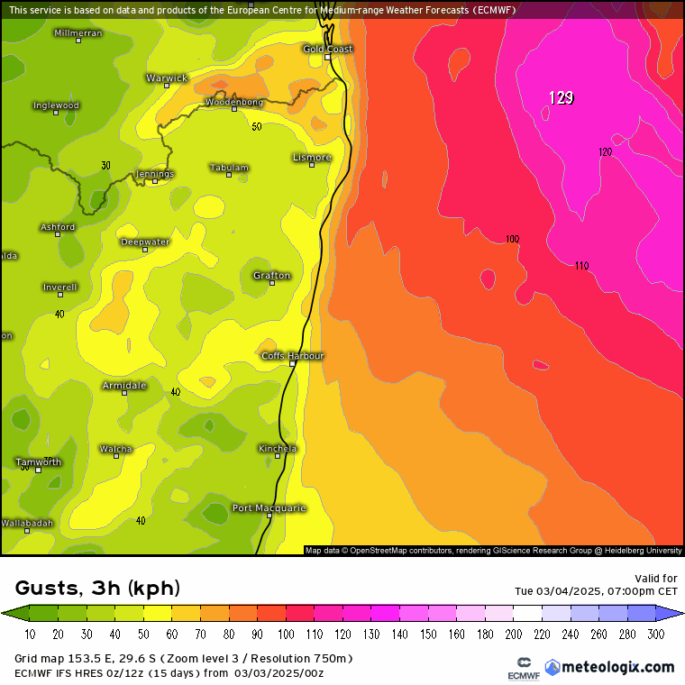
Wind: The strongest winds will likely remain to our north, closer to where the cyclone makes landfall, however gusty and at times strong onshore winds are still likely, particularly about the coast and higher ground. We’ll see average winds up to around 40km/hour with gusts getting close to double that in exposed locations. Winds are currently forecast as follows, but with a few disagreements between the exact landing point of the system as well as the timing there will likely be a few tweaks over the next couple of days:
Rain: The biggest impact from this system away from the coast is likely to be the forecast rain. The highest falls will be on the hills (headwaters) to our west as the warm wet air hits the hills and has to rise…however we’ll all likely see some decent totals. To highlight how much more rain is likely to fall in the headwaters compare this forecast for Bellingen:

…with this one for Point Lookout:

…and you can see how much more rain is forecast for the higher ground. If we do see those falls then we’ll see a decent flood move downstream late in the week. There is still time for totals to change / the system to end up washed out and elsewhere which would significantly reduce totals, but at this time that is not looking likely. If that changes I’ll post an update. Weather models show a range of rain totals for our region but the higher resolution models, such as the European model, are better positioned to reflect the impact of our hills to the west. The European model currently forecasts this much rain across NE NSW over the coming 7 days:
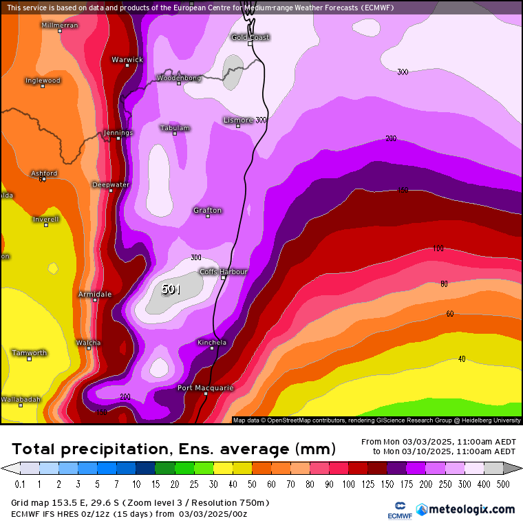
This is an average across a number of runs – some of which show significantly more. An average across all models gives us these 7 day totals:
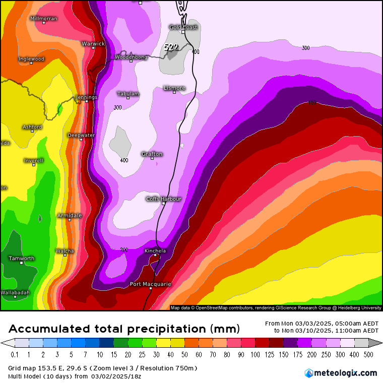
As such a flood, potentially significant, is looking likely. Showers will increase through tomorrow before heavier rain moves in on Wednesday and remains with us (on and off) for a few days before easing into the weekend. Please keep an eye on the BoM warnings page for the latest flood information.
Some useful links should rivers rise:
NSW Bureau of Meterology Warnings Page – for the latest official BoM warnings
Kombu Wholefoods Floodcam – Lavenders Bridge as well as a number of other local river crossings
Bellingen Weather Live River Heights page – live river heights (updated every 30 mins) with notes of likely impacts at different heights
Bellingen SES Facebook page – updates from our awesome local SES crew
You’ll find more links on our Emergency Info page.
Thanks to Tropical Tidbits / Meteologix / yr.no for images.
Thanks to our long term sponsors Snapfrozen and Kombu Wholefoods 🙂


