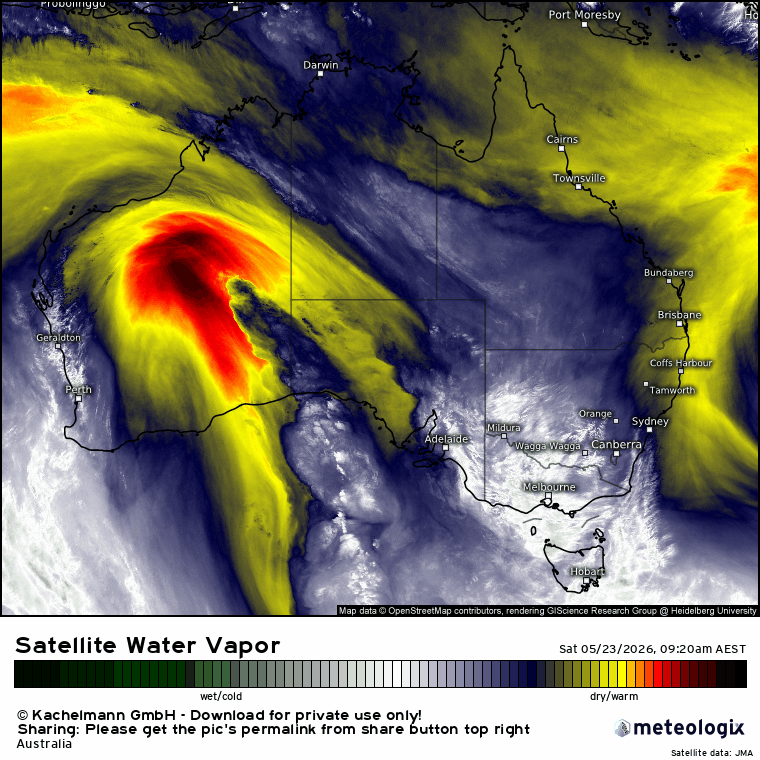
Wow, the showers certainly clattered in and gave some big totals over a couple of days. Here is how it looked over Monday and Tuesday:
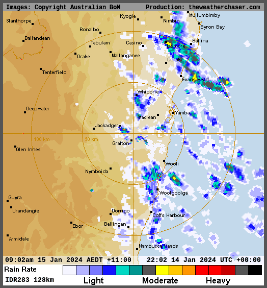
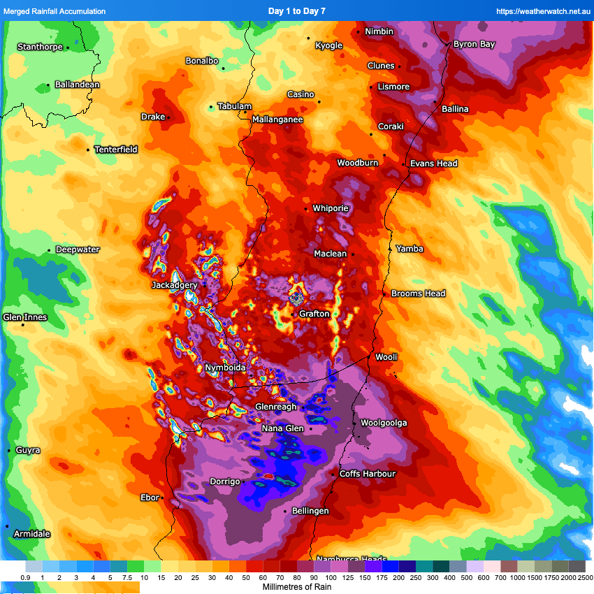
You can see the shower train sitting over our region…and here’s the resultant total rainfall accumulation (from radar) over the last 7 days:
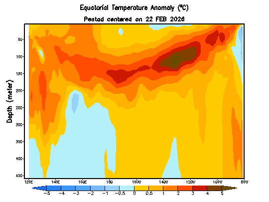
It was part chance that our region saw so much rain – had the shower stream been further north or south we could have seen much less…but one thing that really added to the total was the ocean warmth just offshore. Here’s the current sea surface temperatures across our region:
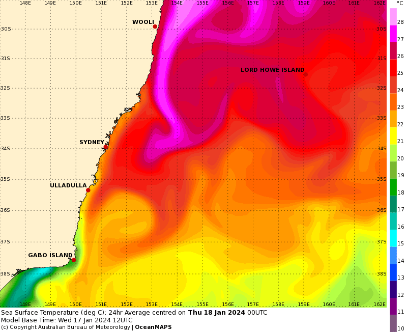
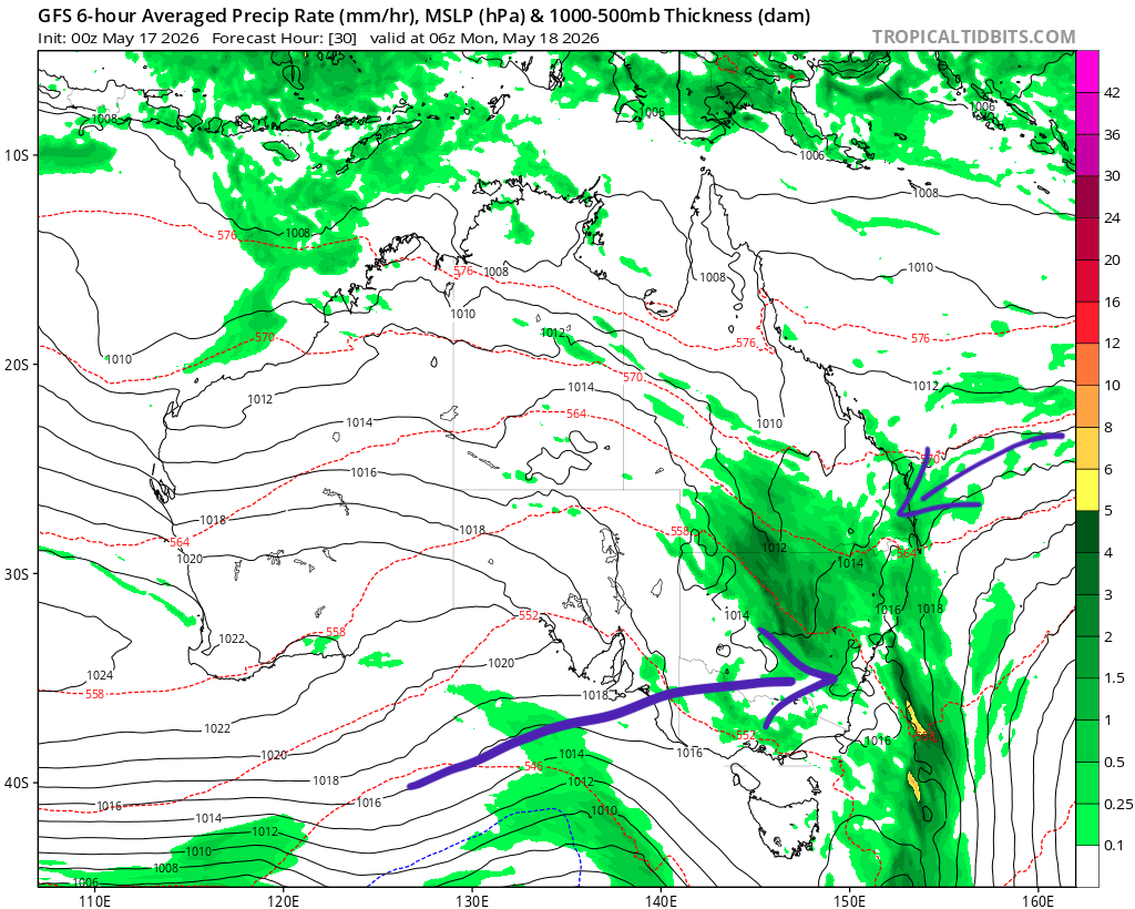
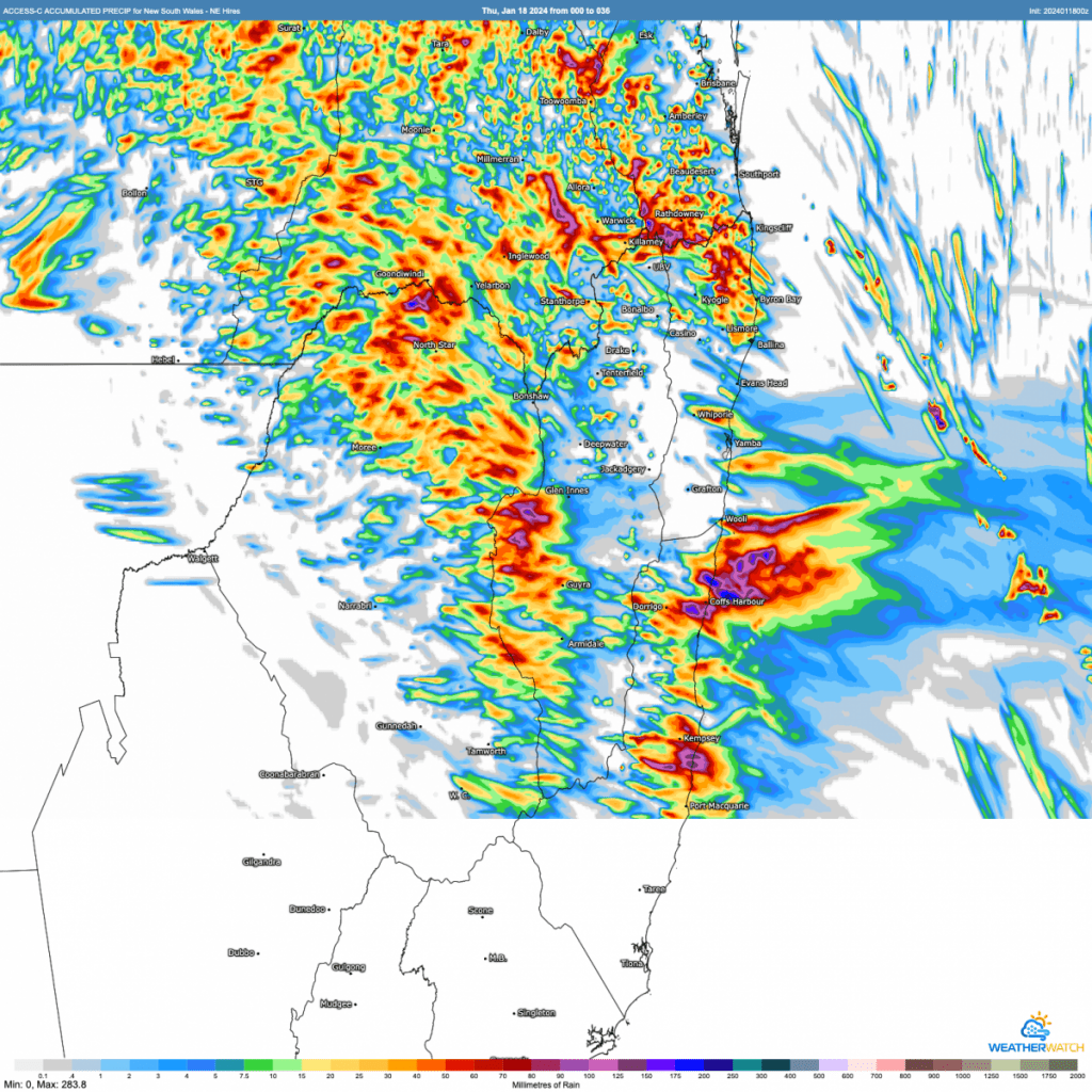
The East Australia Current is pumping right now, drawing water down from a very warm Coral Sea. Those temperatures will likely help the development of a Coral Sea cyclone over the coming few days. It will have to be monitored carefully as some models show it coming close to / crossing the coast. Chances of direct impact on our region are small…but still there and something to watch carefully. I’ll post again if it looks like impacting us. Before that happens we’ve got some clearing showers and storms today. Models show the chances of some decent totals across our region:
This system is moving in from the west which usually means lower totals for us…but as you’ll be aware humidity levels are up there today, so there is a lot of moisture to play with. Worth keeping an eye on the radar this afternoon as the ground is now saturated so river rises can happen more easily.
Once the system moves through today it should dry out for a (welcome) few days. In other good news some excellent work from the Snapfrozen team means that the Blog / Weather News sign up form (on this page) is now working – if you know anyone who has tried to sign up recently please let them know.
Thanks to MetCentre / WeatherWatch / BoM / Weather Chaser for images
Thanks to Snapfrozen and Kombu Wholefoods for ongoing support