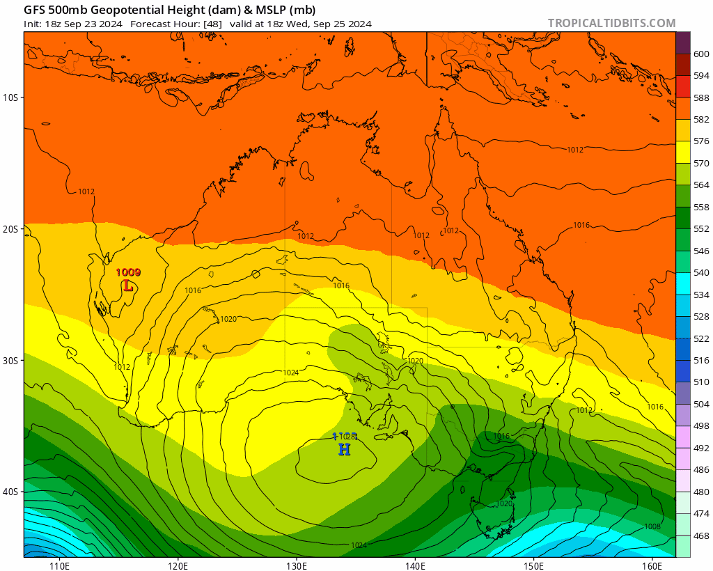
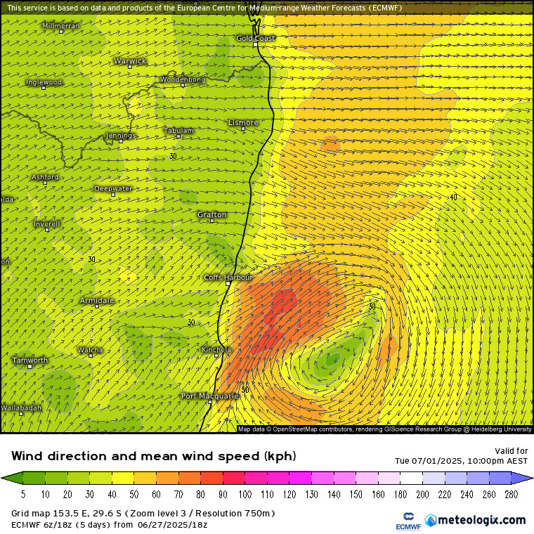
We’ve got another change coming through later this week. We’ll see a trough at the surface and a pool of cold air likely to move through up high. Here’s how it looks on the charts:
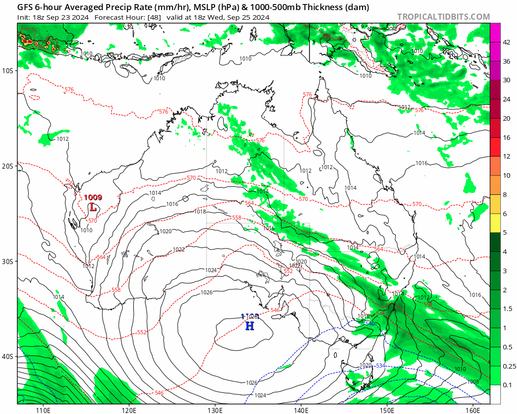
…and you can see the surface trough is also trying to generate an East Coast Low as a result of the strong instability. In terms of rain it’ll likely look something like this:
Models have been a little all over with this one but are starting to settle down…but also still likely to see some further changes before the event kicks for – for example yesterday they all showed the trough and higher rain totals much further south.
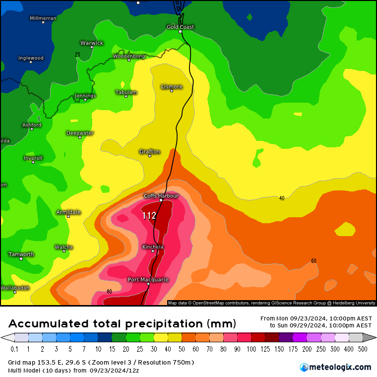
Rain totals could be decent with this event. Here’s the forecast 6 day rain totals across a range of models:
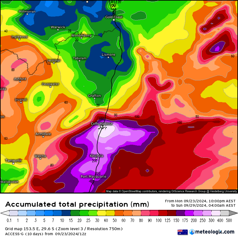
…and you can see everything from a decent downpour to a decent flood – so one to keep an eye on. I’ll post again later this week as we get closer to the event – but don’t be too surprised if somewhere in eastern NSW ends up with a Flood Watch in the next couple of days.
When things aren’t certain it’s good to look at the range of forecast rain totals. Here’s how 50 different model runs (from just the one European model) show the event:

…and another way to look at that data is the forecast average rain totals…being aware that most of the time the actual totals will sit closest to the average:
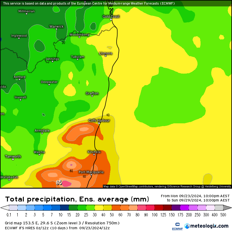
And finally the average across all the forecast models:
…and that’s way enough images for one event! Looking like 100mm or so is the most likely total across our region – but the potential is there for both a bust and our first flood event of the season. The good news is that the rain should clear later on through the weekend with some sun amongst the residual showers:

I’ll post again on Thursday with updated totals and a longer term outlook. Thanks to Meteologix and Tropical Tidbits for the images.


This Post Has One Comment
Pingback: Wet End To The Week - Bellingen Weather
Comments are closed.