A large cyclone in the Coral Sea is moving south. As it moves closer to our region risks increase from early next week. Large swell is likely, beach erosion is a concern and creek / river flooding is also possible.
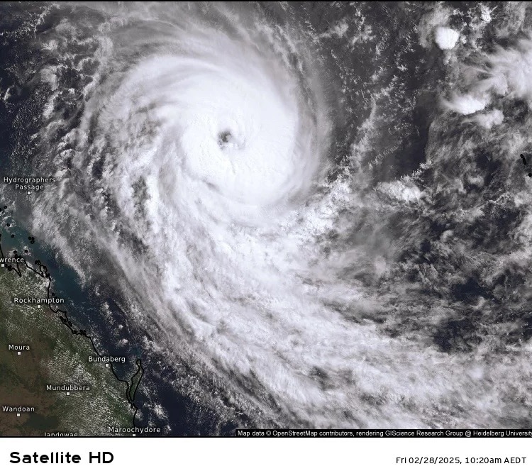
The cyclone in the Coral Sea is now a decent size….made it all the way up to a category 4 system and is still looking good this morning:
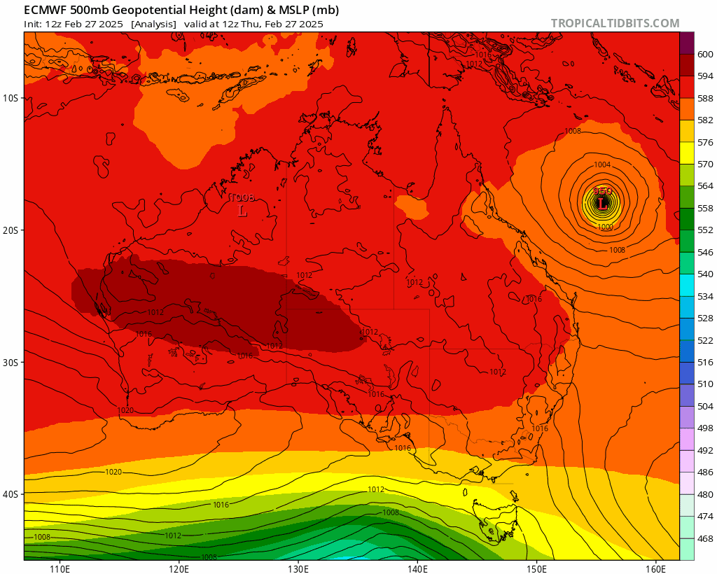
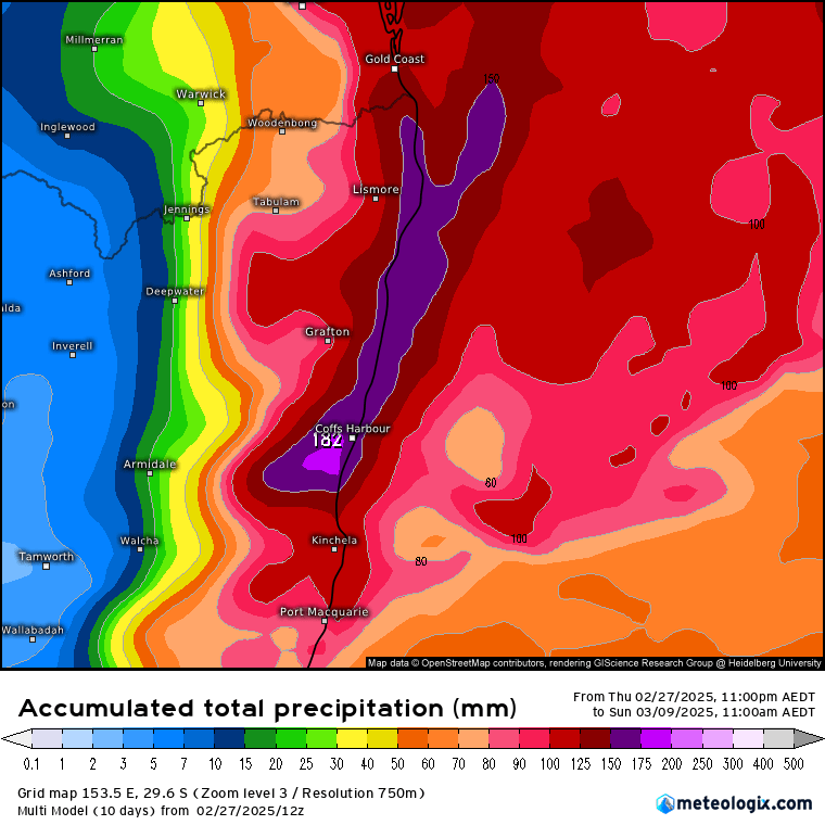
Right now the cyclone is moving steadily south but is going to come under the influence of a number of ridges and troughs over the next few days which are going to pull it one way then push it another. If it was sitting under the influence of one upper system we could be pretty confident with where it is going to go…but this one is, to put it mildly, a lot more complicated. A slight change with one influencer will have a magnifying effect with others that follow, so predicting where it will end up is pretty complicated right now. And all that is useful to know because it helps explain why some models give us a 10 day total that looks like this:
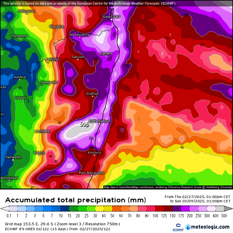
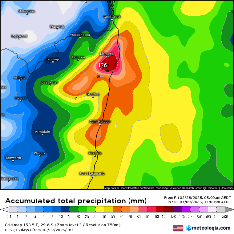
…while others have a 10 day outlook that looks like this:
To get some idea of how complicated the movement is forecast to be over the coming 10 days it’s worth checking out this forecast animation from the (best in class) European model:
That is some seriously complicated movement! At these times it’s usually worth looking at a rainfall average across a number of models as it gives us a decent idea of what we’ll see. Right now that looks like this:
..but the trouble with that method right now is that there is a HUGE range in the forecast rainfall across the models. The cyclone will bring not only wind and rain itself, but will also drag a heap of tropical moisture down south which increases the risk of significant falls. This is one where I’ll be watching models carefully, and perhaps using this weekend to clear out the gutters – while being aware that we could very well end up with either a week of sunshine and big waves or a few days of potentially very heavy rain.
One thing we can be pretty sure about is that we’ll see some very decent (and potentially damaging) swell move in over the coming week – will make for some spectacular wave action at the beach and some dangerous rips. Take care if heading into the ocean.
I’ll post another update later this weekend. To receive updates automatically you can sign up to the email list – details to the right ->
Thanks to Tropical Tidbits, Meteologix for images
Thanks to Kombu and Snapfrozen for ongoing support 🙂


